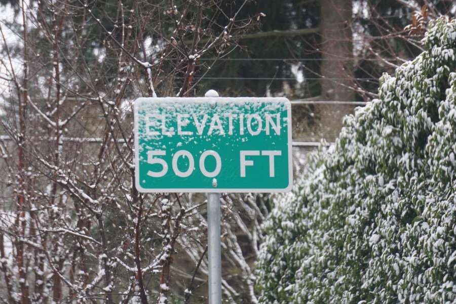
PORTLAND, Ore. (KOIN) – When the meteorologist says there’s a chance of snow at elevations above 500 feet or a winter weather watch in effect for areas above 2,000 feet, it can be informative – but only if you know the elevation you’re at or traveling to.
Knowing the forecast and your chance of encountering winter weather can help you prepare and help keep you safe. Portland and its surrounding area are by no means flat, which sometimes makes it difficult to determine the elevation.
There are hills, but those hills aren’t always high enough to receive much snow. Portland’s two rivers also mean there are plenty of low-elevation areas.
So, in order to help inform people on what the elevation is where they live, here’s a list of neighborhoods, regions and other geographic areas to indicate what their general elevations are. The list includes locations in and around Portland, plus parts of Southwest Washington and the Central Willamette Valley.
The elevations on this list come from the National Weather Service in Portland. If you’d like to find out the exact elevation of your home, try downloading an altimeter map from the Apple or Google Play app stores.
Elevations of 0’-100’
- Quincy 18’
- Vancouver Lake 18’
- Downtown Portland on the waterfront 20’
- Jantzen Beach 21’
- Longview 21’
- Rainier 24’
- Portland International Airport 25’-30’
- Woodland 25’
- Prescott 25’
- Troutdale Airport 35’
- Deer Island 40’
- Vancouver Downtown 30’
- Carrolls 50’
- Castle Rock 50’
- Marshland 53’
- Cathlamet 53’
- Scappoose 55’-61’
- Washougal 65’
- St. Helens 73’
- Kelso 80’
Elevations of 101’-200’
- Ridgefield 100’
- Sunset Field Airport 107’
- La Center 110’
- West St. Helens 111’
- Keizer 134’
- Clatskanie 135’
- Dayton 140’
- Camas 150’
- Hillsboro 150’
- Vancouver’s Hazel Dell 150’
- Sheridan 150’
- Canby 153’
- Lake Oswego City Center 160’
- McMinnville 160’
- Mt. Angel 168’
- Twin Oaks 170’
- St. Paul 170’
- Clackamas Town Center 175’
- Sportsman/Newberg Airport 178’
- Woodburn 183’
- Gervais 184’
- Beaverton Mall 190’
- Yamhill 190’
- Aurora Airport 196’
- Salem Downtown 196’
- Mall 205 200’ .
- Portland State University is at approximately 200’
Elevations of 201’-500’
- Hillsboro Airport 204’
- Vancouver’s Felida Neighborhood 206’
- North Plains Airport 210’
- Salem Airport 210’
- Kalama 210’
- Vancouver’s Lake Shore Neighborhood 210’
- Forest Grove 211’
- Aloha 214’
- Vancouver’s Sifton Neighborhood 220’
- Vancouver’s Orchards Neighborhood 230’
- Vancouver Mall 230’
- Washington Square 230’
- Mulino 237’
- Lake Merwin 239’
- Apple Valley Airport in Banks 247’
- Silverton 249’
- Salem South Hills 250’-600’
- Mulino Airport 257’
- Battle Ground’s Meadow Glade Neighborhood 280’
- Battle Ground 295’
- Hockinson 305’
- Scio 317’
- Gresham 323’
- Dallas 326’
- Aumsville 363’
- Molalla 373’
- Beaver Oaks Airport in Eagle Creek 400’
- Amboy 400’
- Maplewood 410’
- Heisson 430’
- OHSU Campus 450’
- Stayton 457’
- Fern Prairie in Camas 459’
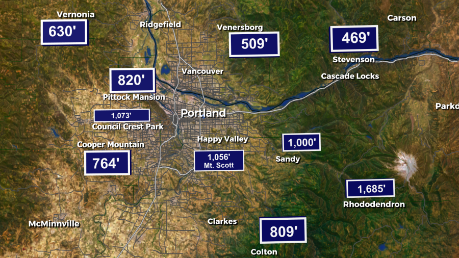
- Estacada 480’
- Silver Lake 484’-520’
- Mt. Angel Abbey 485’
Elevations of 501’-1,000’
- Prune Hill in Camas 500’-600’
- Battle Ground’s Venersborg Neighborhood 504’
- Lucia 540’
- Mount Tabor 550’
- Cornelius Pass Road is approximately 550’
- Oregon Zoo 600’
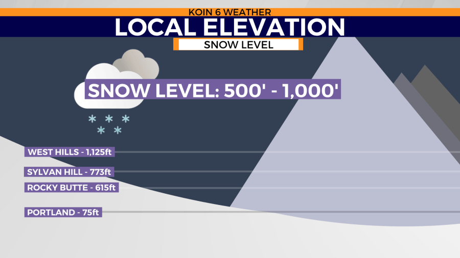
- Powell Butte 612’
- Rocky Butte 615’
- I-5 near Capitol Highway 620’
- Vernonia 621’
- Sandy River Airport in Sandy 704’
- Colton 707’
- Valley View Airport in Estacada 735’
- Sunset/Sylvan Exit 750’
- Portland Community College Sylvania Campus in Lake Oswego 750’
- Happy Valley Airport 797’
- Green Mountain in Camas 804’
- Pittock Mansion 850’
- Cornelius Summit 925’
- West Burnside highest elevation 950’
Elevations of 1,001’-2,000’
- Osburn Field airport in Corbett 1,003’
- Mount Scott 1,050’
- Council Crest 1,073’
- Mt. Pleasant 1,499’
- Yacolt Mountain 1,774’
- Devils Peak 1,803’
- Livingston Mountain 1,948’
Elevation of 2,001’+
- Elkhorn Mountain 2,225’
- Larch Mountain 3,496’