PORTLAND, Ore. (KOIN) — The first day of winter could bring a wave of arctic air and freezing rain to the Willamette Valley and the low-lying areas of Southwest Washington, creating hazardous driving conditions for the holidays.
KOIN 6 Meteorologist Kelley Bayern reports that current weather forecasts remain volatile and are subject to change. However, according to the latest weather data, travel could be especially hazardous between Thursday and Saturday.
“We’re still watching for potentially impactful weather late this week as arctic air arrives and puts Portland in the freezer,” Bayern said. “Chances for a city-wide ice storm are possible with impacts starting Thursday night.”
After a mild start to the week, chilling arctic air is forecast to blow into Northwest Oregon and Southwest Washington on Wednesday. Experts say this rush of cold, arctic air will likely cause freezing temperatures around the greater Portland area. On Wednesday night, temperatures could dip to 17 degrees in Portland. Freezing temperatures will linger into Thursday, when the Portland area is forecast for a high of 24 degrees and a low of 19 degrees.
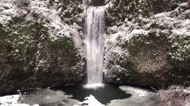
The arctic air will also create blustery conditions across the region, especially through the Columbia River Gorge, where easterly wind gusts could reach 60 mph between Wednesday and Friday, the National Weather Service warns. These icy winds could create subzero wind-chill conditions throughout the gorge, causing potential driving hazards like black ice.

“Temperatures in the single digits are expected in the Columbia River Gorge and Cascades,” the NWS said. “Wind chills will be even colder than that as easterly winds begin increasing. Temperatures this cold will increase the threat of frostbite and hypothermia for people who are outdoors and not dressed properly for the cold temperatures. In addition, any lingering wet spots on roads will flash-freeze and form black ice.”
Rain and snow forecasts remain uncertain, but weather models are suggesting that there is a growing threat of snow turning into freezing rain and sleet in Northwest Oregon and Southwest Washington between Thursday and Friday. These conditions will be especially harsh for
“Regardless of the outcome, anyone with travel plans on Thursday and Friday should pay close attention to the forecast over the coming days as guidance comes into better agreement and the details become more clear,” the NWS said.
Warmer local temperatures are forecast for Christmas Eve and Christmas Day, with highs in the 40s.