PORTLAND, Ore. (KOIN) — Wildfires in Oregon are burning across the state, including the Bootleg Fire — the largest wildfire in the United States at this time.
Oregon continues to grapple with uncharacteristically hot, dry and windy conditions.
Here is an overview of the biggest and fastest-growing fires in Oregon and southwest Washington.
Sign up for public alerts here
Bootleg Fire
The Bootleg Fire, which began July 6 in Klamath County, is the largest in the nation right now at roughly 212,377 acres. For reference, that’s larger than the size of New York City.
As of Wednesday morning, the blaze was 5% contained and 1,338 total personnel were assisting in the firefighting efforts. It’s not known what sparked this blaze.
The Bootleg Fire continues to burn actively on the Fremont-Winema National Forest, approximately 11 miles northeast of the town of Sprague River. Due to the size and complexity of the Bootleg Fire, the fire will be managed using two zones — in the north and in the south.
The wildfire is actively burning on the Fremont-Winema National Forest. Officials say it will continue to be extremely active in unchecked portions of the perimeter, especially with unstable air conditions, extremely dry fuels and well above normal temperatures — along with extremely gusty winds. Poor humidity at night is contributing to the fire spreading throughout the night, as well.
According to officials, fire growth was primarily reported to the east in the greater Gearhart Wilderness area. Because of the heavy smoke, air operations were severely limited.
“We’re making steady progress where winds and terrain allow,” said Rob Allen, Incident Commander for PNW2 Incident Management Team. “But for the third day in a row, firefighters had to disengage at times for their safety and weather isn’t going to change for the foreseeable future.”
As of Tuesday night, 21 homes were destroyed and hundreds of others are under Level 3 (Go Now!) evacuation orders. A total of 54 other structures have been decimated, as well.
Fire officials estimate the Bootleg Fire won’t be contained until the end of November.
Evacuation levels as of Wednesday afternoon
LEVEL 3 reducing to LEVEL 2
Sprague River. Upper tableland area north of Oregon Pines Rd is being reduced to a Level 2 (GET SET) evacuation notice. Beatty, north. East side of Godowa Springs Rd south from the transition with Forest Service Road 3462 to Highway 140. is being reduced to a Level 2 (GET SET) evacuation notice.
LEVEL 2 EVACUATIONS
Level 2 (Get Set) evacuations in place for the Klamath Forrest Estates/Moccasin Hills Area, Klamath County on the west side of Godowa Springs Road, south of Oregon Pines Road and Tableland Road to the river.
LEVEL 1 EVACUATIONS
Level 1 (Get Ready) evacuation notice is in place for Klamath County, between Beatty and Bly three miles south of Highway 140 from Yellow Jacket Springs to Fishhole Creek, along with the area from the intersection of Sprague River Road and Forbes Road extending east to Godowa Springs and Yellow Jacket Springs and four miles south of the Sprague River. Also, Near Yamsi Ranch. Williamson River Road from the intersection of Forest Service Road 46 and Forest Service Road 44 extending north approximately 8 miles.
Information: Bootleg Fire

Game Hog Creek Fire
The newest wildfire to break out in Oregon is the Game Hog Creek Fire in the Tillamook State Forest, about 22 miles northwest of Forest Grove. It is up to 70 acres with zero containment. However, forestry officials said fire lines are still being built and the fire’s spread has been largely halted.
Officials say it’s burning in timber and slash north of Highway 6. The fire initially sparked on July 3 and was contained before it reached more than 6 acres. It had been quiet up until Tuesday — but rising winds in the evening reportedly caused the flames to jump control lines.

A firefighter douses the Game Hog Creek Fire in the Tillamook State Forest. July 2021. (ODF) 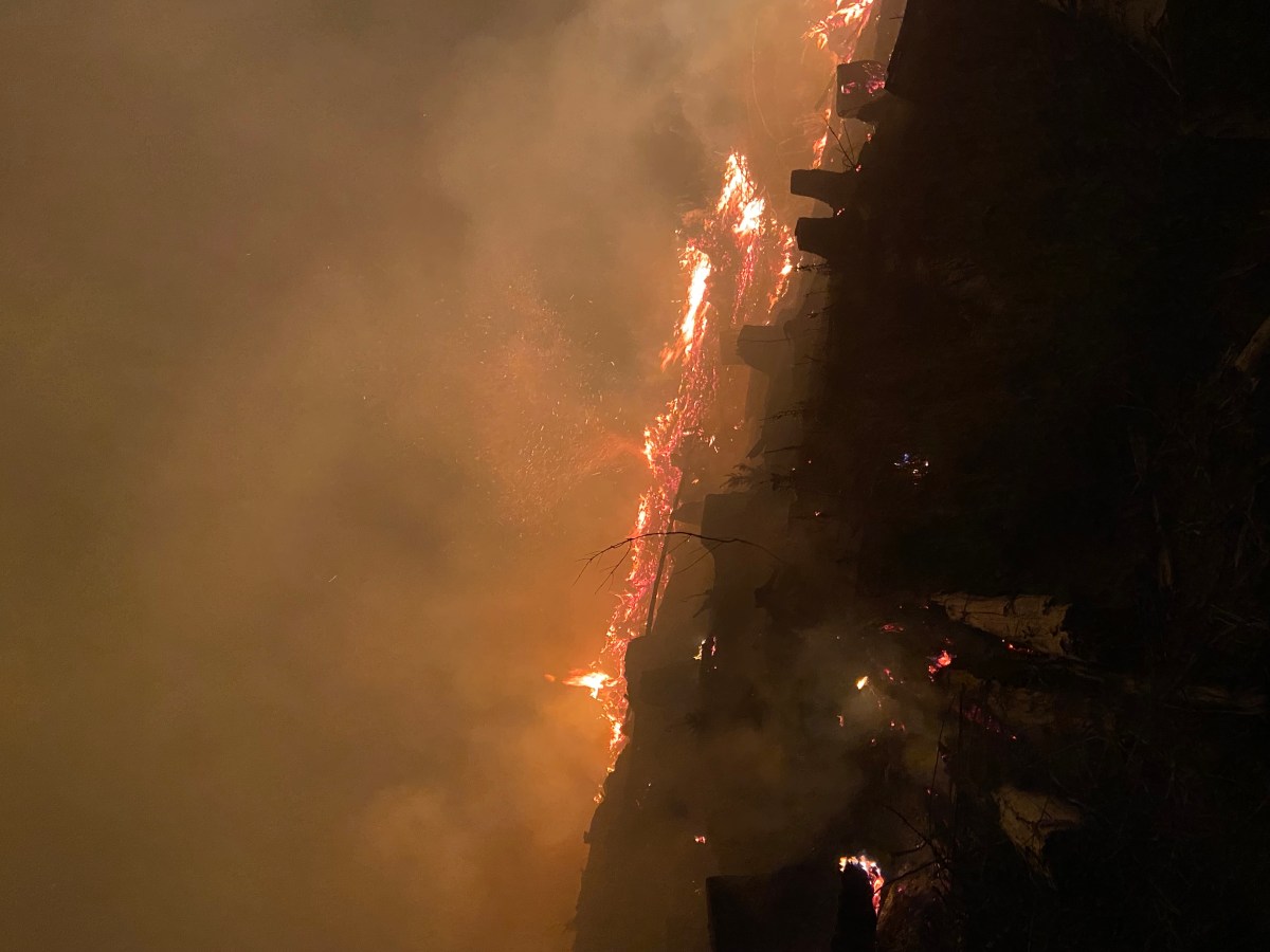
The Game Hog Creek Fire burning in the Tillamook State Forest. July 2021. (ODF)
Fire crews responded after 7 p.m. on Tuesday, consisting of approximately 100 personnel from Oregon Department of Forestry offices in Tillamook, Columbia City, Astoria, North Cascades, Forest Grove and the West Oregon District in Polk County along with the Hampton Lumber and Stimson Lumber Company.
Forestry officials said work will continue through Wednesday night and they expect little growth. Crews will continue building containment lines Thursday and, if all goes according to plan, will start mopping up and cooling hot spots within the fire’s interior.
Drift Creek and Idiot Creek forest roads along with the Fear and Loaming mountain bike trails are currently closed. Rogers Camp trailhead is being used as a staging area for firefighters and is closed to the public. The Elk Creek Campground is still open but smoke is likely in the area.
According to the National Weather Service Portland, smoke from the Game Hog Fire may affect Washington and Yamhill Counties as the day continues.
The cause is still under investigation.
Jack Fire
The Jack Fire in Douglas County spread to 13,795 acres as of Tuesday night. Officials say it is just 15% contained at this time. The Jack Fire currently is 100% on Forest Service Managed Land.
Full Jack Fire evacuation map
The Jack Fire was first reported around 5 p.m. on July 5. Flames are burning north of State Highway 138 and east of Jack Creek Road. Crews say between the steep terrain, fuels and inaccessibility, the fire grew rapidly.
Areas of the Umpqua National Forest were ordered closed until February 28, 2022, unless rescinded sooner.
Information: Jack Fire
Grandview Fire
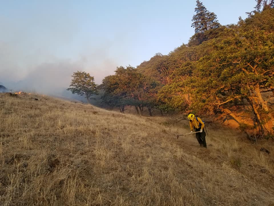
The Grandview Fire first sparked around 1:30 p.m. on Sunday, burning lands protected by the Oregon Department of Forestry and on the Crooked River National Grassland. As of 8 a.m. Wednesday, the Grandview Fire was burning around 5,971 acres and is 5% contained, officials say.
The governor declared this fire a conflagration, bringing additional resources to support the containment efforts. Task forces from Marion, Yamhill, Linn, Benton, Lane, Umatilla and Columbia counties, along with a Clackamas County hand crew are working to protect the 421 homes that are currently threatened by the fire.
As of Wednesday morning, a total of 694 personnel were involved in the firefighting efforts.
Officials say winds from the north and east have pushed the fire southwest and into Stevens Canyon. Although there is active fire behavior, the ODF says firefighters have had significant success throughout much of the area.
Containment lines are in place near the most populated areas to the east and south. Crews will continue working to hold and strengthen those edges.
Red Cross has set up a temporary evacuation shelter at Sisters Middle School.
Information: Grandview Fire
Darlene Fire
The Darlene Fire erupted late Monday afternoon and has jumped to 700 acres as of Wednesday morning. The fire is about 2 miles southeast of La Pine and moving to the southeast, between Finley Butte Road and state Highway 31, the Deschutes County Sheriff’s Office said.
There is a Level 2 evacuation notice for the areas south of the Deschutes County line including the Sun Forest Estates, Split Rail subdivision and Antelope Meadows
Evacuation information for the Darlene Fire
La Pine Middle School is a temporary evacuation point and the La Pine rodeo grounds opened to accept animals.
Bruler Fire
The newest fire to spark in Oregon is the Bruler Fire near Detroit.
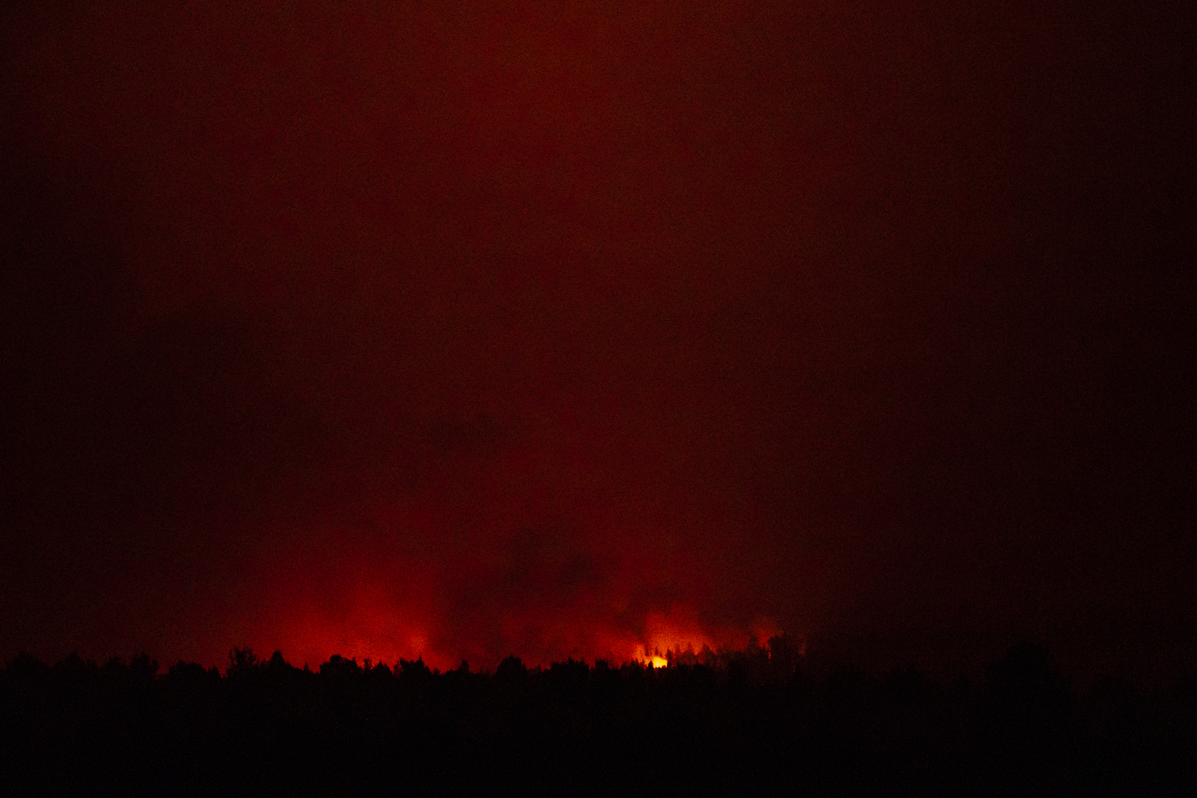
The Bruler Fire, near Detroit, began flaming on Monday, estimated to be around 100 acres as of Wednesday morning. The National Weather Service said that GOES-West visible satellite imagery showed a “decent column of smoke rising from a location a few miles south of Detroit Lake.”
Crews aggressively attacked the fire on Tuesday. Aircraft will be dropping water in an attempt to slow growth. Additional resources are expected to arrive in the coming days. Officials say smoke will continue to be visible from the town of Detroit and Santiam Pass, with light to moderate smoke expected to settle in lower elevation areas in the vicinity overnight.
“The safety of the public and the firefighters is our first priority. We’re in the process of closing several roads and trails to ensure firefighters can work efficiently and that the public remains safe. This will be managed as a full suppression fire,” Sweet Home District Ranger and Agency Administrator Nikki Swanson said.
No communities are currently threatened by the blaze. However, people are asked to avoid Daly lake, Tule lake, the Old Cascade Crest trails, Forest Roads 11 (Straight Creek Road/Quartzville Road), Forest Road 10 leading south from Detroit Lake, along with Forest Roads 1161, 1133 and 1012.
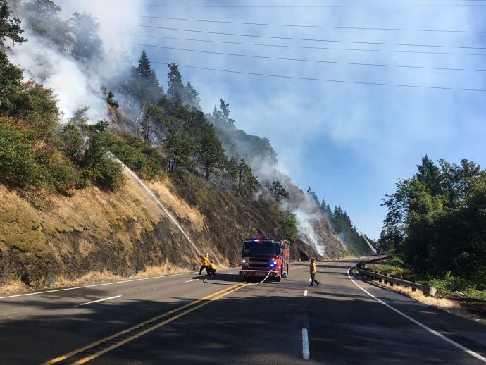
Lyle Hill Fire
A new wildfire is growing rapidly in Southwest Washington, estimated to be about 301 acres and still 10% contained as of Wednesday morning. The cause of the fire is under investigation.
The Lyle Hill Fire in Klickitat County began Monday night, prompting Level One (Get Ready) evacuations for the Centerville-High Prairie area from milepost 2 on Centerville Highway to Alder Springs. Officials say homes and orchards are threatened.
Evacuation information for Lyle Hill Fire
Over 100 personnel are involved in the firefighting efforts. The area reportedly lost all water pressure, so firefighters are forced to drive 12 miles out of town to fill water tenders and bring them back — a 24-mile round trip.
Brush fire near Canby
Highway 99E was briefly closed and Level 3 evacuations were issued after a brush fire ignited a few miles north of Canby on Wednesday afternoon.
All evacuation orders had been lifted by 8:30 p.m. and officials said the fire was under control. It’s cause is unclear at this time.