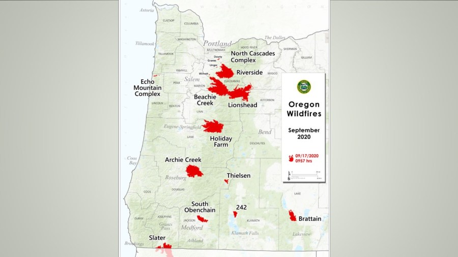
PORTLAND, Ore. (KOIN) — While the rain is a welcome sight for firefighters, the commanders battling the Riverside Fire in Clackamas County don’t believe the rain will end the blaze and may cause different issues going forward.
The fire, now listed at 137,865 acres and 10% contained, is expected to continue to burn in the deep layers of needles on the forest floor, stumps, logs and standing dead trees, officials said. Firelines are still being constructed along the west and north sides, while on the east and south fire crews are trying to find indirect spots in some distance from the fire to limit its spread in the rugged terrain.
The fast and heavy rains could cause flash flooding and debris flow from the burned areas, they said. The gusty winds might knock over trees that are weakened, so people are asked to avoid roads in the burned areas.
Ground is highly unstable
Damien Kullman’s home is down a steep slope off Highway 224. Firefighters saved his house, but the guest house on his property burned, along with trees and brush across 10 acres.

On Friday the fire marshal talked with Kullman about the possibility of trees coming down as the ground is still smoldering in spots, with roots burning underground and the threat of landslides from the rain.
The fire ground is unhighly unstable as the burn continues and the rains loosen the soil, rocks and roots.
Kullman pointed to a bank where “you can see a lot of exposed rock and gravel and dirt now as the rains come. I am afraid we might get a washout and take that out. Also all the trees we see on the edge where the river came up, definitely looks like some of those trees are possibly going to come down also.”
Drones are also not permitted in the fire zone, officials said. “If you fly, we can’t. All fire aircraft will all be grounded if a drone is spotted,” officials said in a statement.