PORTLAND, Ore. (KOIN) — The latest run of models by the KOIN 6 Weather team shows not a lot has changed over the last several hours. That means there is still the chance for some potentially dangerous, stormy weather in the region Wednesday.
“The timing on this is really important,” said KOIN 6 Meteorologist Joseph Dames. “This is going to be an afternoon event into the evening commute.”
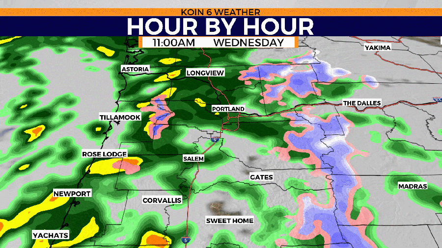
The first rain showers arrived on the Oregon coast early Wednesday morning. As the system moved over the Coast Range, it started to fall in the Willamette Valley and the Portland Metro area by mid-morning.
Spacing between clouds is allowing for some surface heating late Wednesday afternoon. The storm development is still possible into the evening — and that threat holds until 7 p.m. to the sunset hour.
Moments of gusty wind are still the main concern this evening.
“Gusty winds could cause some tree damage and knock down some power lines,” Dames said.
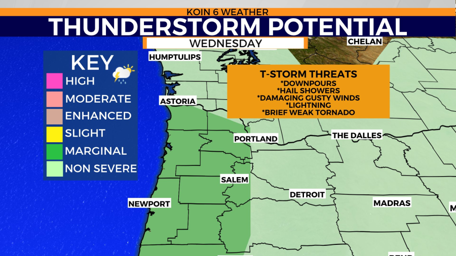
At this point, the building of thunderstorms is more likely for the central Oregon coast and into the western Willamette Valley.
There is also potential for a few nocturnal storms on the coast. This means we may have a rumble of thunder and a moment of heavy rain into the night, most likely from Lincoln County north to Clatsop County.
While some stormy weather is almost a guarantee — and there is a chance of a severe thunderstorm that could produce some damaging wind, hail, and flash flooding — the likelihood of a weak tornado is quite low.
Dames said it is important for people to keep an eye on conditions and be aware of your surroundings. If you see dangerous weather, seek shelter. Thunderstorms can drop heavy pockets of rain which can cause hazardous driving conditions.
If you want to know about dangerous weather in the region as soon as we do, click here and sign up for our severe weather email alerts.
Be sure to tune into KOIN 6 News and keep checking KOIN.com for complete weather coverage.