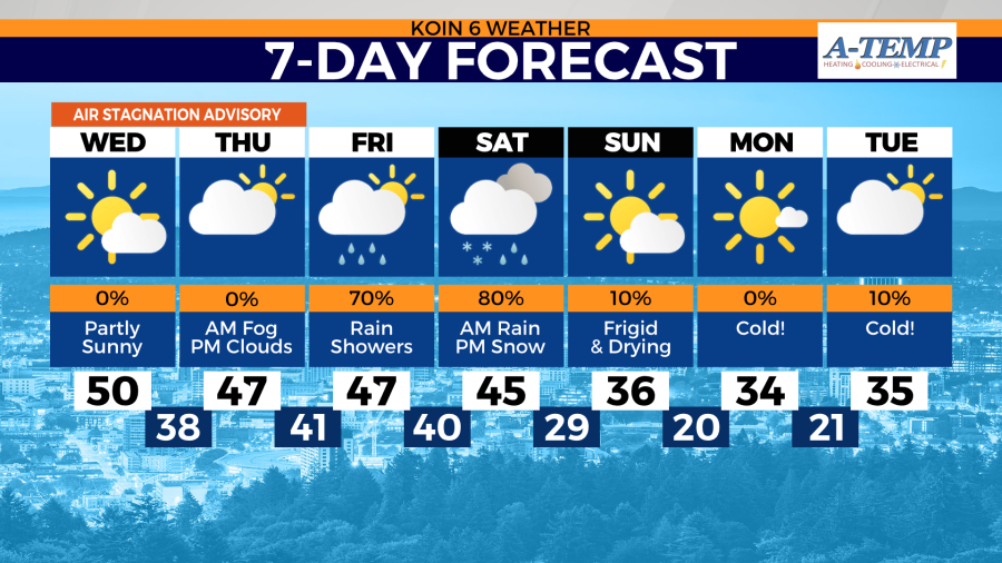
PORTLAND, Ore. (KOIN) — Another round of arctic air is on its way to the Portland metro area — with the chance of snow in places like downtown becoming increasingly more likely as lingering rain showers coincide with freezing temperatures.
Snow accumulation and elevation are still uncertain. What KOIN 6 meteorologists do know is that some higher elevated spots will see snow and lower elevations will see bone-chilling temperatures starting Saturday night and lasting through the start of next week.

The Pacific Northwest is expecting these colder-than-normal temperatures because of the jet stream’s erratic behavior. Cold air will force its way into the region Saturday night. A surface low-pressure system will help pull colder and wetter air into the region this weekend.
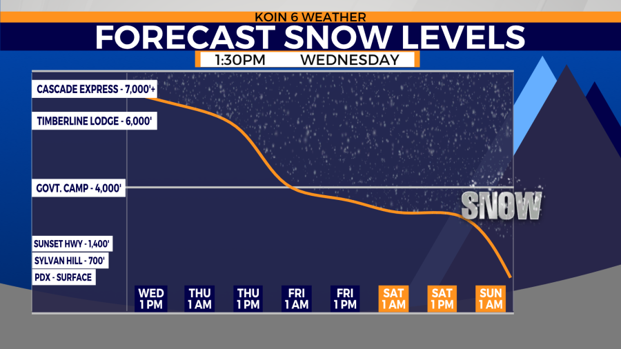
Scattered rain showers will become more frequent throughout the day Saturday. Snow elevations will still remain above 3,000 ft. during the afternoon.
Snow elevations begin to drop late Saturday night into early Sunday morning. That’s when the snow potential beings to increase.
Snowfall elevations and totals still remain uncertain because of the disagreement seen in long-range weather models. The European model (ECMWF) is showing more of a rain/snow event for the Portland metro area. Snow chances become increasingly less likely farther south. This is due to the cold air influence the Columbia River Gorge has on the Portland metro area.
Snowfall totals will likely be minimal with the European scenario due to the less than a half inch of snow forecasted. Snow that may fall Saturday night will likely melt on contact.
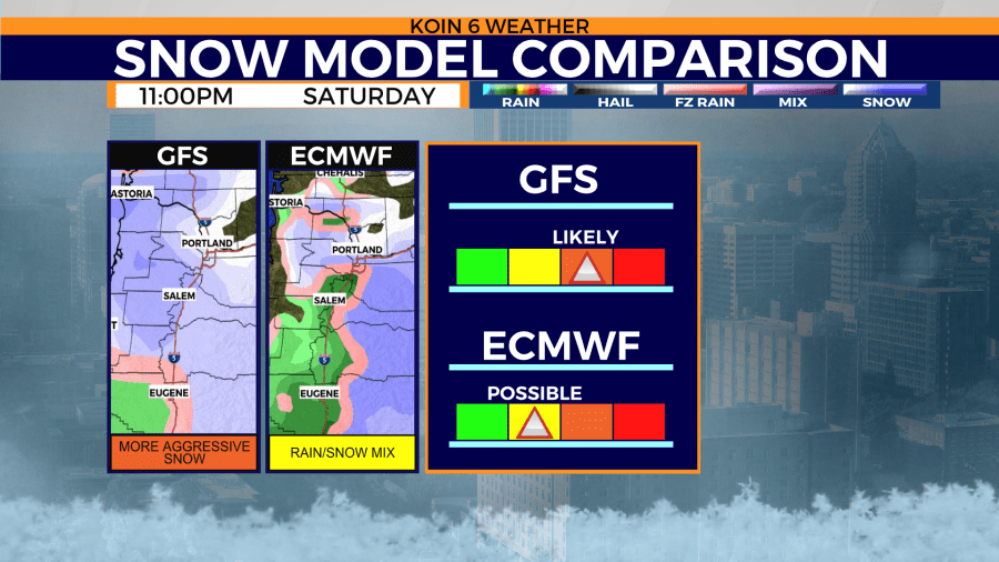
The Global Forecast System (GFS) indicates a little more widespread snowfall along the Willamette Valley, but less accumulation in this forecast. Meaning, more lower lying elevations might see snow falling, but no snow sticking on the ground.
In general, the forecast doesn’t become more accurate until about a day or two out from the event. That’s due to higher definition, short-range, weather models becoming available. When those higher-definition weather models start showing the same snow pattern in regard to elevation, timing, and accumulation, then the forecast becomes more accurate.
LATEST KOIN 6 WEATHER FORECAST
Stay with the KOIN 6 Weather Team for the most accurate weather forecast in town as our meteorologists continue to pinpoint the timing and potential threats associated with this latest winter blast.