PORTLAND, Ore. (KOIN) – Have you spotted the snow up on the mountain yet? This late spring weather has proved that June gloom still exists here in Portland and June-uary still exists for the Cascades.
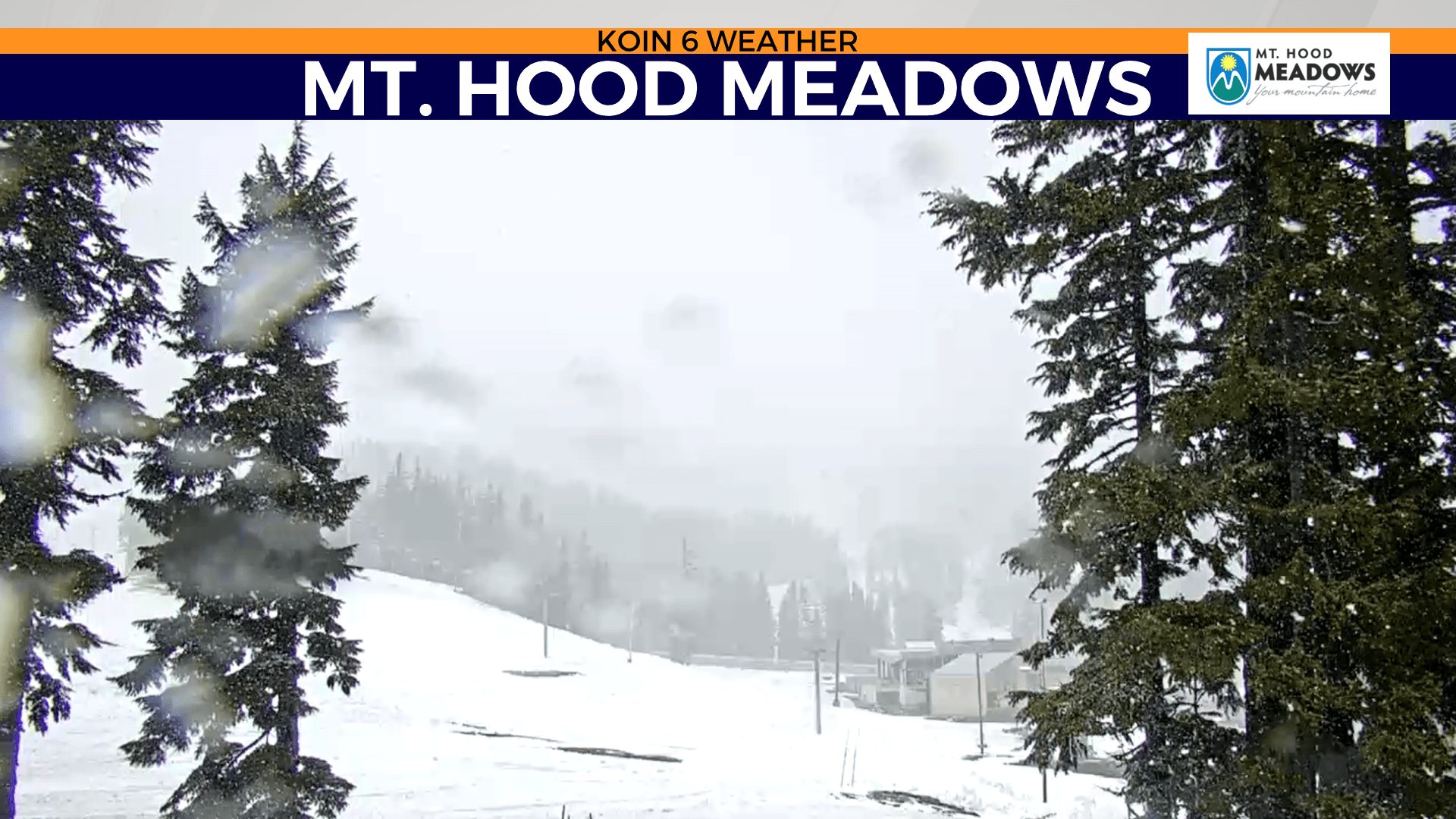
We aren’t jumping into summer as quickly as many would like this year. Snow levels dropped to about 4,500 feet Monday morning and as of the early afternoon, it’s still snowing with confidence up on the mountain.
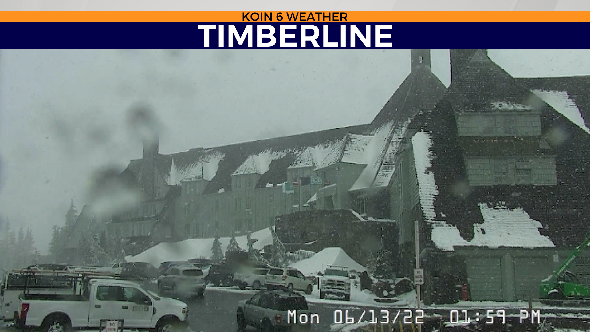
You can see the view from our Mt. Hood Meadows camera and if you use the slideshow, you can see the snow piling up on the roof of Timberline lodge. If you wanted to hold on to winter and were thinking about a cozy meal up in the lodge, now would be a great time to do that.
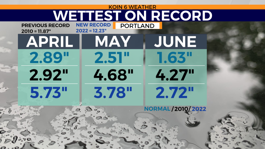
Before we get into the details about what may keep us in this pattern for the next five to seven days, let’s take a look at our new three-month rain record for April, May, and June (graphic below). The Portland Airport topped over 12 inches this weekend, which broke the previous record set back in 2010. If you combine the three months below, we haven’t recorded this much rain in Portland since 2010 and it is now the record going back to 1940 — and we still have half of June left!
The wettest April on record did help propel us into this, but we also had a wet May and we are also experiencing a wet June. The normal amount of rain for the three-month combination is just over 7 inches. We haven’t quite doubled that, but we are just about trying to! This week is expected to be drier, but we will likely see a few showers.
Why are we probably going to see minor changes to the forecast this week? We have two massive ridges expected to hold in the midsection of the United States. The first is in place right now, strengthening on Tuesday. We have what is known as an Omega Block forming (admittedly more noticeable this weekend). This usually entails two cut-off lows with a large ridge in the middle. We aren’t quite to that level of interference Tuesday, but it seems like it will be a lot closer come the weekend.
Use the slider to see the difference between Tuesday and Saturday. I’ve added an image of the Greek letter Omega to help support the visual appearance of an Omega Block.
This type of pattern usually prevents swift movement to the weather pattern. This will keep the PNW cool and it will leave the midsection of the US, in a situation where they will be dealing with dangerous heat.
Due to that massive ridge, there are heat alerts extending across the Midwest, expanding all the way north into Minnesota and Wisconsin.
Extreme heat and heat indices for the southeast, just south of that lobe of low pressure that makes up the right side of the Omega block.
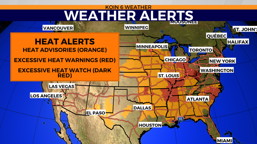
What does this mean for temperatures? It’s going to be nice and cool up here in Portland for the next day. We will then jump back into that relatively cool pattern near the end of the week too. Meanwhile, temperatures are expected to approach triple-digits for many locations in the Midwest.
There will be a 40-degree difference between Portland’s afternoon high and those coming out of the the Mississippi valley. It can take time for these type of patterns to shift. Which part of the reason for our cooler weather this week.
