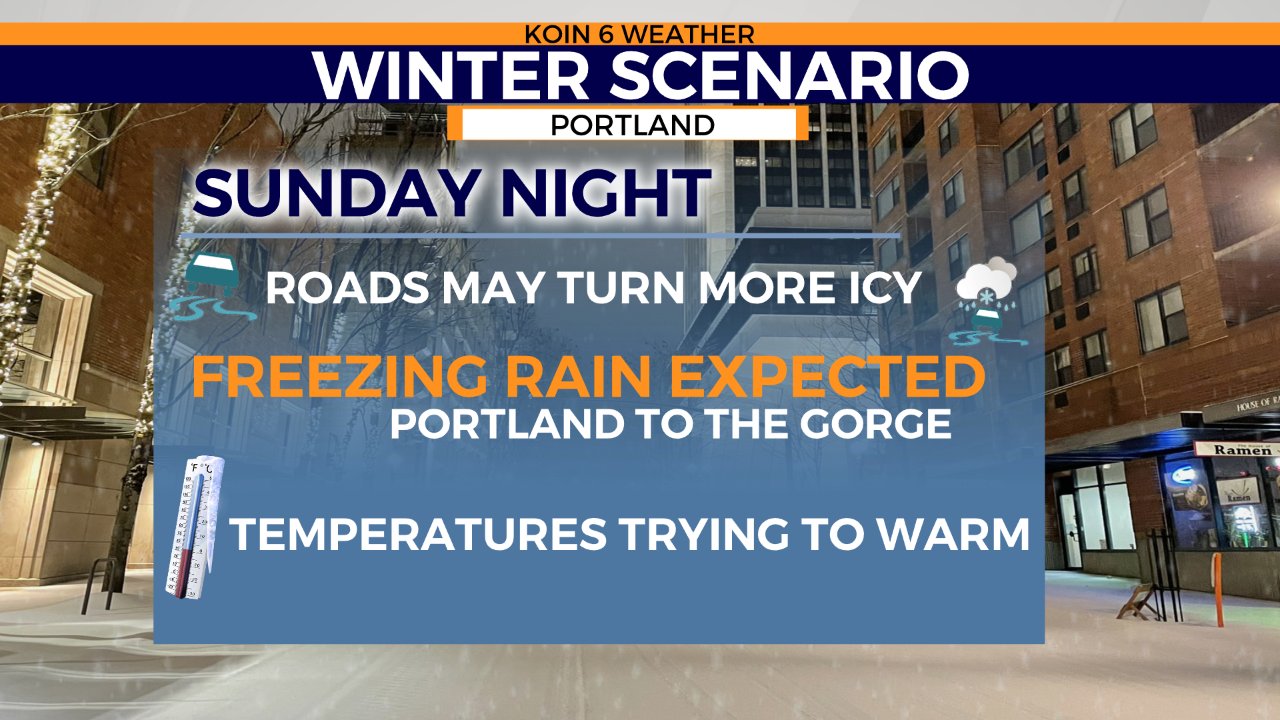
PORTLAND, Ore. (KOIN) – We’ve been cycling through the different winter stages across the Willamette Valley since Thursday. We are now in the final act of trying to transition back to warmer Pacific air as we finish the weekend. The concern Sunday night is going to be how long it takes for conditions to warm and how much ice will we see glaze over the area before the temperatures climb.
Sunday night is going to likely be mostly freezing rain, with temperatures projected to climb above freezing closer to midnight. There is still snow on the ground and cold air banked on some of the hills, leading to a challenging forecast.
Jennifer Dowling and photojournalist Andrew Bissette traveled to Gresham through neighborhoods encased in ice and snow Sunday afternoon and spoke with residents who had been impacted by this Valentine’s Day weekend storm. Check out their travels in the video below:
What you should prepare for:
Roads turning icy once again, even the ones that had some improvements. The city is doing their best to help prevent the ice. If you are traveling this evening, prepare for icy spots.
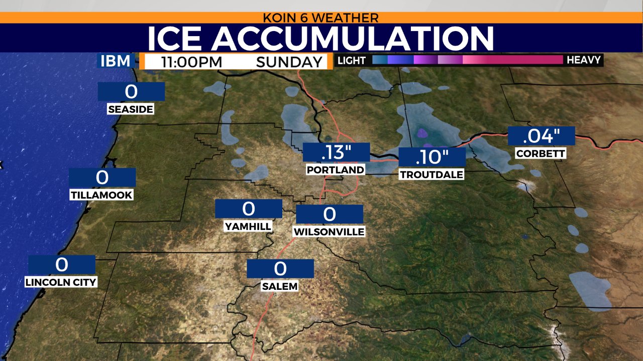
The worst of the freezing rain will be that area in the Gorge near Multnomah Falls. It’s possible that there may be up to 1.00″ of ice for some locations. The west hills may see somewhere around .25-.50″ of ice, closer to .10-.15″ around downtown Portland.
We started the evening with very light freezing rain and a wintry mix around the area. We have already seen the wind shift and the temperatures warming south of Wilsonville. Most of the layers above our head are above freezing, leaving just the surface around Portland below. This is why most are seeing rain to the south at this hour.
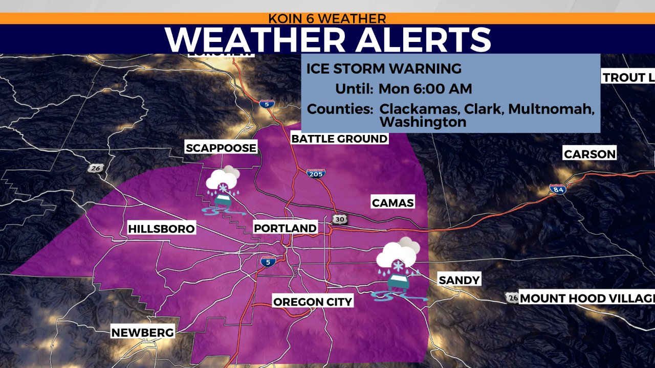
There are no changes to the ice storm warning that is in place until 6 a.m. Monday morning. Although the tracing extends well out to Hillsboro and south past Oregon City, very little ice is expected in these locations at this hour.
Here is an idea of the vulnerable spots and some of the ice projections by 11 p.m. tonight. Points south of Portland are likely to just start seeing rain. That is just about what we are picking up on the radar this evening. Ice impacting areas like Washougal and Troutdale through the night into the morning. Travel will be icy.
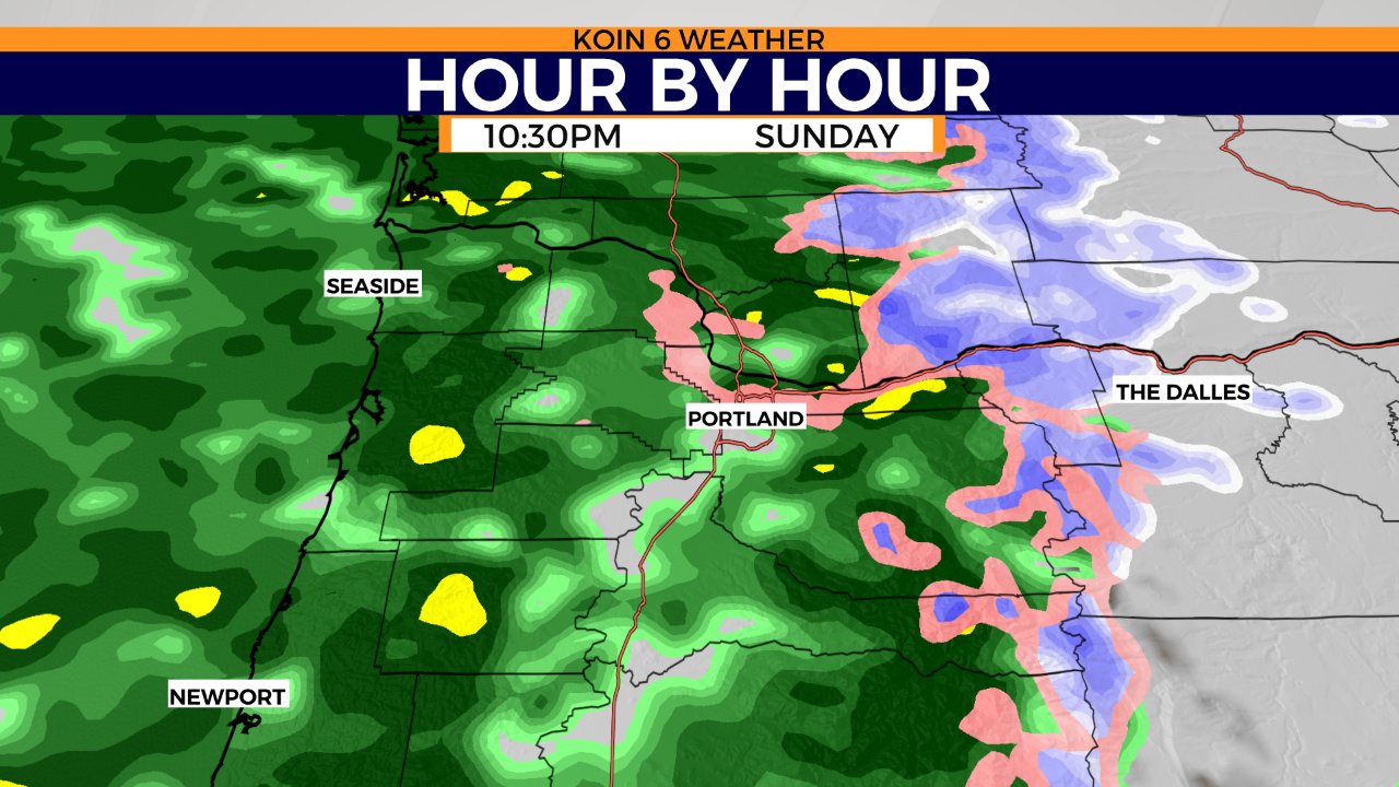
The hour by hour forecast is throwing more moisture in by late Sunday, which is also going to be around the time that we are hoping temperatures start warming near Portland. This weather model keeps the freezing rain from the west hills through Portland into the Gorge. Snowfall for the mountains up in Washington and also the east slopes of the Cascades. Snow levels are bumping up tonight but expect snow for the passes over the next two days. We are going to collect a lot of mountain snow the next few days.