PORTLAND, Ore. (KOIN) – The new year started wet and unseasonably warm for January in Portland, but it looks like we’re in for a change starting this weekend, with a more dramatic temperature drop early next week.
We’ve been riding this balmy temperature wave almost every day this winter with highs well above the normal 45 degrees and lows far from a seasonable 35 degrees. Temperatures like this are more common for early spring. Jan. 3, we blazed a new trail breaking the previous 60-degree record and registered a new high of 62 at PDX! Jan. 7 was also unusually warm, 58 degrees!
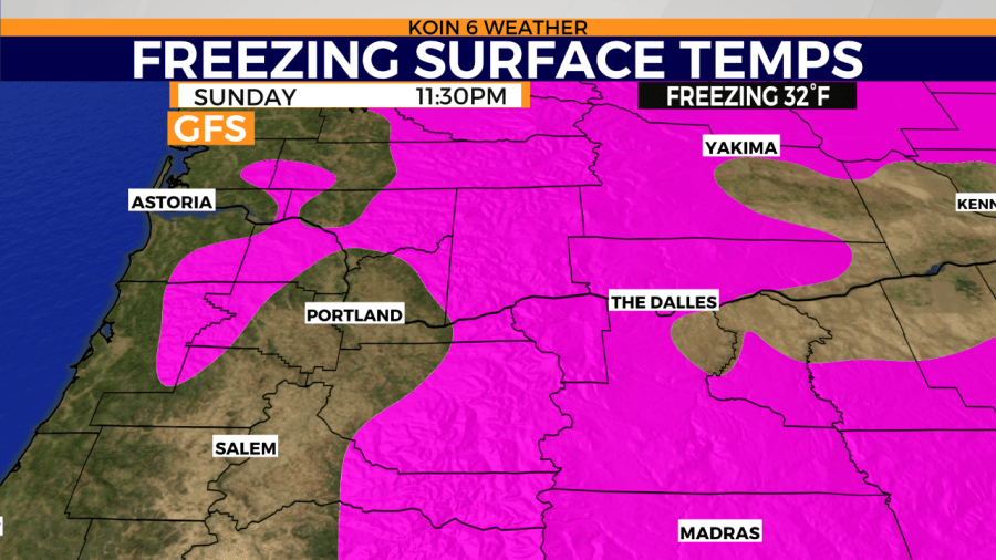
That unwinter-like trend appears to be coming to an end by Monday. We are eyeing an overall pattern adjustment that may drop cold arctic air from Canada straight into the PNW as a few fronts roll through Oregon next week with moisture.
DOES THIS INVOLVE THE WILLAMETTE VALLEY?
It is likely that areas of the Willamette Valley will be battling cold enough temperatures to support a snowy profile next week. That does include the Greater Portland Metro Area and communities north and south all the way to Eugene.
WHAT IS THE TIMING?
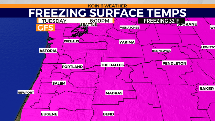
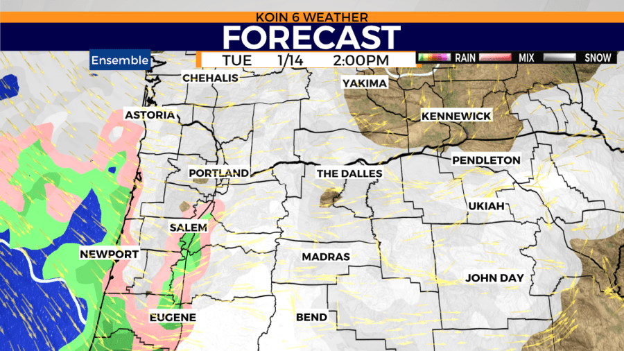
Depending on where you live and which weather model is favored, snow for parts of the Willamette Valley could begin as early as Monday. It is likely that it takes a bit longer for our atmosphere to truly cool down enough, but the projection of an area of low pressure colliding with the south-central Oregon coast on Monday is showing up in the GFS weather model. This could spell snow for areas south of Portland. A second system is scheduled to arrive by midweek, which could be a bigger snow maker for the Portland area based on an ensemble of weather models. Caution, before you start making plans – we are nearly a week away from that forecast event.
HOW ABOUT THE MOUNTAINS?
We have high confidence the mountains are going to score big time, accumulating several feet of snow this week after already collecting more than a foot in the last few days. Now is the time for our ski resorts to build up the base. You can read more about that here. A Winter Storm Warning is in effect for the OR/WA Cascades Friday morning until Saturday because we could see anywhere between 2 to 3 feet of snow for the ski resorts. If you can, avoid driving over mountain passes until Sunday. Friday through Saturday will be tough with wind gusts up to 55mph = blowing snow, bad visibility.
WEATHER MODEL SUPPORT?
Alright, so what are we looking for as far as forecasting snow for areas of Portland? General consistency from weather models gives us more confidence in the information. It doesn’t have to be the fine details, just support of cold enough air and available moisture. Then it’s working out the more skillful parameters of the incoming system and answering the where, when, and how much questions. Right now weather models are leaning towards daytime temperatures in the lower 30s by midweek with a chance for lowland snow around the same time. Keep checking back with KOIN.com as we post new forecast information several times a day.