PORTLAND, Ore. (KOIN) – All aboard transitional air!
We have warm and cool air all around us. We will dip our toes in both air masses through the week. However, it sure looks like we will be more cool than warm. Why? Portland is going to be in and out of multiple short waves.
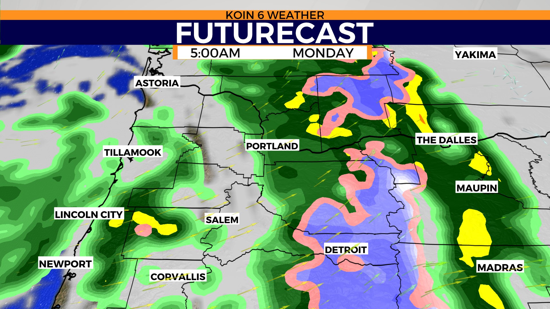
A short wave is the guiding force for low pressure in the core of a trough. Our first will arrive overnight into Monday morning. We will have morning rain, turning over to showers. The steady rain will come before most wake up and get going.
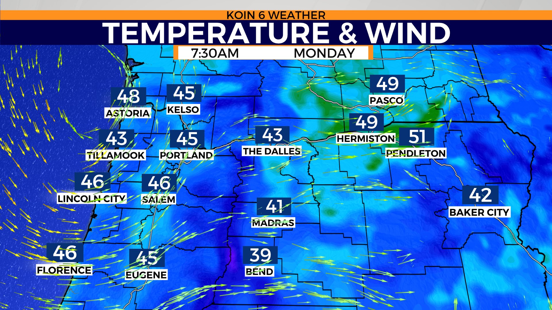
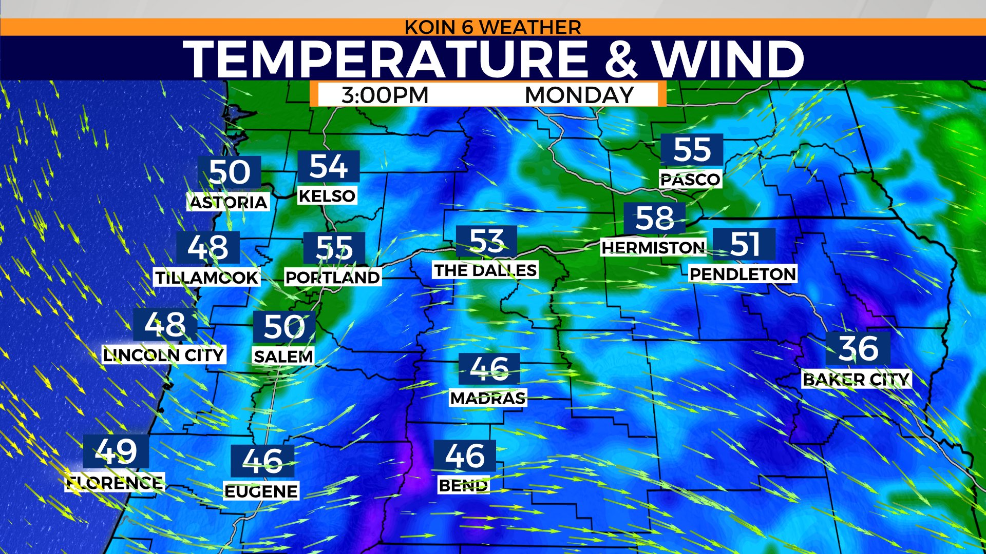
Expect more of a showery environment by the morning commute. The roads should be wet and the ground will be damp if you’re going to be out early. Temperatures will be in the upper 40s for most neighborhoods. No worries, we are expected to warm another 10 degrees by the afternoon.
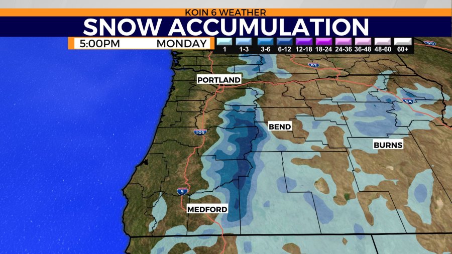
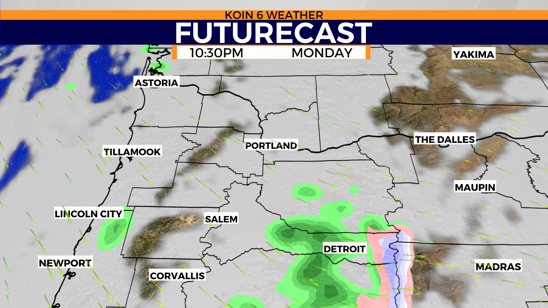
You can cycle through the slideshow below to get a visual representation of the forecast.
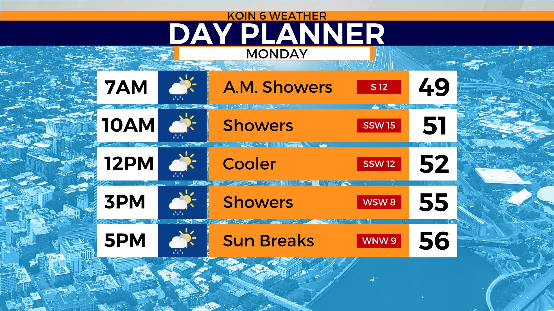
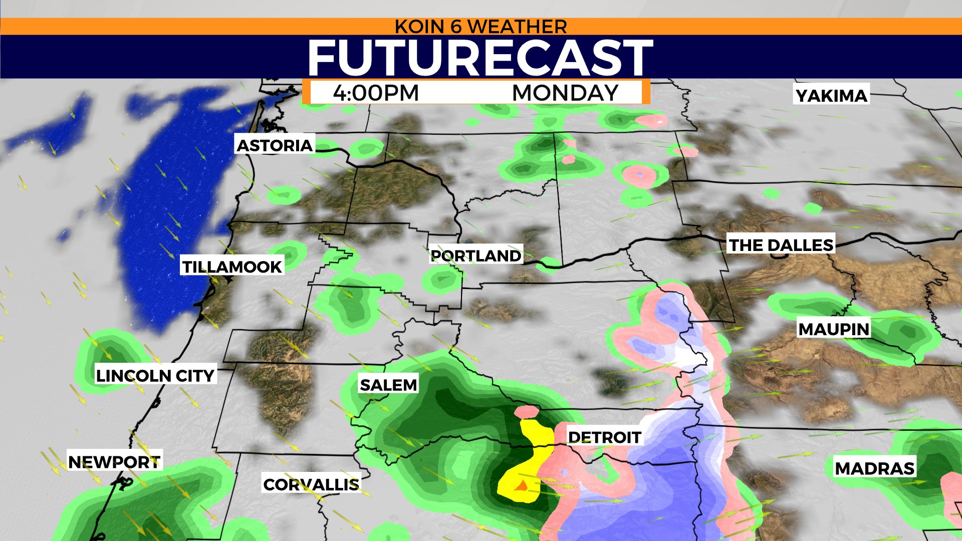
The day planner shows sun breaks and showers from 7 a.m. to 5 p.m. There is also the possibility of a thundershower or two. That means a few downpours or even some small hail is possible. Those usually come with some gusty wind, too.
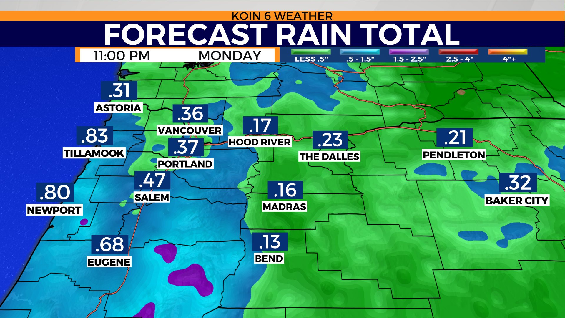
By Monday night conditions start to stabilize. Rain totals will vary, but expect some locations to reach about a quarter of an inch or more. Rain totals likely slightly higher in the central and southern valley. That is because the associated area of low pressure departs to the south and the rain chances remain higher throughout the day. Temperature below average Monday for all.
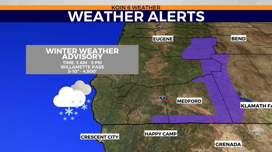
We have a winter weather alert to discuss, too!
The Cascades and higher terrain in central and southern Oregon will be bringing in enough snow to warrant a winter weather advisory. There may be 5 to 10 inches around 4,500 feet and above. This does include Willamette Pass.
This snow will be useful for the drought. If we can get a few more early this month, that would be real valuable.