PORTLAND, Ore. (KOIN) — Spring storms continue to bring hail, graupel, and even snow back to the Portland metro area for the first week of April. Warming temperatures fight with the lingering winter air, making it hard to determine if it’s hail or graupel that’s falling.
Graupel
Graupel’s formation is typically associated with colder storms. It’s more likely to fall during the cooler months as opposed to the summer. The National Weather Service defines graupel as ‘snow pelts‘. So, it’s easier to associate graupel with winter-like conditions.
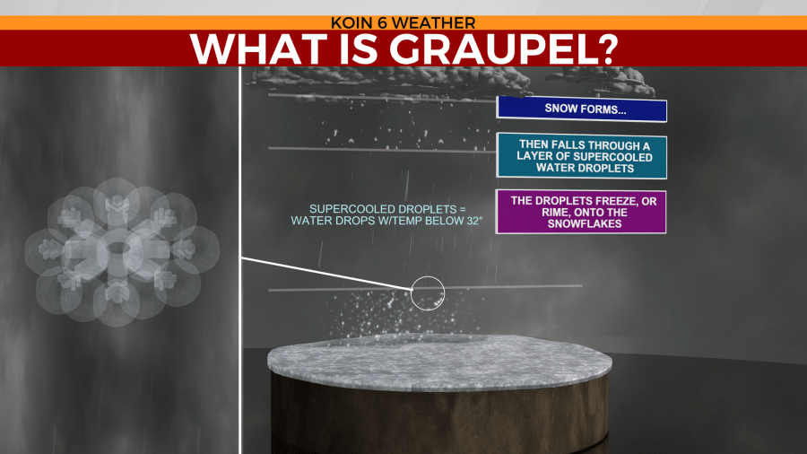
The graupel pelt starts off as a snowflake high in the atmosphere. That snowflake then falls into an area of what’s known as supercooled water droplets. That’s water that remains in its liquid form, despite temperatures sitting below freezing. As the snowflake enters this region, those supercooled water droplets instantly freeze onto the snowflake, creating a small pelt of frozen water. These are usually very small in size and sometimes look like Dippin’ Dots Ice Cream.
Hail
The process for hail to develop is much different than that of graupel. It might sound odd, but warmer air actually helps in forming hail stones. Convective weather systems are the cause of hail formation. Convective storms are the scientific name of a typical thunderstorm and explains why they form. These storms usually develop with some type of lifting mechanism such as a front or warming air that rises. That rising air creates an updraft. Updraft winds take small water droplets and send them to the cold and high elevations of a storm cloud.
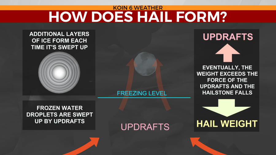
Those water droplets begin to freeze. As they grow and size and become heavier, the newly formed ice stones fall into the warmer sections of the storm cloud. That helps attach more water droplets to the small ice stone. The updraft winds can grow in strength as the storm matures. As it does so, that small freshly water-coated ice stone is then sent back up into the cold regions of the storm. That freezes the new layer of water onto the ice stone, making it grow in size. That process continues until the updraft is no longer able to keep the heavy ice stone suspend in the air.