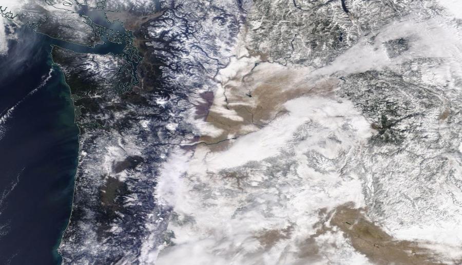
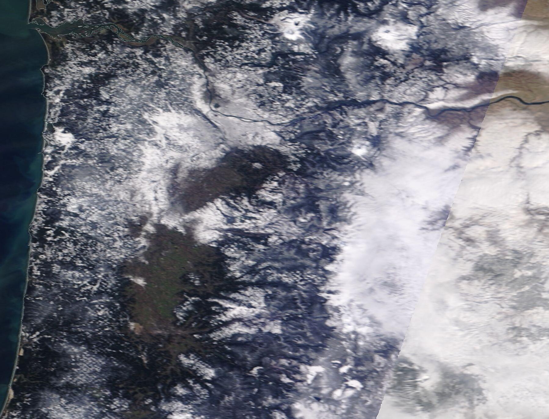
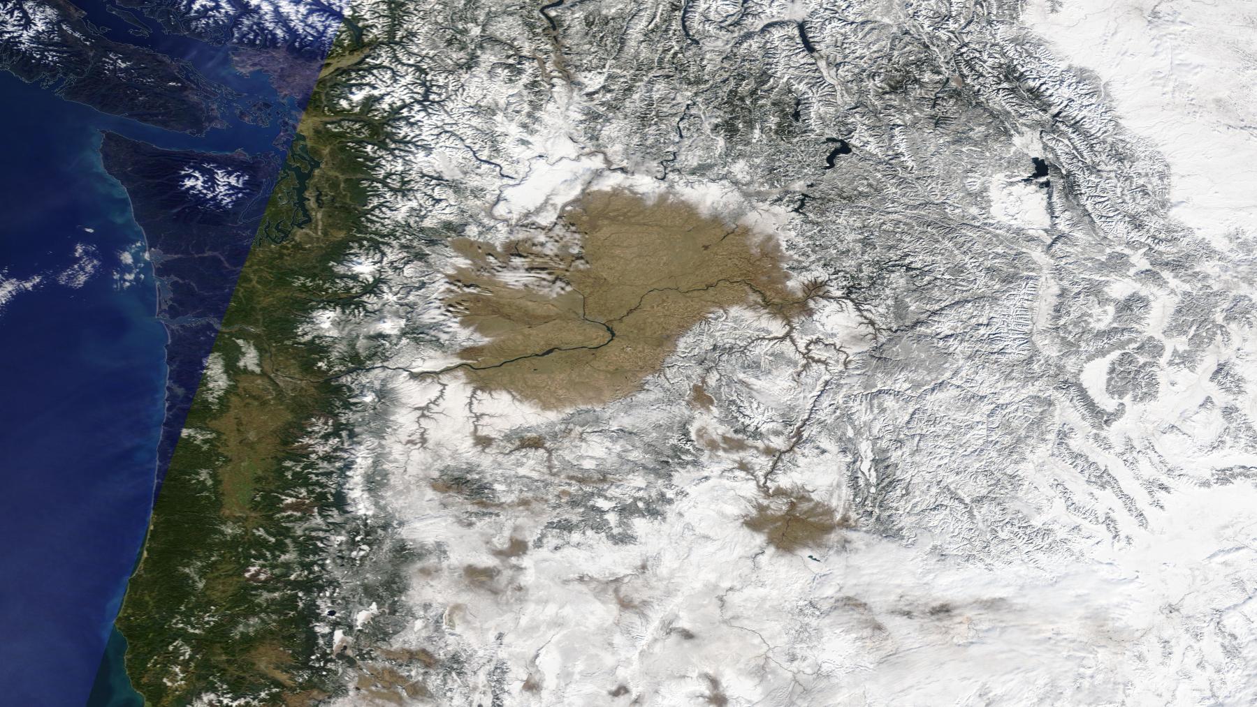
PORTLAND, Ore. (KOIN) – Friday’s clear skies left a window for NASA satellites to capture a breathtaking view of the record snowfall dumped on the Pacific Northwest this week.
Images taken from NASA’s “Worldview” satellite observation system show the blanket of ice and snow now covering Oregon and Washington after this week’s record snowstorm. The image also gives context to the 10.8 inches of powder that halted traffic and frosted rooftops around the Portland area between Wednesday night and Thursday morning.
Portland’s abundance of cloudy days prevented NASA from capturing an immediate before-and-after visual of the storm. Based on NASA’s backlog of images, the region’s last clear, sunny day was on Jan. 30. While the photos were taken almost a month apart, they still give a look at how dramatically the region’s snowpack has changed in the last 23 days.
KOIN 6 Meteorologist Kelley Bayern reports that Friday and Saturday’s clear skies may give way to more snow in Portland early next week.
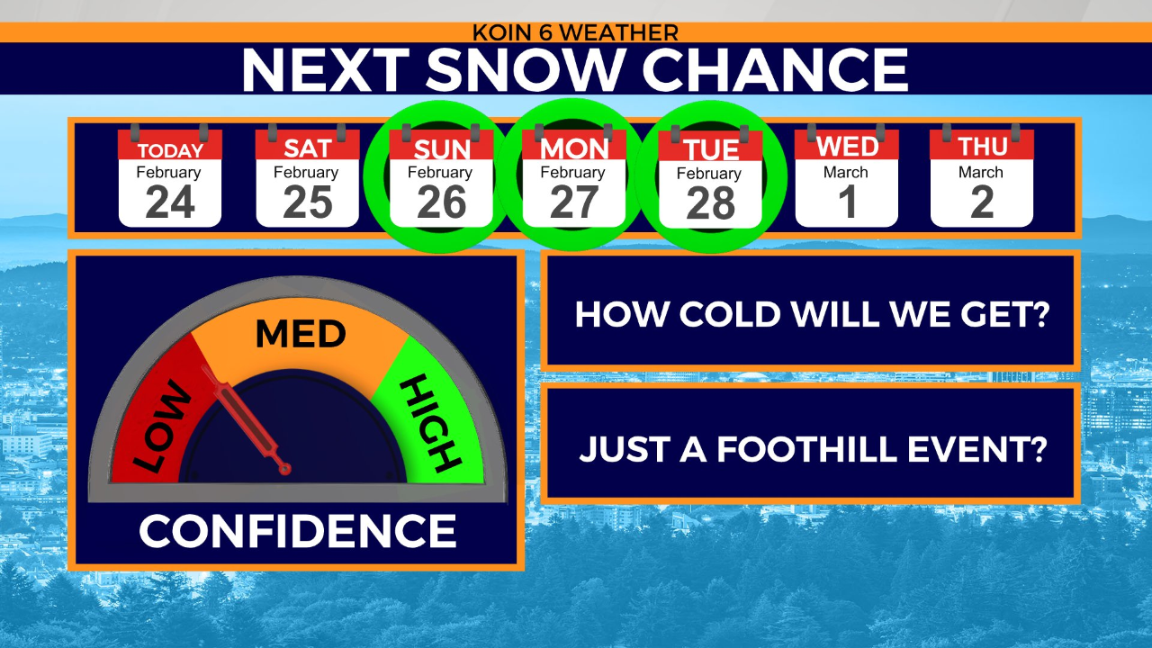
“We have potential for more city snowfall right on the heels of this latest event,” Bayern said. “Sunday morning through Tuesday morning will be wintry and wonky. We’ll slowly scour out the arctic cold into Saturday afternoon. But it’s still a tough call on city snow levels as these storms shift in and mix things up.”