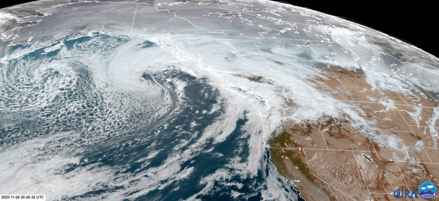
PORTLAND, Ore. (KOIN) — Ready for another round of rain? Below you are looking at a satellite image of the incoming rainy episodes that will be here today. Thursday will be a tandem of an early front and then a second area of low pressure catapulting in behind that front. This is why I chose the satellite image below because you can see both in the works to the west. A more developed area of low pressure and to the west, the beginnings of what will be our secondary low that arrives behind the front.
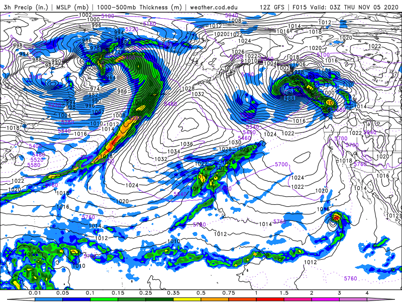
You can use the graphics below to help visualize the two-step process that we will encounter tomorrow. You can see the secondary low forming to the west of our deep area of low pressure that is going to be driving that occluded front east to the north. The first of the rain will impact more of the northern region and then the second area of low pressure that moves in will bring moisture farther south and to areas of the Central Cascades. That means we have two different trajectories for these systems, leading to more widespread rain for Thursday and this will impact most in the state.
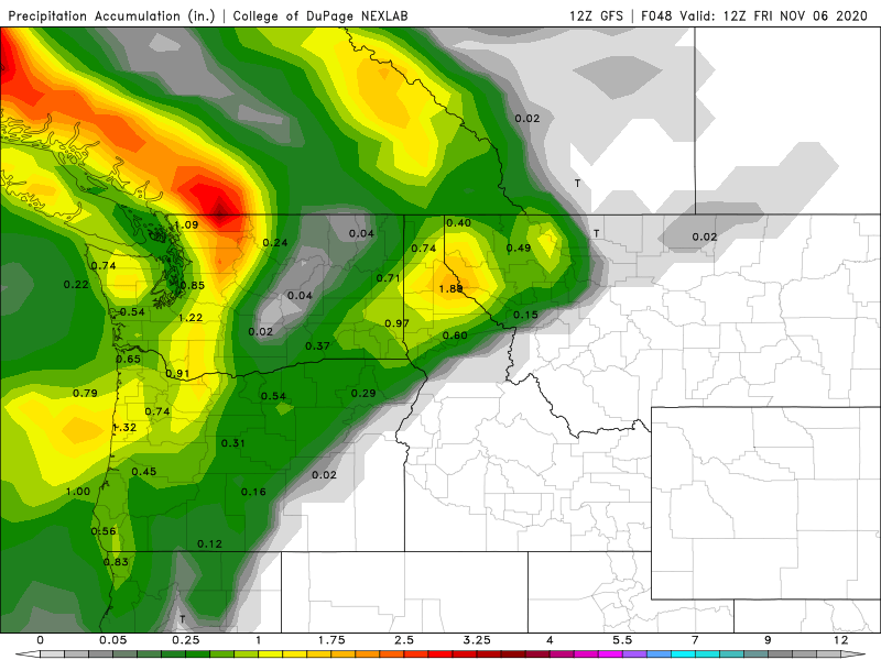
If we take a sample of the total accumulation by Friday morning, we should be somewhere around .75 inches to potentially an inch of rain. Highest totals for the Oregon Coast around Lincoln County and locations south. Rain totals pretty hefty around the Northern Cascades and portions of the Columbia River Gorge. I would even say that we have some decent moisture for areas like The Dalles and folks south toward Bend.
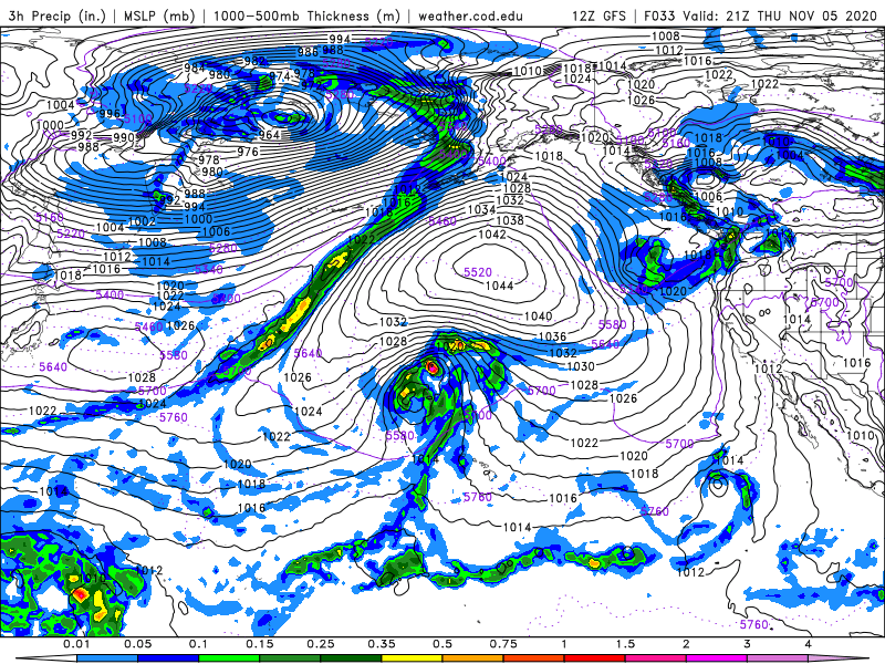
By Friday morning, we may still have a few showers hanging around, but the cooler air starts moving in behind this system. We may start to see some snowfall for some of the Cascades if the moisture is hanging around long enough. Rain still likely to the south and even extending through areas of the Columbia Plateau.

A better chance for accumulating snow for the mountains on Friday evening and night. By this time, a majority of the moisture is to the south, leading to more of a snow event for the central and southern mountains. This would impact Mt. Bachelor and parts of Deschutes County before areas like Mt. Hood. That cold air then sticks around for the weekend.
