PORTLAND, Ore. (KOIN) – We have another scorcher of a forecast on Monday, but there is some better news attached to the evening forecast — cooler air is coming.
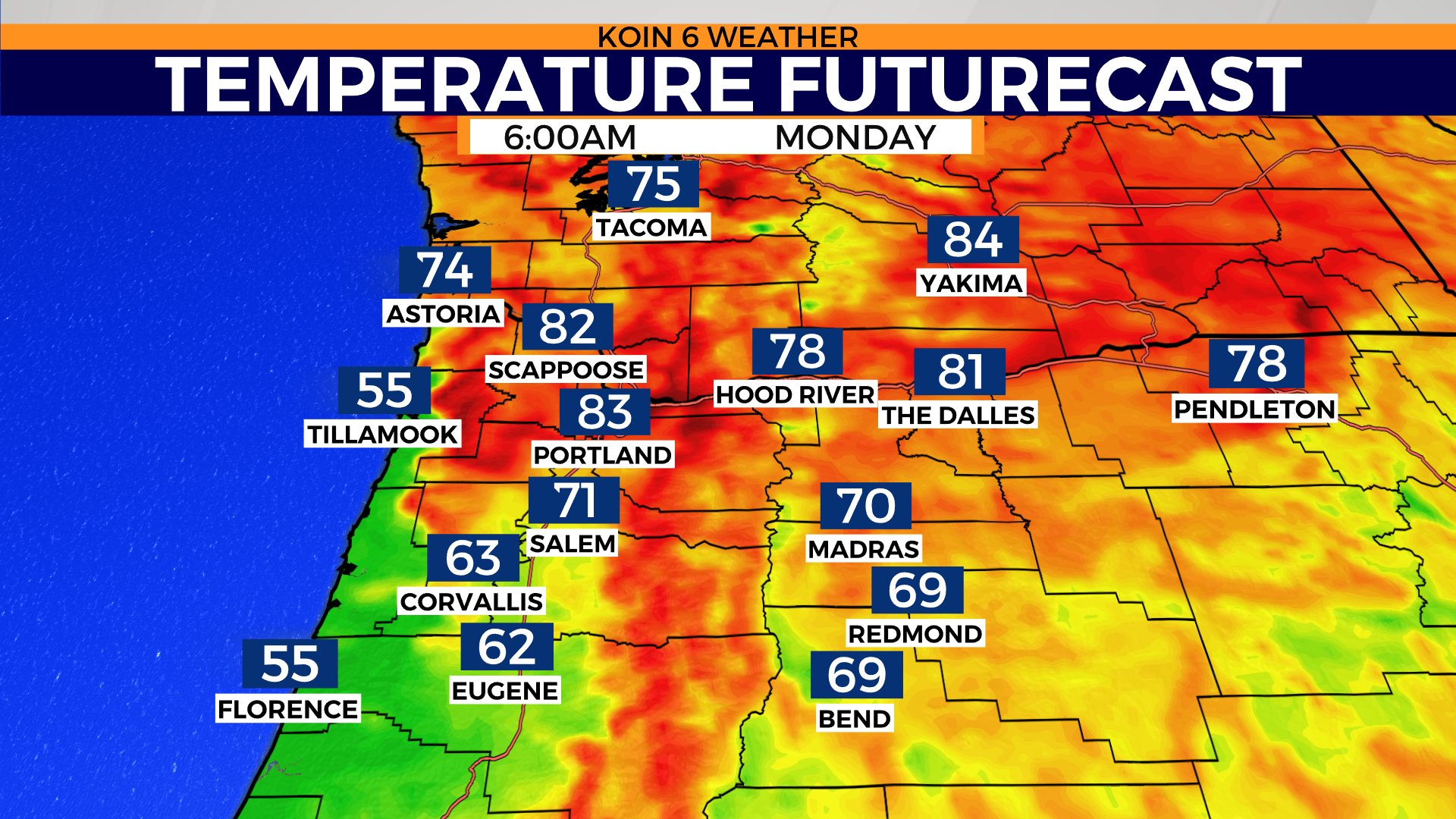
We start the week in the lower 80s. There is a strong chance that we will not dip below 80 degrees Monday morning. After topping off at 112 degrees on Sunday, the warm air is huddled close to the surface and it won’t be able to cool in time before the sun comes up. It’s likely we start the day with the warmest low ever on record in Portland.
Right now, weather models have temperatures cooler for counties south of Marion. Portions of the Oregon coast should cool nicely, however, the northern Oregon coast may still be dealing with some heat to start the day.
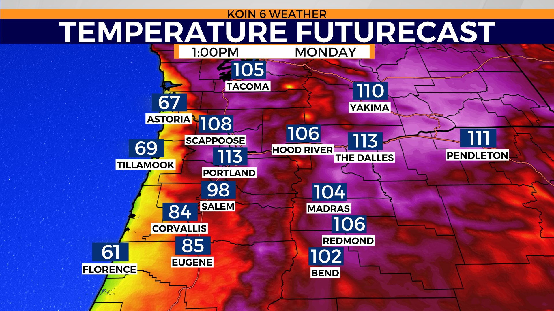
Cycle through the graphics below so you can see what happens for the afternoon and evening. By the time we reach 10 or 11 a.m., we may already be in the triple-digits. Locations around Portland are expected to be the most grueling today. There is a strong chance that we top the all-time record again for the third day in a row.
The forecast high for Portland is 113, which would be the warmest day that we’ve ever experienced since taking records and also the third warmest of our heatwave. That means extreme heat is here to start the week, which will continue to pressure our routines around here.
Here is the good news, there is a strong possibility that an onshore flow will take over by the late evening hours, dropping our temperatures significantly. Weather models are promoting the mid-80s by 8 p.m. today. That is a drop of 20 degrees, and for some, maybe even 30 degrees by sunset. I bet it will feel really nice as nature helps us out tomorrow.
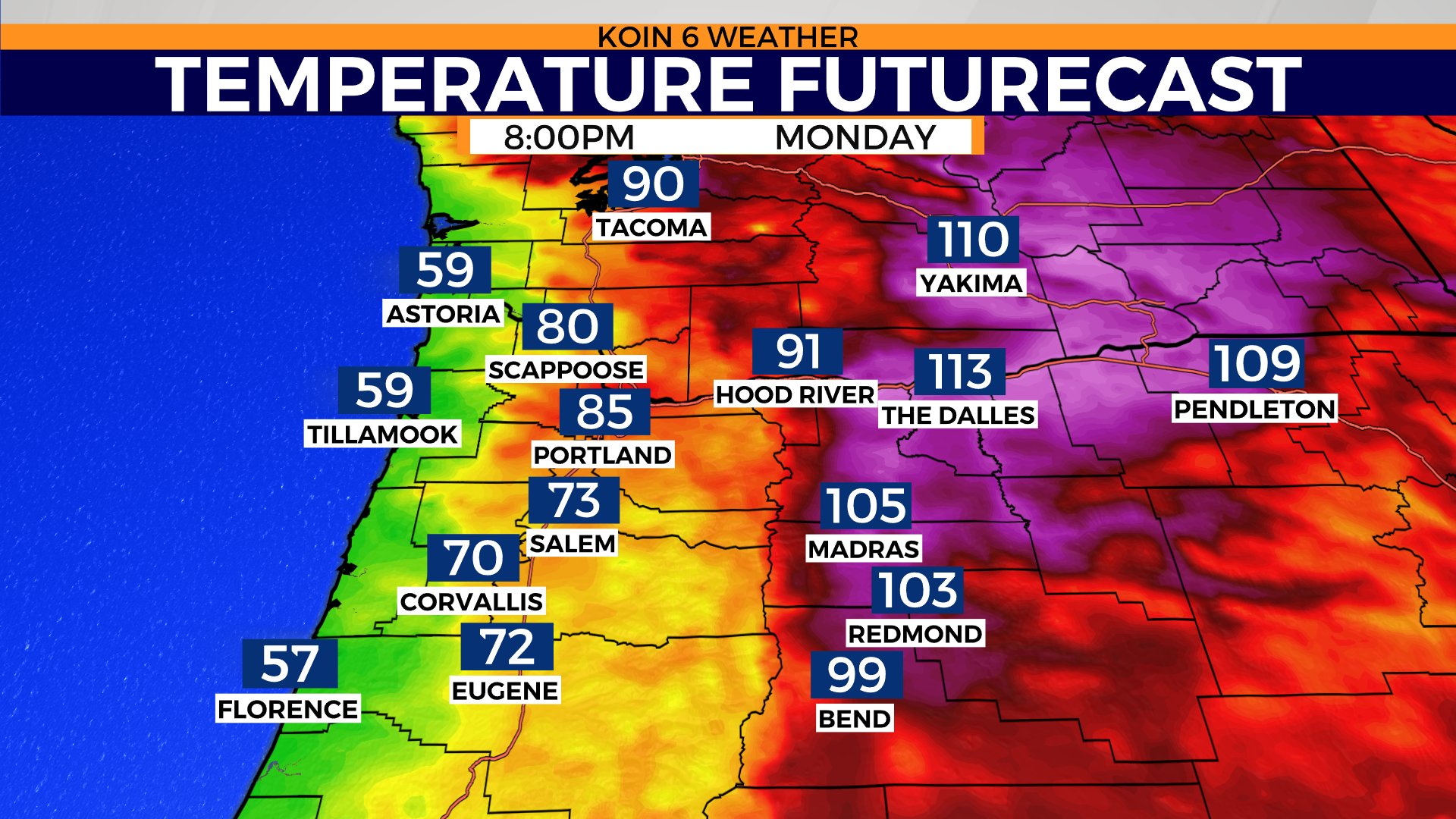
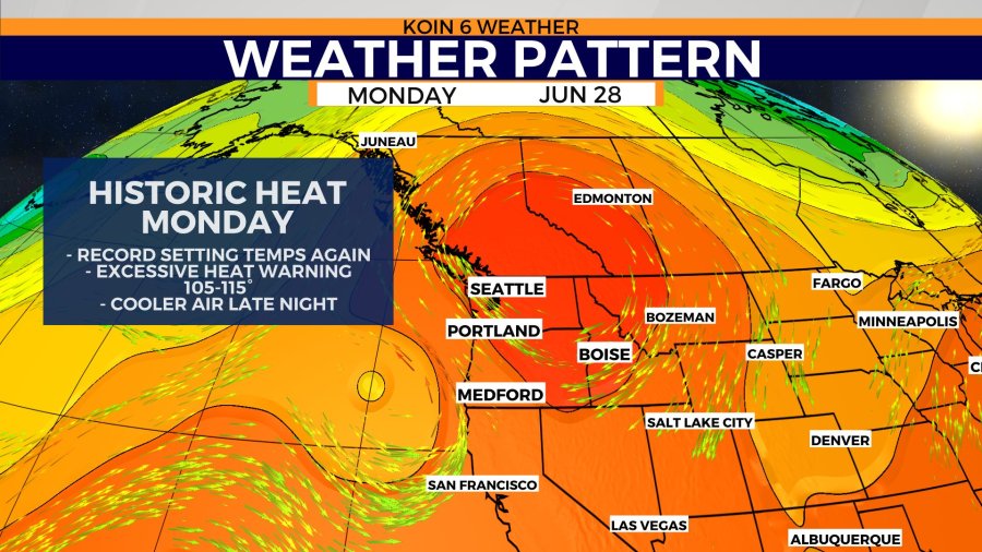
This heat is going to pressure the Seattle region and areas of Canada once again. That dome of heat, which is just bringing historic heat to the Pacific Northwest, will slowly shift east. It won’t be enough to bring some ease to the heat for those of you east of the Cascades, but it will sidle east enough to help the coast and valley as I mentioned by the late hours Monday.
That heat dome will cause some ruckus through the week, which you can find more updates on here. A reminder, that fire danger is a large concern too. With the breezy moments and dry conditions, we have to be cautious. Expect a blue sky around here because of this ridge of high pressure that will continue to hold the weather pattern in our section of the United States for some time.
Lastly, our forecast has been so warm, that it breaks our normal frequency calculations for Portland. The frequency chart for the month of June has Portland hitting 100 to 105 0.1% of the time. Before now, 105 was not available to incorporate into the frequency table. It has never happened before because the June all-time record was 102. Not only have we topped 105, but we also have topped 110.
This forecast is so far from our normal, we have been 30 to 40 degrees above our normal high for June. Something to think about, but we will definitely have more information about this historic heatwave in the coming days, weeks, months and likely years. This will be a situation that is studied and used for comparison for ages.