PORTLAND, Ore. (KOIN) — Snow flurries will continue to fall across parts of the Portland metro area through the middle of the week.
Below-average temperatures will keep snow elevations near 1,000 feet. A stray snowflake or two might find its way lower than that as light rain showers fall. Any snow that may fall around 1,000 feet now through Wednesday morning will melt on contact.
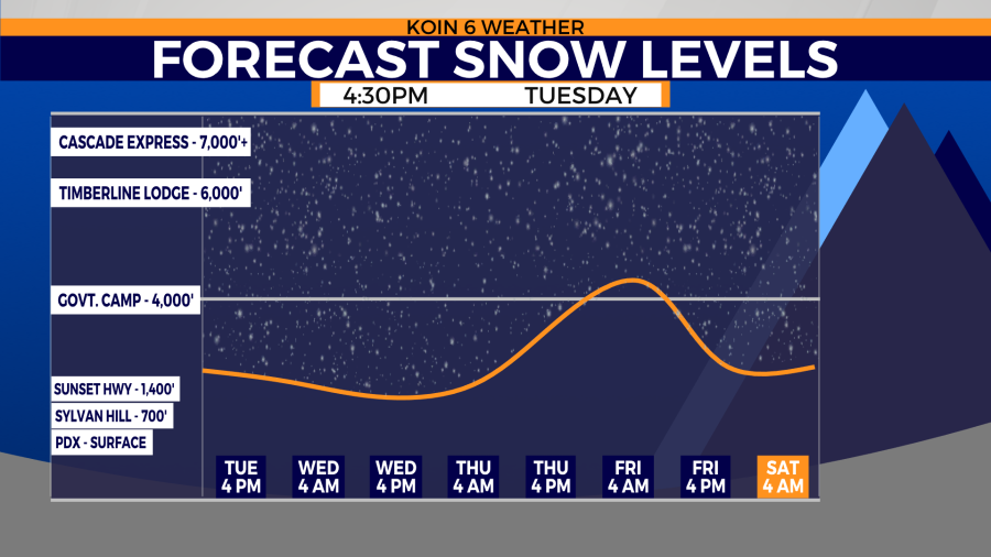
A wintry mix remains a possibility through Tuesday morning as temperatures sit slightly above freezing come sunrise.
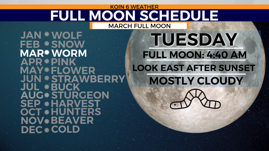
If clouds break enough Tuesday morning Portlanders will enjoy the views of the ‘worm moon’. That’s the name The Old Farmer’s Almanac gave to the full moon in March for warming soil allowing worms and beetle larvae to begin to emerge.
Temperatures will gradually warm through the week and into the weekend. That’s due to Thursday and Friday’s return of an atmospheric river. The bullseye will be just south of Oregon, but the rain and snow impacts will be felt in western Oregon and Washington through the week’s end.

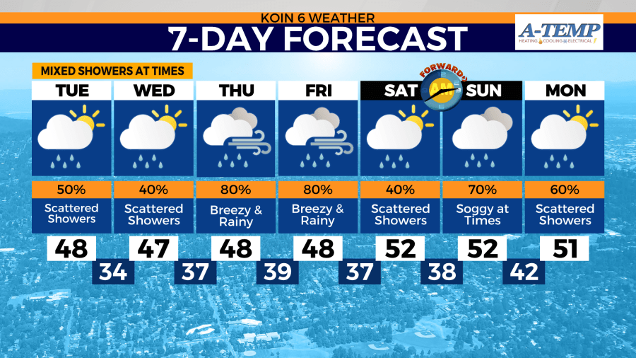
Not only will the weekend bring warmer temperatures and wetter conditions, but daylight saving time begins. Clocks will need to be set ahead one hour early Sunday morning. An hour of sleep will be lost Sunday, but an hour of light in the evening will be gained.