PORTLAND, Ore. (KOIN) — With the buzz of an arctic blast of frigid air and citywide snowfall coming our way by Christmas weekend, many folks are wondering how the roads will fare through it all.
Will you be able to make it to the family by the holiday? The clock is ticking and time is running out. By Sunday, weather models are hinting at snow on the ground around Portland.
Before we get into those details, let’s jump into the week ahead and lay out some of the best times to hit the road and when things may start to turn dicey.
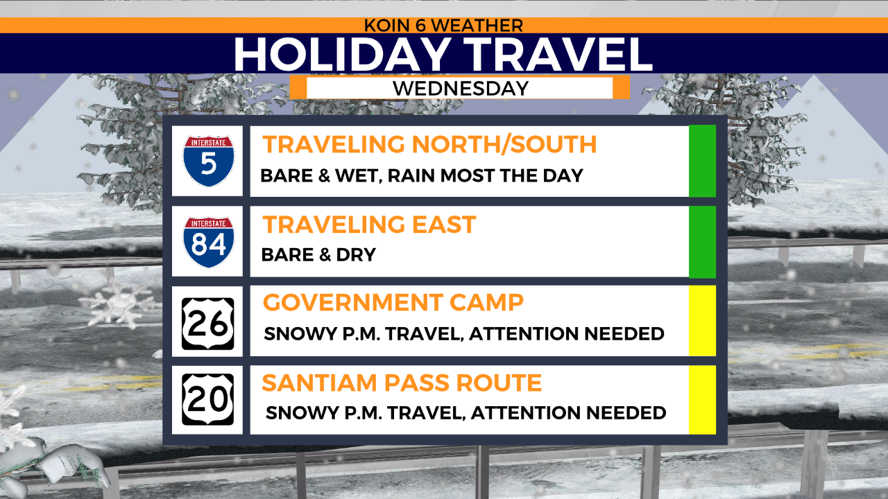
Wednesday – You’re Good to Go
Metro Area and I-5: A low-pressure system will bring in heavy rainfall for the remainder of the day. Expect to see wet roadways throughout I-5 in and out of Oregon on both the north and south ends. No issues for your drive expected tonight.
The Gorge and I-84: Staying wet and bare with snow levels hovering well-above river levels. No issues for your drive expected tonight.
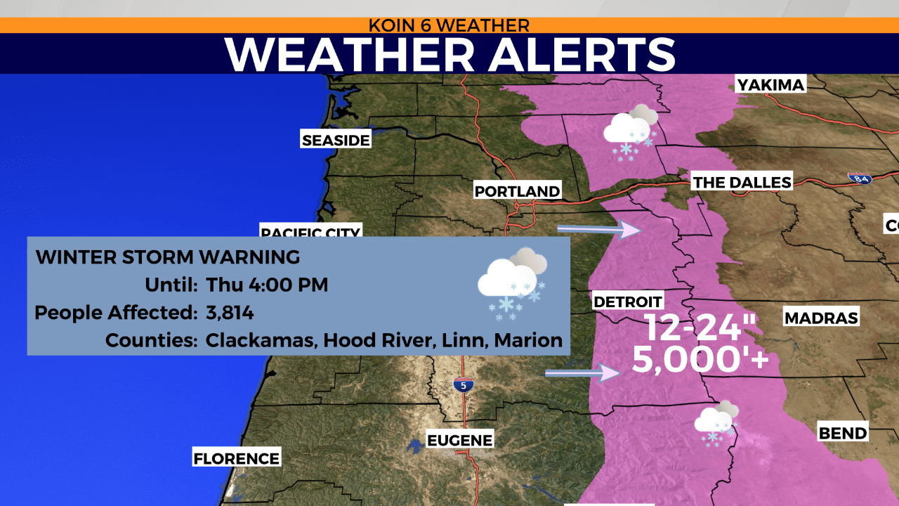
Cascade and Coast Mountain Passes: Roadways are drivable through the afternoon, but lookout for steady snow showers beginning tonight through Thursday. A Winter Storm Warning is in effect until Thursday afternoon for one to two feet of new snow above 5,000 feet. The passes may become impossible to cross by Thursday. Drivable today but heavy snow coming Thursday.
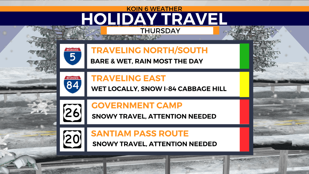
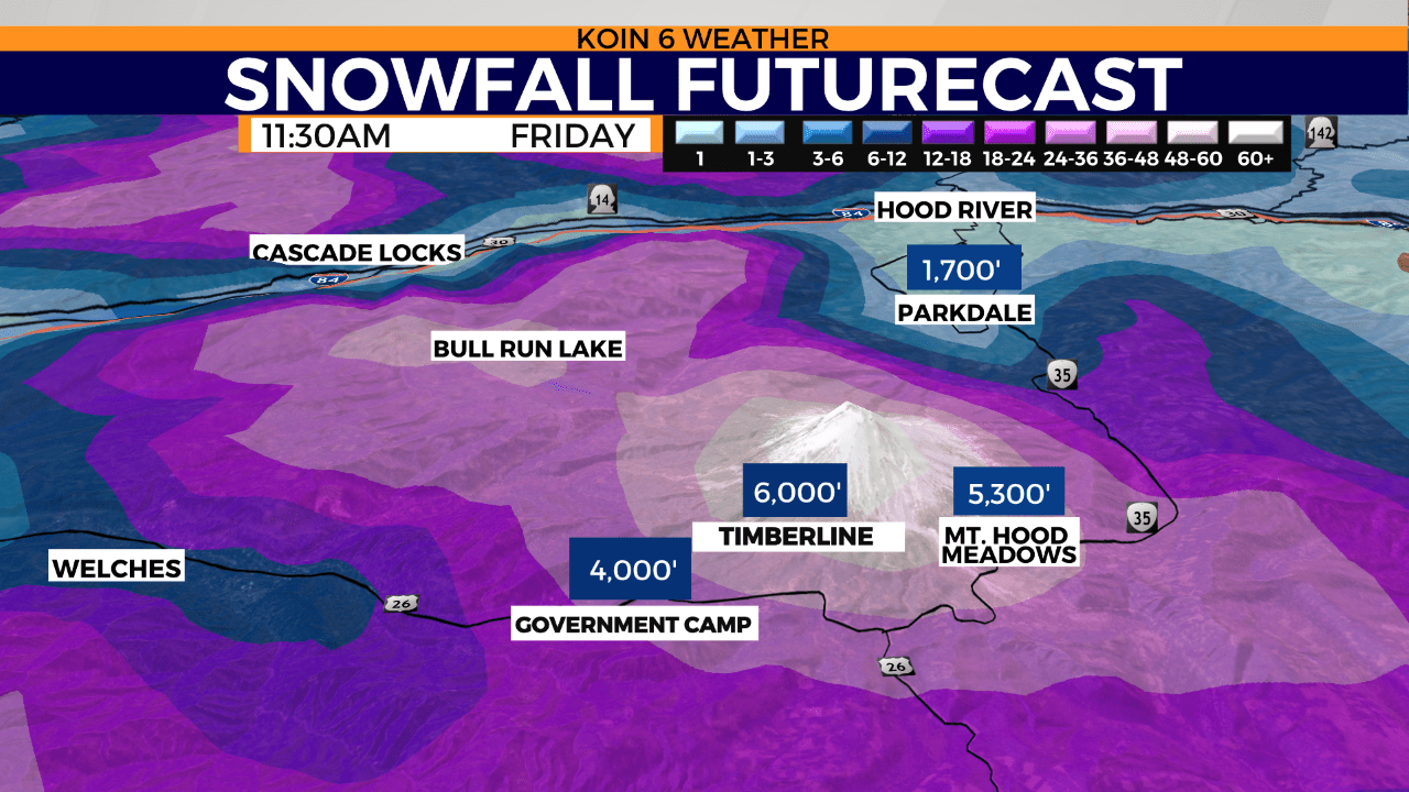
Thursday – Some Routes Turn Dicey
Metro Area and I-5: More rain showers are expected with bare and wet roadways. Snow levels start to dip lower to the 2,000-foot elevation. I-5 north looks wet and bare, yet I-5 south may start to pick up light snow showers over the Siskiyous by the evening. No issues are expected around NW Oregon. Use caution near the south end of the state.
The Gorge and I-84: Rain throughout the day with a rain & snow mix possible by the evening. Snow levels will hover around 2,000 feet. No accumulation is expected down to river levels. No issues are expected for your drive.
Cascade Mountain Passes: Heavy snow expected with tough travel conditions likely. Be prepared for congestion and delays or closures. Tough pass travel expected.
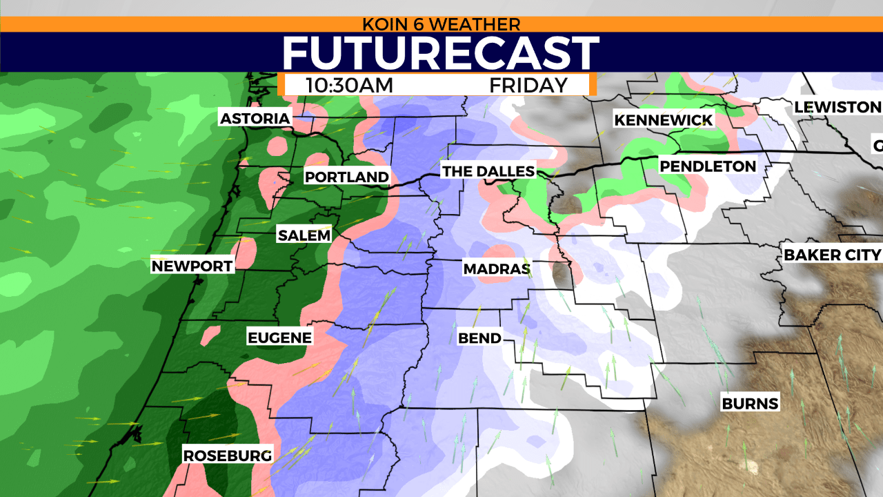
Friday – Use Caution
Metro Area and I-5: Snow levels will hover near the foothills as plenty of moisture filters in. Expect a chance for morning snow flurries, transitioning to all rain by late morning. Few issues are expected around the Portland metro area. Heavier snow is possible near the Oregon and California border on I-5 across the Siskiyou Summit. Expect tough travel across I-5 at times as several inches of snow may accumulate over the interstate.
The Gorge and I-84: Rain throughout the day with a rain & snow mix possible by the evening. Little to no snow accumulation is expected down to river levels. Snow levels will hover around 1,500 feet. Expect a few issues on the road but use caution.
Cascade Mountain Passes: Heavy snow expected with tough travel conditions likely across all passes. Be prepared for congestion and delays or closures. Feet of snow will have accumulated over the past two days. Tough or impossible pass travel expected.
Coast Range Mountain Passes: Rain likely with light snow showers possible by nighttime. Expect a few issues on the road during the day and use extra caution by the evening as snow begins to fall over higher elevated routes.
Christmas Day – Snowfall is lingering, keep watch up north
Metro Area and I-5: Snow levels will again hover near the foothills with a mix of rain and snow flurries and transitioning to all rain throughout the afternoon. Few issues are expected around the Portland Metro Area for much of the day. If you’re traveling north into Washington State via I-5, expect snow showers with little accumulation throughout the evening. Heavier snow may begin to fall around the city by the overnight hours.
Siskiyou Summit I-5: Heavier snow likely on I-5 across the Siskiyou Summer near the Oregon and California border. Use caution and expect slow travel across I-5.
The Gorge and I-84: Rain and snow showers likely. Snow levels will hover around 500 feet with a dusting to a half-inch of accumulation possible on I-84 and down to river levels, especially across the eastern sides of the gorge near Pendleton and southward. Use caution on your drive.
Cascade Mountain Passes: Heavy snow expected with tough travel conditions likely. Be prepared for congestion and delays or closures. Tough pass travel expected.
Coast Range Mountain Passes: Rain and snow likely and transitioning to all snow by the evening. With snow levels hovering around 500 feet, expect light to moderate accumulations on roadways. Expect slippery conditions and use caution on the roadways, especially throughout the evening hours.
The KOIN 6 Weather team will continue to monitor conditions into Sunday when there is potential for accumulating snow down to the valley floor. We’ll be back with more updates.