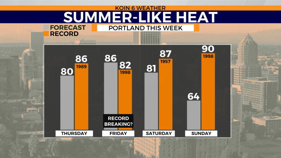
PORTLAND, Ore. (KOIN) — Portland jumps from winter to summer in just a week and there’s a reason why the Pacific Northwest is warming so fast.
For starters, temperatures have sat nearly 10 degrees below normal for much of the month of April. When temperatures warm closer to normal in the mid 60s, it’s going to feel much warmer.
However, this week’s temperatures go from below-average to above with a nearly 30-degree jump from Monday to Friday.
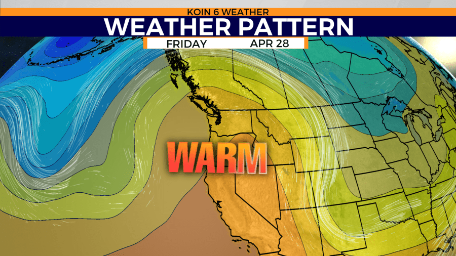
Portland’s latest atmospheric setup has a ridge of high pressure building over the western half of the country. That ridge is formed by the jet stream moving north. That allows high pressure to dry the west out as temperatures build.
Oregon and Washington have seen high-pressure ridges before, but there’s another mechanism helping in building the heat this week. It’s known as “downslope winds.”
These strong easterly winds were the cause of some of the devastating wildfires seen in western Oregon in September of 2020. This round of east winds comes when vegetation remains wet and snow-covered thanks to April’s surplus in moisture. So, the only major impacts to the region is warming temperatures and gusty winds Friday around the Portland metro area.
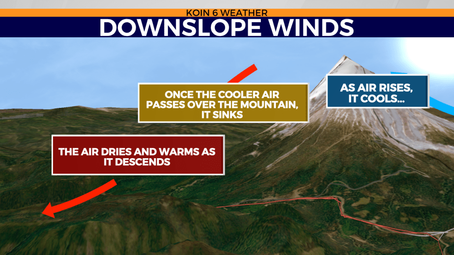
These easterly winds cool while moving up the sides of the Cascades. Once they hit the crest, the air starts to descend. As the air lowers in elevation, it speeds up, warms up and dries out.
The combination of downslope winds and a ridge of high pressure is the cause of Portland’s long-overdue warming trend this week.