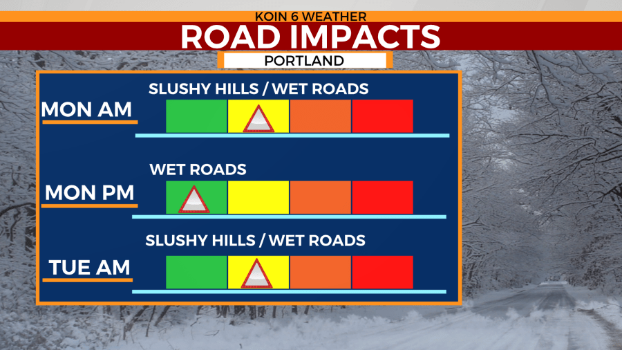
PORTLAND, Ore. (KOIN) — A KOIN 6 Weather Alert remains in place as the chance of snow returns to lower elevations Monday morning and again Tuesday morning.
No snow accumulation is expected for the metro area, but locations above 700 feet could see a light dusting come the mid-morning hours Monday. Very little travel impacts will be seen in the metro area, but some higher elevated locations could see slush build in areas Monday morning.
Snow showers could be heavy for some at times, but the duration of the event will be relatively short. Snow chances move in around sunrise, but by lunch, skies will start to clear.
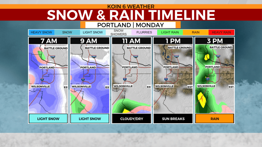
A few sun breaks are possible in the early afternoon hours. That will help warm temperatures into the low 50s Monday afternoon. That’s still nearly 10 degrees cooler than normal for the first week of April.
If a snow chance wasn’t enough for the new workweek, Portland then gets a chance for a stray thunderstorm or two by the afternoon and evening hours Monday.
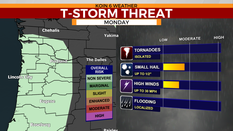
No severe weather is expected with these showers. However, colder temperatures Monday night into Tuesday morning will send the Pacific Northwest back to winter with the return of potential snow.
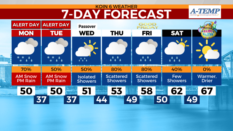
Warmer temperatures are expected to work their way back to the Portland metro area by the weekend.