PORTLAND, Ore. (KOIN) — The National Weather Service issued a Winter Weather Advisory from 9 p.m. Saturday until 10 a.m. Sunday, mostly for the hills and locations above 500 feet.
If you have plans for Saturday night, it could get interesting. Models are coming into good agreement that snow will drop to the valley floor anytime Saturday night after 9-10 p.m. and is likely to remain there until 5 a.m. or so Sunday morning.
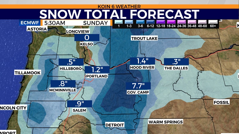
A cold front will drape itself across the northwest part of Oregon and southwest Washington later Saturday and Saturday night somewhere between Kelso and Salem, bringing with it heavy precipitation across the entire metro area.
It will start out as rain in the valley and slowly transition to snow in the hills first. By later Saturday night, there is a good chance that it will drag snowfall levels all the way to the valley floor about 10 p.m. to midnight.
There will be a about a 50-mile-wide swath of wet snow somewhere between Salem and Kelso. Models are going for anywhere from a trace to as much as 3 inches around the Portland metro area later Saturday night, with the most being in the hills above 500 feet elevation.
It will then turn back to rain by sunrise Sunday. So, only about 4-6 hours of localized wet snow.
Localized flooding is also possible on Sunday.