PORTLAND, Ore. (KOIN) — There will be some dry time this week, but it won’t be here on Monday.
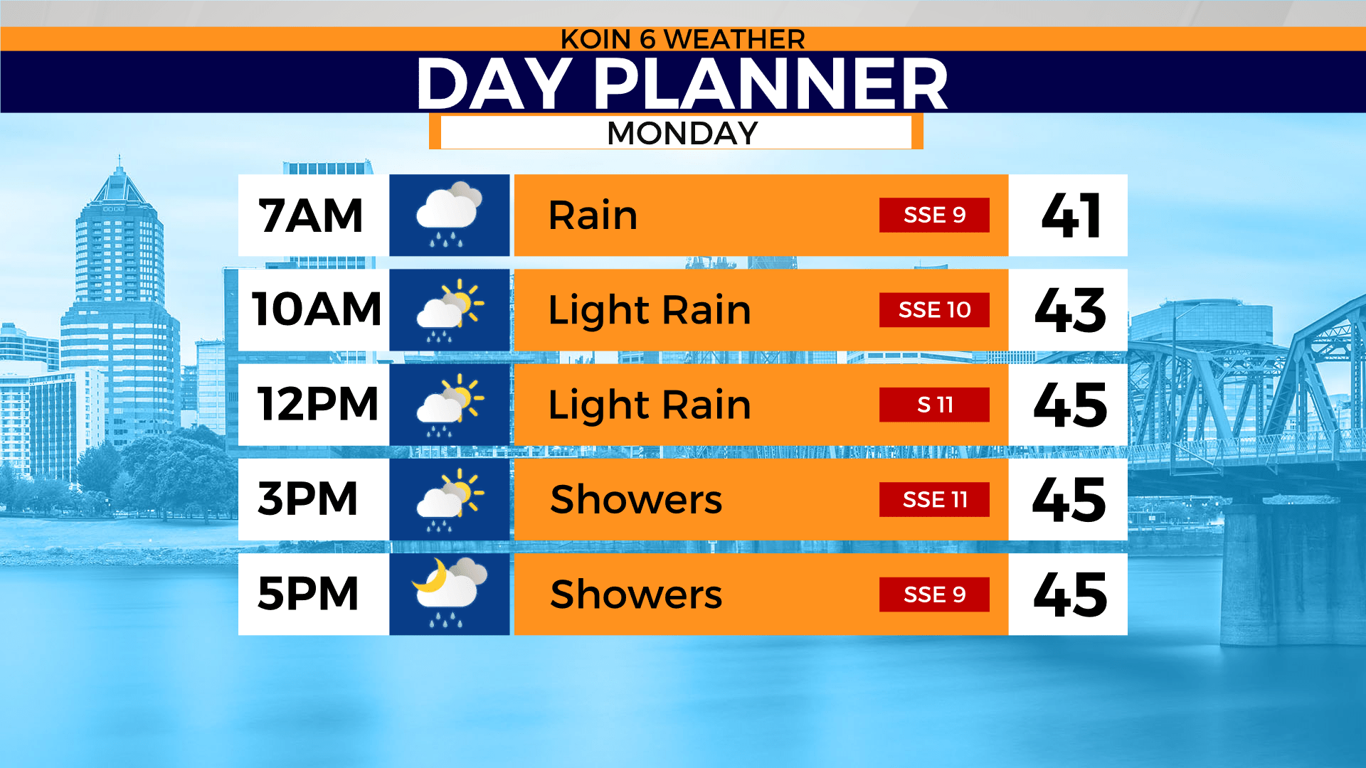
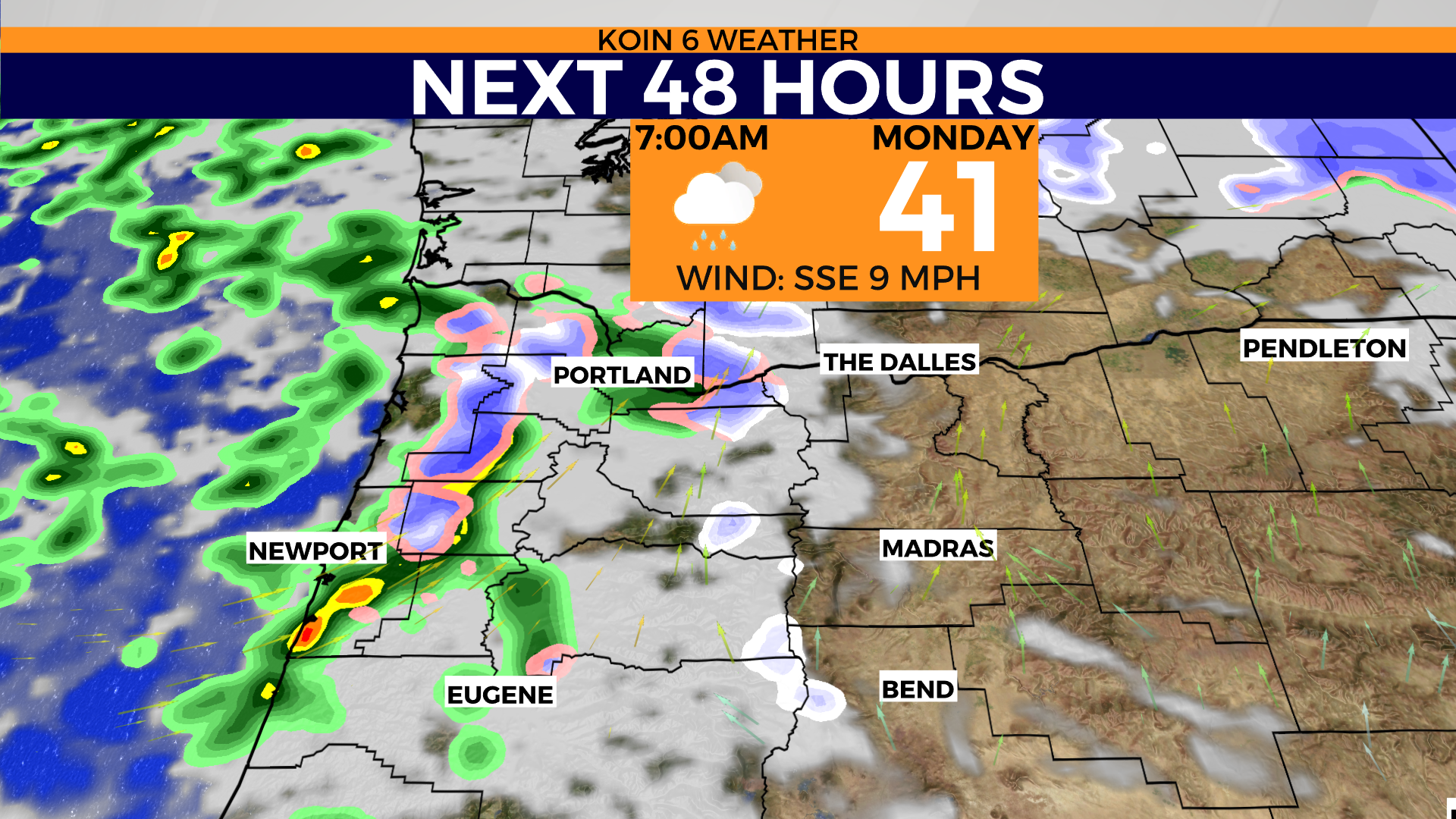
There is a large trough of cold air which is creating some bumpy weather. Showers will be moving in and out for the next 24 hours. That means we will have a mix of rain and there may even be some snow that tries to fall to the lower elevations.
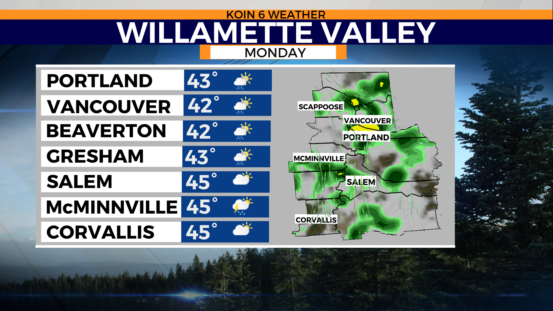
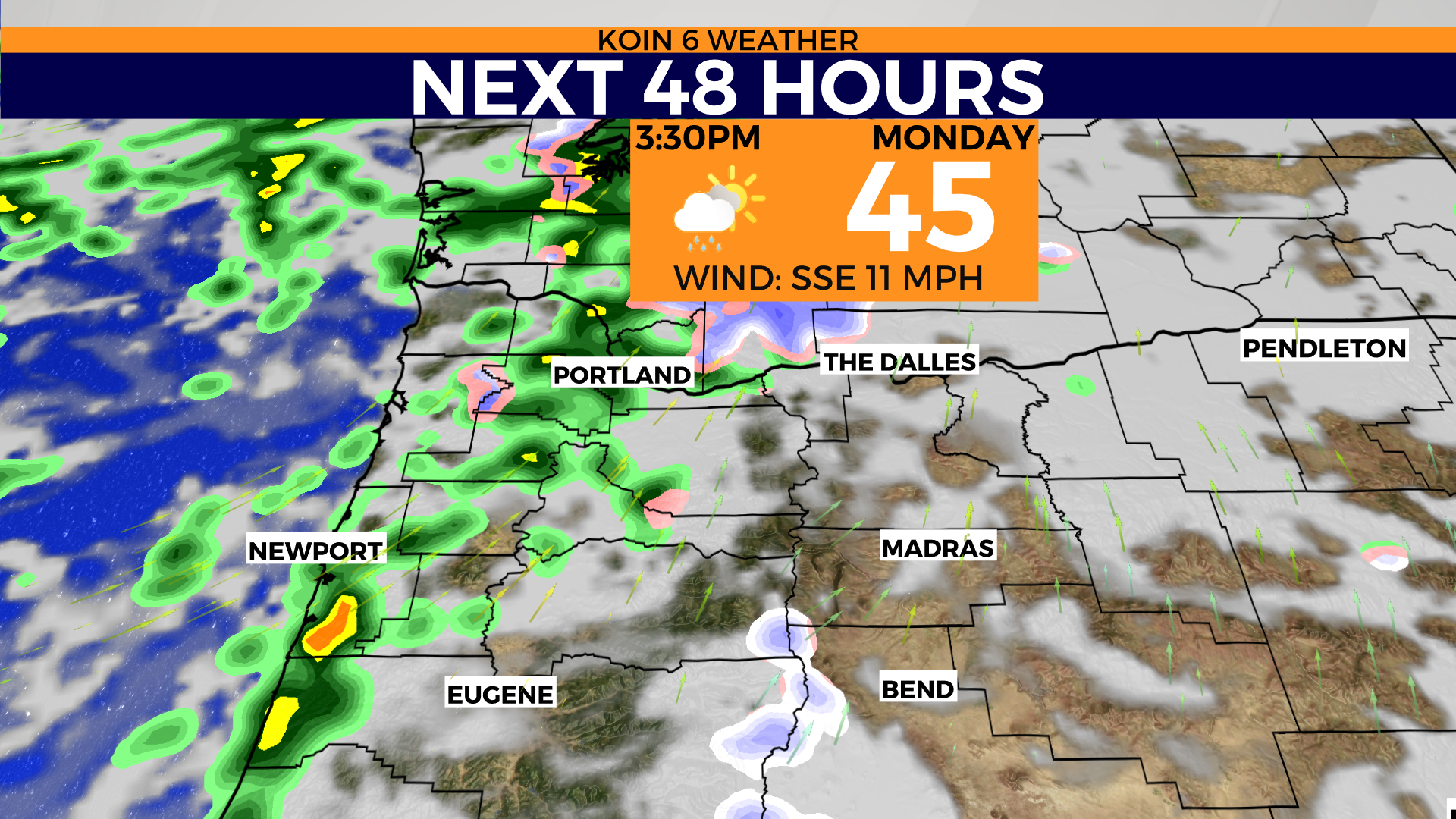
The southern Willamette Valley and the Cascade foothills will be vulnerable for this come Monday morning and night. We can’t rule out a little snow for the hills around here too (1,000 feet). Most areas that see snow will see it because of the rain that cools down the environment to transition to snow. Temperatures around Portland Monday morning should be in the upper 30s.
With unsettled weather on Monday, you will want a rain jacket. Temperatures will warm to the mid-40s by night. Conditions will dry out come Election Day and we will have some frosty mornings this week.
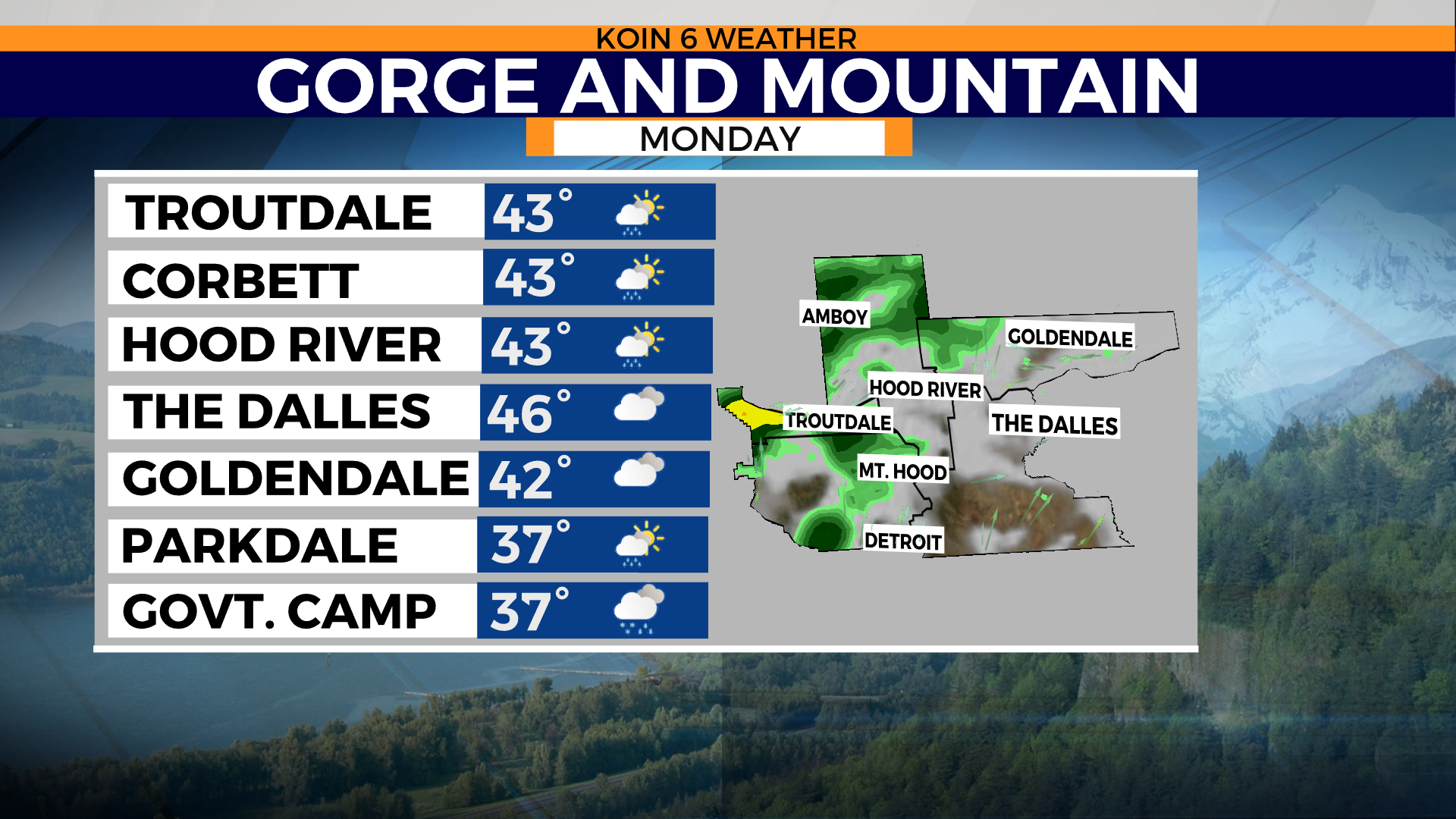
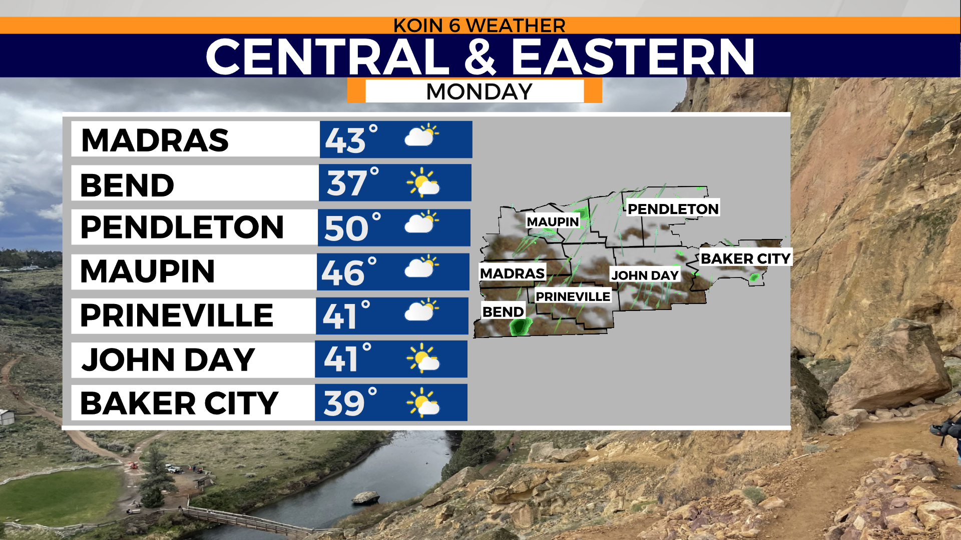
Swipe through the slideshow below to see the forecast in your area.

Stay with KOIN 6 News for all the latest weather details.