PORTLAND, Ore. (KOIN) — Lower snow elevations return Wednesday as April 12 remains Portland’s record latest seasonal snowfall date. Snow elevations drop to nearly 1,000 feet. No snow accumulation is expected Wednesday morning below 1,000 feet, however.

Wednesday morning lows will fall into the 30s. That will help keep snowflakes intact for locations in higher elevations. The West Hills of Portland will see a few early snow flurries, but nothing is expected to stick.
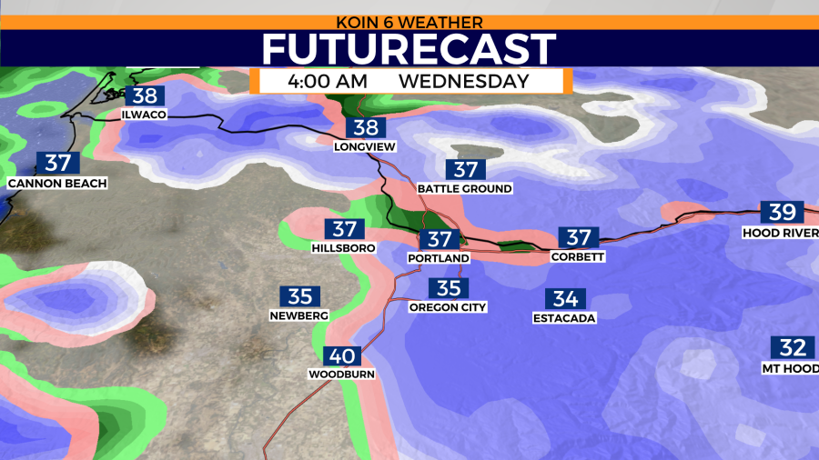
A stray snow flurry or two will transition to light rain showers by the mid-morning hours. Temperatures will begin to warm from there, with afternoon highs expected to sit in the low 50s, nearly 10 to 15 degrees below normal.
Scattered showers remain in the forecast through Thursday. This comes as warmer temperatures slowly work their way back into the Pacific Northwest. Afternoon highs will near 60 by the weekend.

Oregon and Washington’s latest warming trend is short-lived. Another round of rain and wind helps knock temperatures down to the mid-50s as early as Monday next week.