Editors note: KOIN 6 News has a more recent weather story available here.
PORTLAND, Ore. (KOIN) – Just like that, we are preparing for a significant winter event that is going to impact the Greater Portland Metro Area and many surrounding communities through the weekend.
It will begin tomorrow and make a major impact by Friday. We will focus on Thursday and Friday and briefly talk about what may follow as we will update you well into the weekend.
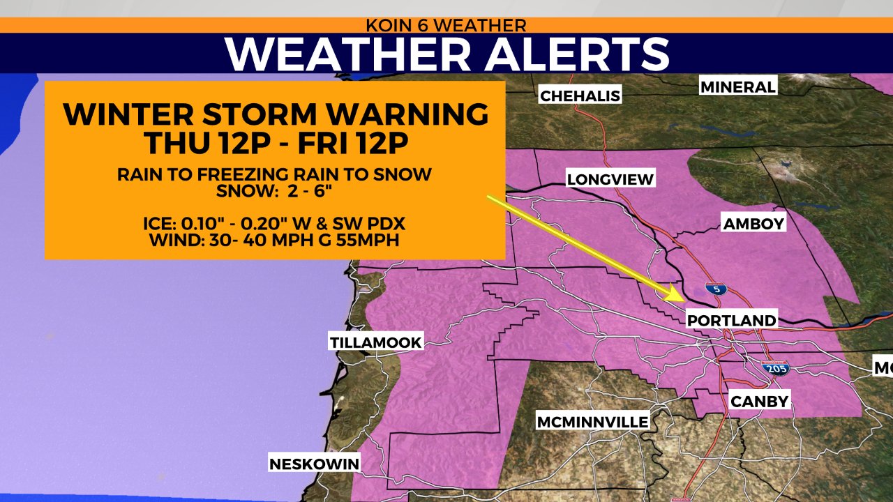
There is now a Winter Storm Warning for the Portland area, with everything in effect tomorrow at noon. This is a change to the winter storm watch that we had in place up to this point, you can read about that here (a good start if you are just jumping into the forecast). This will detail the general weather story, but what you need to focus on, is the travel and life impact that will start Thursday afternoon.
Most of the morning should not be an issue, but conditions will worsen through the day, especially by night. That is the main takeaway if you have to leave tomorrow and you live anywhere from Salem north.
How it all unfolds
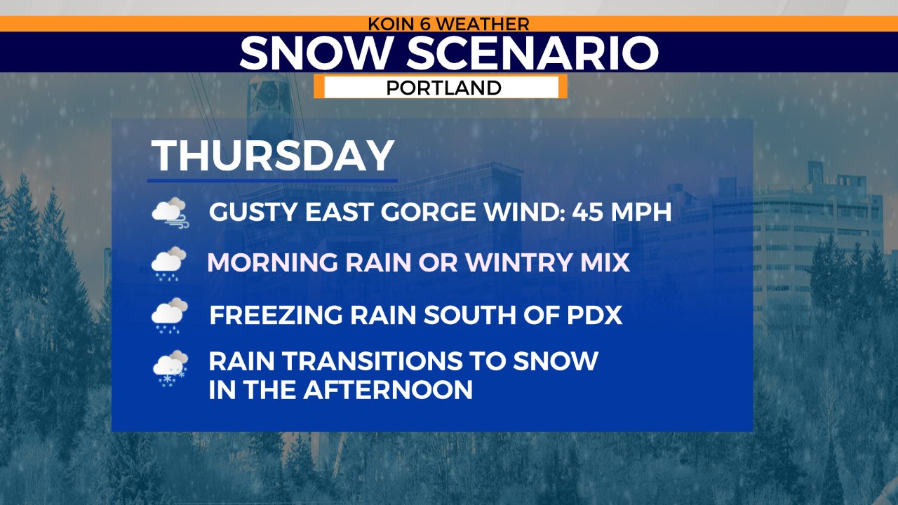
Cold air is still scheduled to start funneling in through the day Thursday. We will have a gusty east gorge wind that will hit the mid-40s and potentially even stronger just west of the opening, areas around Troutdale. In fact, the wind may be pushing the 60s and stronger for areas of the Gorge. We may have some blizzard conditions through the Gorge.
Moisture starts moving in early, mainly in the form of light rain for the valley. It is possible that through the morning hours there may be a wintry mix for locations south and around Portland. We may start seeing freezing rain skirting the Portland area as early as late morning and mid-day. Most locations that are picking up rain will see it transition to freezing rain through the day at some point. That means the ice can start accumulating for your afternoon commute. This is why you need to be ready to decide to refrain from much travel late Thursday. We will start to watch the light rain transition to snow, especially from northeast Portland down through the city by evening and night.
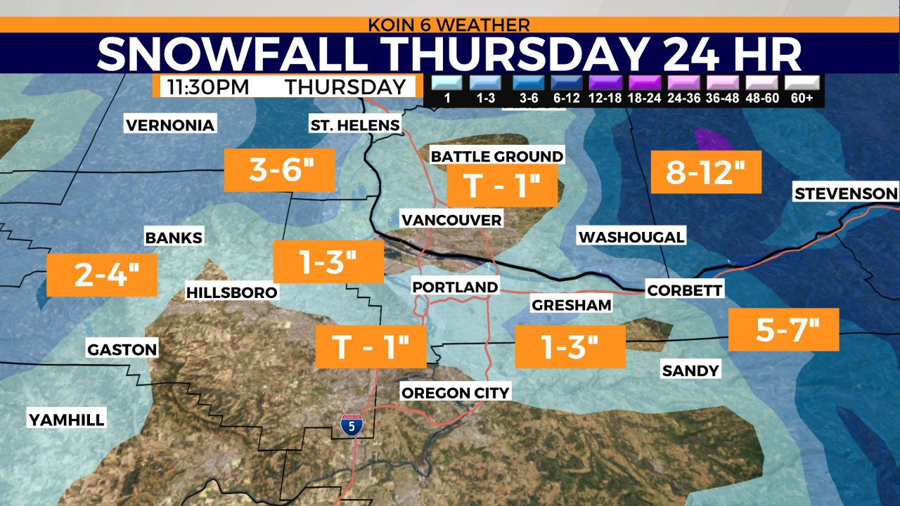
Most of the snow should arrive overnight into Friday and then it sticks around for most of Friday. Although this weather model below is keeping us around 1 inch for Portland by 11:30 p.m. Thursday, it is possible that we see higher totals especially to the northeast Thursday night. I wouldn’t expect much more than 2 to 3 inches if we do end up with more late Thursday. It’s a whole different story by Friday, where snow totals will be much more aggressive.
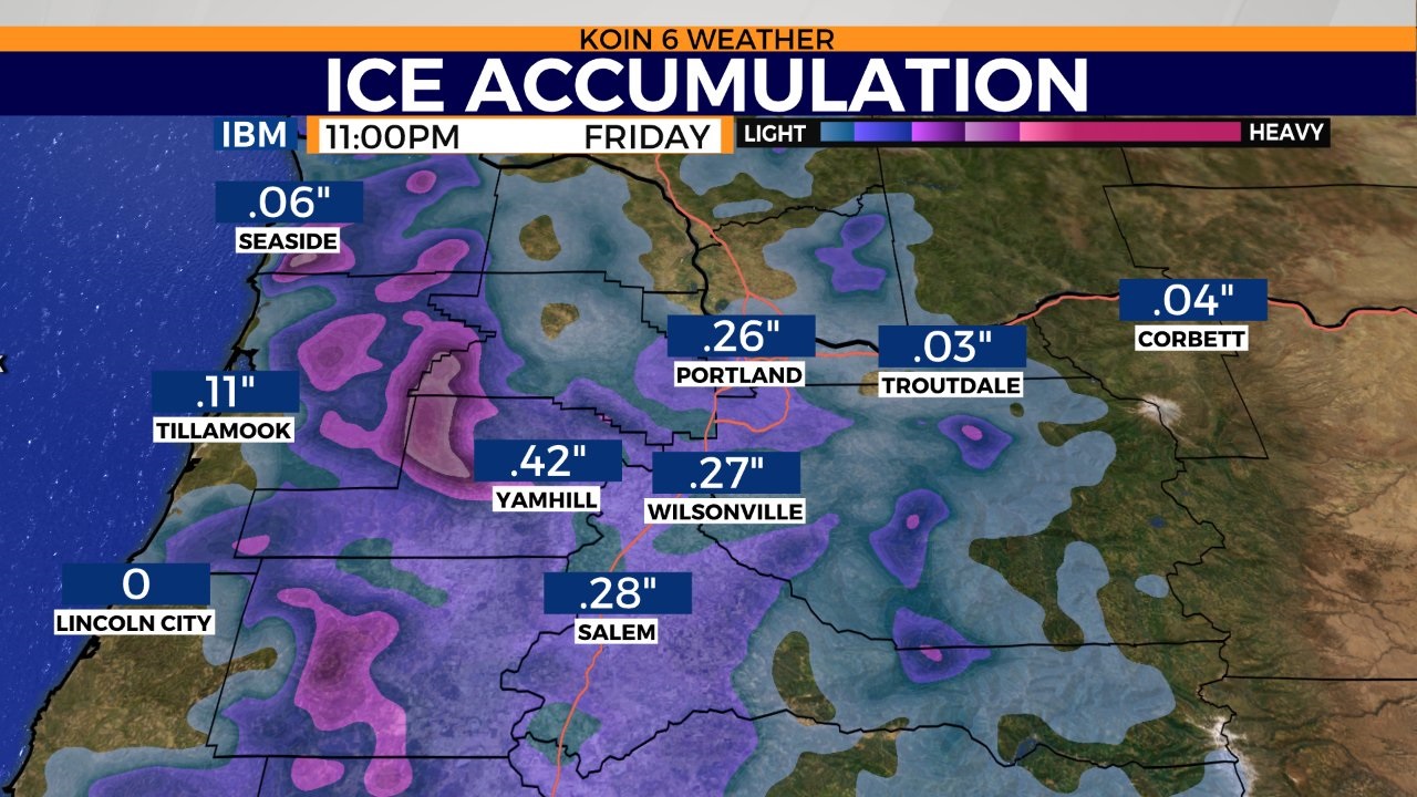
I want to show you one of the weather models in regards to the freezing rain around the area Thursday and Friday. It is plausible that many locations find somewhere in the ballpark of 1/4 to potentially 1/2+ inches of ice because of the freezing rain. It will take some time for the ground to get cold, but trees, bridges, utility poles may ice up quick. Now is the time to get things charged up and plan for possible utility interruptions.
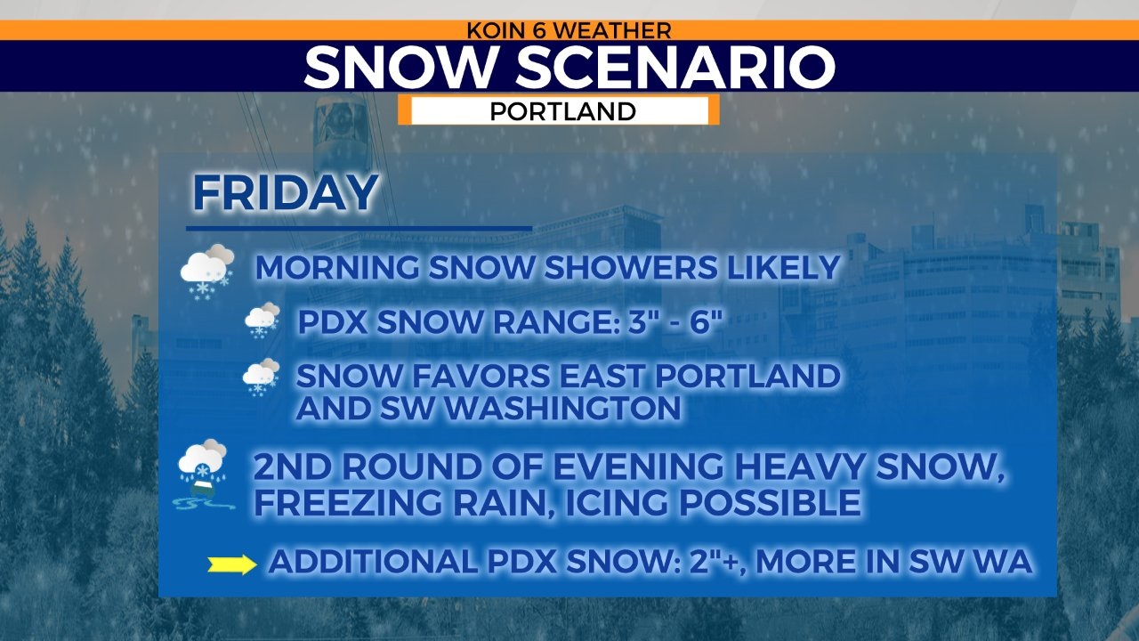
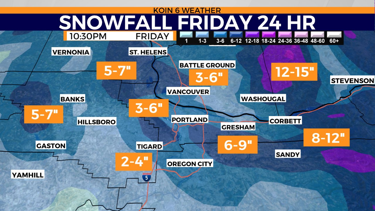
Let’s transition to Friday because I think this is when the snow starts to add up around Portland and Vancouver. Most weather models have us into the 3 to 6 inch category by Friday afternoon. In fact, some have us pushing the 8 inch more mark, which I believe we will have some isolated areas that find something like that by Friday night (northeast). You can find a breakdown of everything is going on for the Portland area for Friday in the graphic below. What should be noted, is areas of the Gorge will already be hit with snow and wind at this point of time. Travel through the Gorge will be limited or shutdown. Mountain snow will also be significant, leading to snow for the passes and hard travel.
As you can see here, one of the weather models has snow south of Oregon City down into northern Marion county. Heavier snow out west coming off the coast range and a swath of higher totals from I-205 east through Gresham. This is just through Friday and I want to leave the door open for higher totals due to the significant cold air and projected precipitation totals.
Food for thought
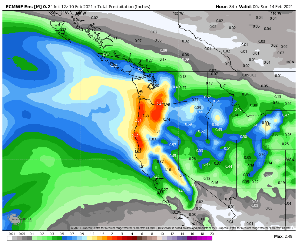
Weather models are projecting some significant moisture around here through the weekend. Starting Thursday through Friday, with the next event blending in quickly on Saturday, most weather models have around 1 – 1.5 inches of total precipitation around the valley with even more surrounding. This is a lot of water to work with and with temperatures dropping to the mid-20s around Portland and the Gorge area, and we may find some serious snow totals if we don’t cut them down with a rain and wintry mix. Some weather models are projecting even more, which may be a bit over the top.
In many cases, during events that include parameters that are sometimes extreme, weather models have a hard time handling the event. For example, are they underplaying the cold arctic air that is moving our way? If so, we may have a larger event on our hands.
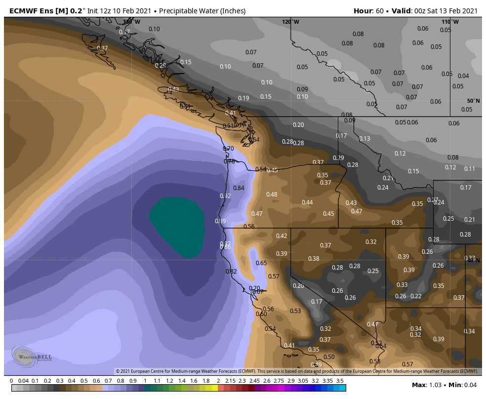
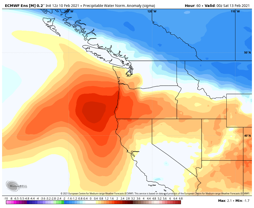
What is causing the increase in moisture? It may be the strengthening of the temperature gradient that is going to allow for a little more strength to this system.