PORTLAND, Ore. (KOIN) – A constant flow of information at our fingertips can be quite the quandary. While a smart phone might make us feel smarter, a list of data without a practical explanation can also leave a user rather confused.
We all know there is a weather app on your phone that can give you a forecast. Many times in the ever-changing winter weather, those weather apps really drop the ball and build quite the hype (think kale events).
There is no doubt that those forecasts are getting better, but they still don’t give you the best information. Those weather apps are typically auto-generated without a human analyzing the data.
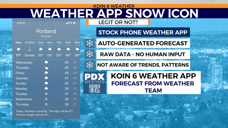
Why is it important that a weather forecaster modifies the app data?
Just like any other auto-generated tool, it can come with errors. A meteorologist, forecaster, and weathercaster can take the data and run it through additional science and cross it with experience. Weather apps have a really tough time with valley inversions and other setups that can completely display a forecast that isn’t even close to the outcome. Of course, humans can make mistakes too, but with experience and the ability to use active radar and satellite to analyze goes a long way.
What should I do?
It’s always best to be connected with the KOIN 6 Weather team on social media and to use our KOIN 6 PDX Weather App. We can take the information from the weather models and give you a forecast to help prepare for your day. We are familiar with locations like Sylvan Hill, Interstate 84 through the Gorge, US-26 at Government Camp and all those tricky locations around the region, whereas a computer isn’t familiar with those routes and locations that we travel daily.
Upcoming forecast
With all that in mind, you may be seeing snowflakes on your smartphone weather apps right now! Yes, forecast models are trending to cooler, wet weather for the Pacific Northwest as early as this weekend. In fact, some weather models are pushing snowflakes on your app as early as this Friday (January 10). It is going to take some work to get our temperature profile in the valley cool enough to support snow. In fact, on Tuesday, temperatures are in the upper 50s and Troutdale broke an afternoon high record at 59 degrees.
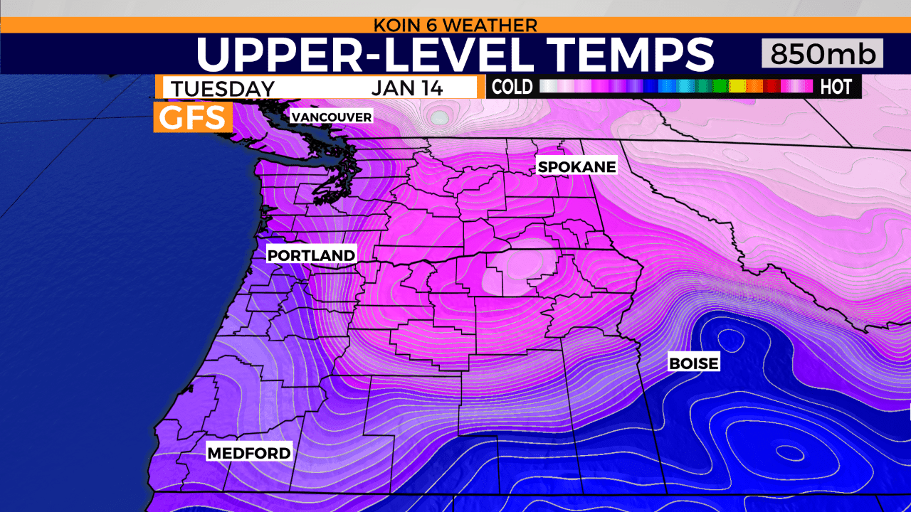
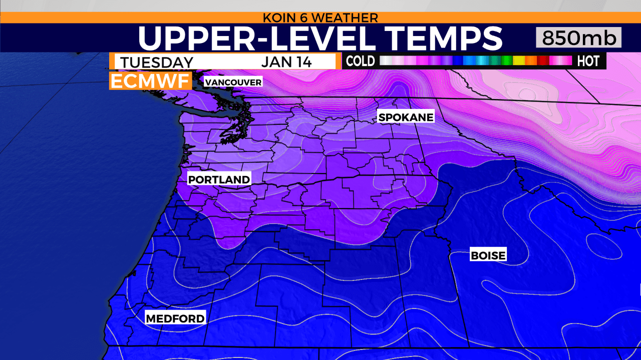
So what is going to be able to bring our temperatures down? Typically a chain of cool systems and some arctic air out of the Columbia Basin is needed to help cool down the valley floor. Which one weather model (GFS) is trying to depict come the week of Jan. 12-19. Below is a comparison come Tuesday, Jan. 14 (current coldest day), where the GFS has temperatures much colder aloft and more widespread than the competing ECMWF weather model. We typically look aloft when it comes to forecasting, these models are displaying temperatures around 5,000 feet.
It’s the first step to understanding if we have enough to start the process for snow in Portland. The GFS weather model would support snow, the alternative would be more difficult.
Conclusion
I would prepare for colder and wet weather this weekend and next week. Right now, weather models support plenty of mountain snow and then snow levels dropping to elevations close to the valley floor.
If you live in elevations from 500 to 1000 feet, I would be prepared for the chance for snow. We will have updates all week and weekend.