PORTLAND, Ore. (KOIN) – We don’t want to get over our skis here, but it’s going to be feeling more like an early summer day on Thursday as temperatures may flourish well into the 70s around the valley for one day.
If we happen to hit the upper 70s or near 80, that is more like a late June or early July temperature. Of course, it’s spring, so you know it won’t stick around and we are going to be on quite the roller coaster this week.

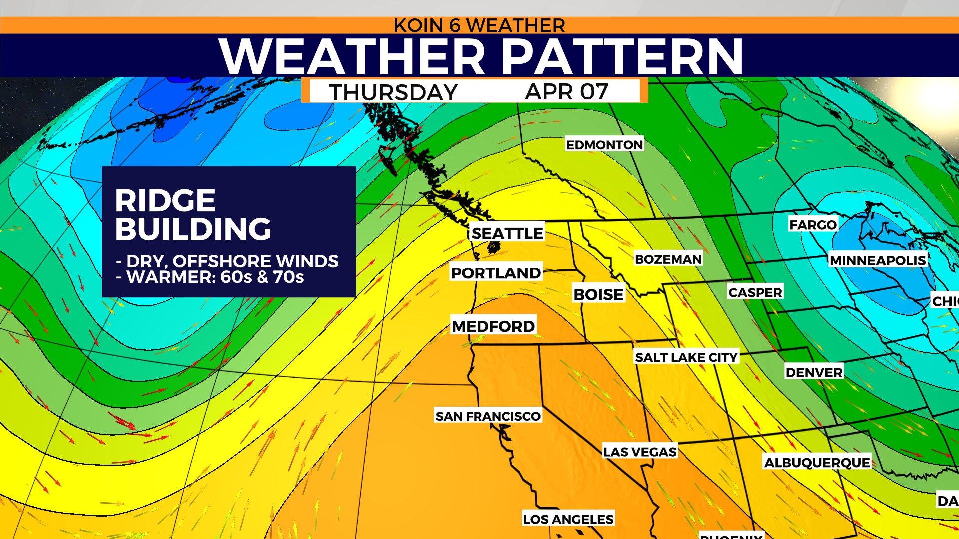
First, Portland is going to be basking under a blue sky with some thin clouds for the next two afternoons. We are already pulling in that sunshine on Wednesday. A building ridge of high pressure is going to act like a broom, brushing away all the thick cloud interference. You may see a thin veil of clouds, but not enough to impede the view. The axis of the ridge will be right over us on Thursday, slightly shifting to the east through the day. A strong southerly wind will flow through the valley, with an east breeze near the western Gorge and Portland.
This type of ridge is the one that would boost our summer temperatures into uncomfortable territory. When it is here in the spring, it puts us into a sweet spot (around here). The ridge is broad enough to impact everyone in the Pacific Northwest (PNW). Temperatures will be well above average for the coast, valley, and everything to the east. Gear up for a spring day that you may not want to end.
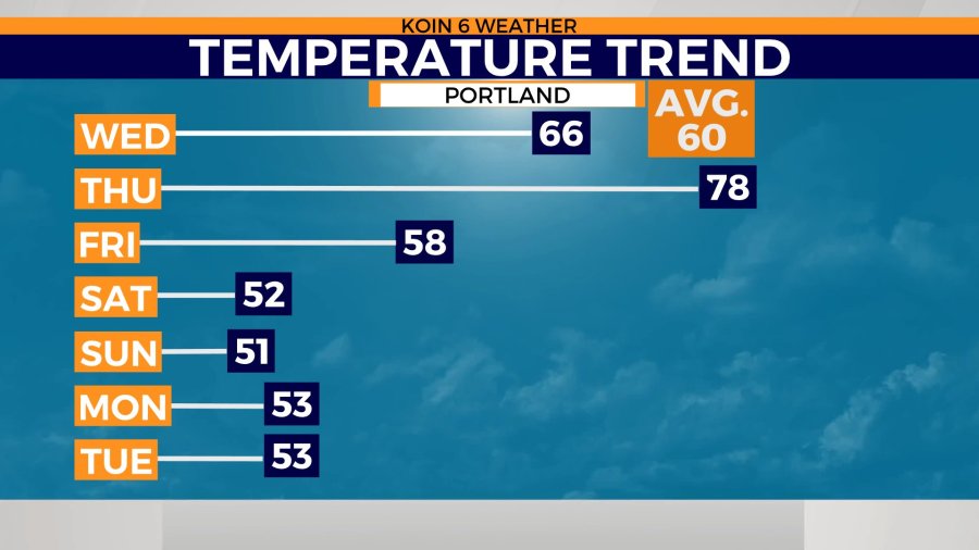
Portland is expected to top off in the mid-60s on Wednesday. It will jump an additional 10 degrees on Thursday. It’s possible that we mix out to the upper 70s. There is a warm layer of air above our heads, due to that aforementioned ridge, which is going to help boost the daytime highs around the valley.
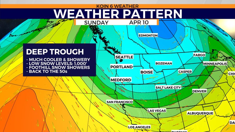
Here is the deal we are making: we are going to be warm for a day, but then sacrifice the weekend to cold weather. We didn’t come up with the deal, but it’s happening. Follow the temperature trend below, it will lead you to the lower 50s by Saturday. You can expect over a 20-degree drop from Thursday’s high temperatures and the weekend high temperatures. That is because that ridge isn’t going to hang around all that long. What is to follow, is the opposite, low pressure and cold air.
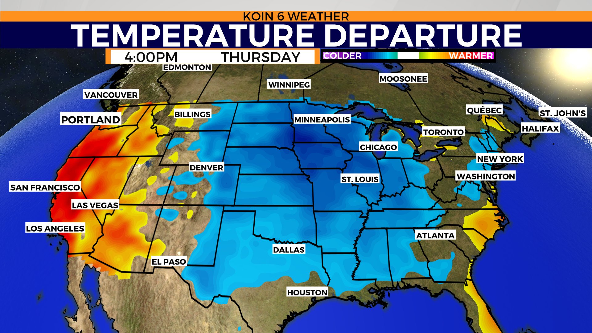
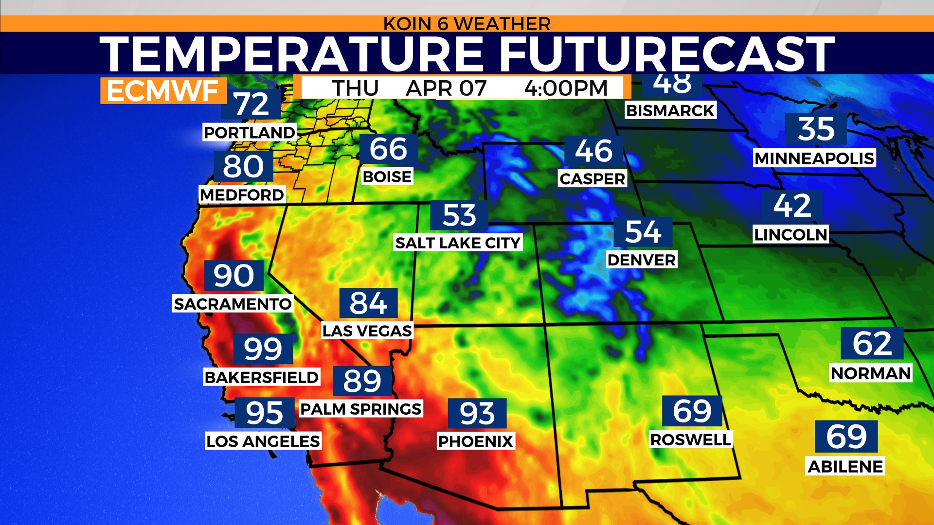
For now, we are absorbing all the warmth out here across the west coast. You will notice that the temperature departure from Vancouver south to Los Angeles is well into the red (warmer). This is exactly where that ridge is setting up. Meanwhile, there is a trough of cold air to our east that is going to prevent temperatures from warming much east of the Rockies. Weather models are projecting temperatures around the lower 90s for Sacramento and even pushing triple-digits for Bakersfield. It is underplaying the temperature around Portland, as we have to take into effect some other parameters. The boost from the wind should help push our temperatures up above the lower 70s. Regardless, you can see that we have some serious heat around here today.
THERE ARE SOME BIG CHANGES LATE WEEKEND/EARLY WEEK
We will be giving up that taste of summer in a swift fashion. By the weekend, a large expanding trough will drop south bringing in cold continental polar air from the north. With a pairing low pressure, trying to collide with the Oregon Coast on Monday, we are in store for some rain and low snow levels.
As discussed above, the temperatures are going to be well below average and even flirting with the upper 40s for a few days this weekend. Snow levels are expected to drop to 1,000 feet and likely below by Monday morning. This is good enough to bring a return of snow for the foothills in the region.
You will want to protect your vulnerable plants and flowers this weekend; however, the likelihood of snow on the valley floor is low. Is it possible we have snowflakes around the region mixing in with rain? That may be possible.
We are going to watch this system as the weekend nears. Just be ready to ride the roller coaster up and down this week.