PORTLAND, Ore. (KOIN) – Imagine that you have your cell phone ready to capture some eerie clouds that are moving in. Within minutes, those clouds begin rotating overhead.
A funnel cloud forms and finds its way to the ground: congratulations, you now have captured a tornado in the Pacific Northwest.
For local weather enthusiasts, stormy days are a treat. With a recent EF-0 tornado confirmed in north Battle Ground on Sept. 27, we now have another weak tornado to add to our Washington twister total.
Watch the EF-0 captured on video below. Credit: Tyler Mode.
Does it feel like there are more tornadoes happening in Oregon and Washington? They certainly garner a lot of attention, and rightly so.
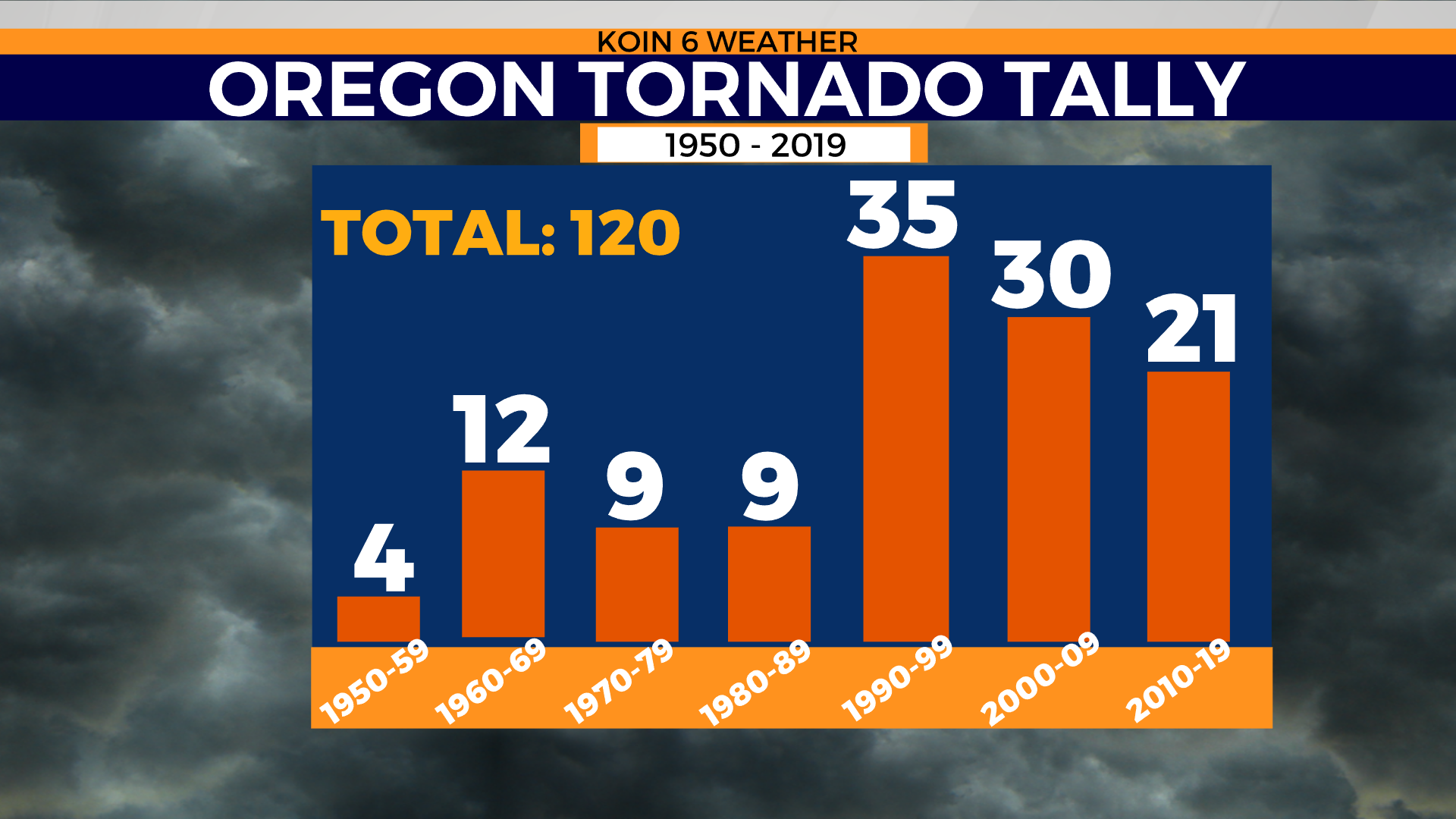
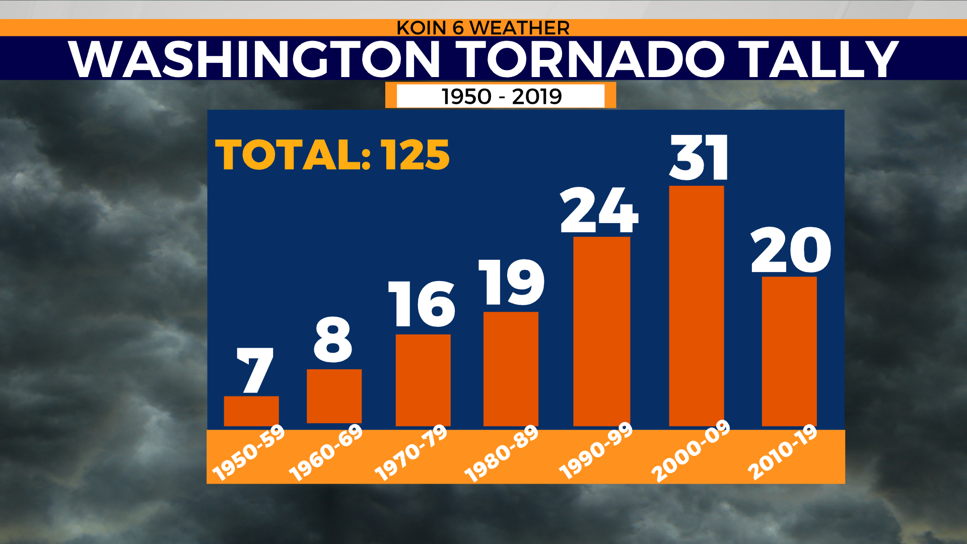
During a 69 year period, 1950 to 2019, a total of 120 tornadoes were documented in the state of Oregon. For the same time period, Washington counted 125 tornadoes.
Now, swipe through the graphics below to see the number of tornadoes in the state of Oregon and Washington by decade. Notice the upward trend in the last 30 years, starting in 1990?
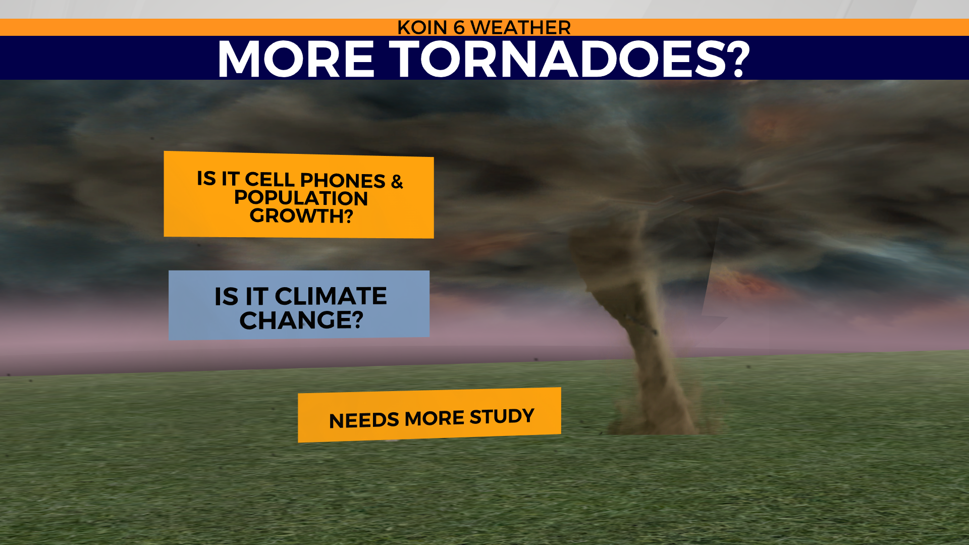
What’s causing this apparent increase in tornadoes? Is climate change setting up the perfect recipe for tornadoes to more easily develop? We know that heat trapping gasses, like carbon dioxide, put more water vapor in the atmosphere. More water vapor feeds a cycle of warming. This does affect our weather. Unfortunately, there is little research focused solely on our region that directly links climate change to the number of tornadoes. You will, however, find extensive research that examines the link between climate change and tornado strength and frequency in the South.
We must also consider our ever changing social habits and technology. Weather awareness and modern forecasting tools in recent decades have helped us better spot tornadoes. If you’re old enough you’ll recall the internet is kind of a new thing. Prior to the 1990’s the internet was in development but the World Wide Web didn’t go public until April 30, 1993. It has come a long way in the last 28 years. Then smartphones of the 90’s were married to a 3G network in 2001 – that was a big game changer! Thank you new millennium. I can shoot a tornado and share it within seconds.
As you scroll through the graphics below, notice the increase in tornadoes in the 1990’s. It’s during this time in the mid 90’s that radar covering the Portland area was moved from NE Portland to the top of Dixie Mountain in Scappoose, OR. Radar is a critical tool that allows us to warn the public when a storm is approaching. We can see tornadic signatures thanks to radar. Better radar technology means better identification of tornadoes and longer lead time in warnings. An even bigger boost to our radar abilities happened in 2008 when RTX was upgraded to the latest and greatest dual pol radar.
Another possible possible reason for the increase in reported tornadoes is the expanding population, especially here in the Pacific NW. More homes also means more opportunity for storm damage. It’s just one more way for a tornado to leave its thumbprint. Survey teams use that evidence to confirm a tornado was indeed responsible for destruction.
All of that may be part of the reason that we are noticing more tornadoes around the Pacific Northwest (PNW), but more research is needed before we can truly point the finger at the direct cause.
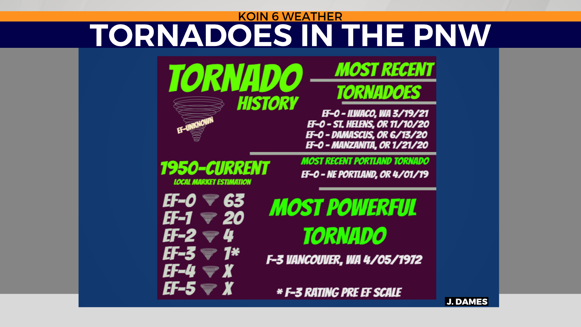
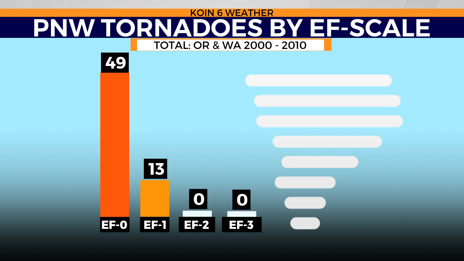
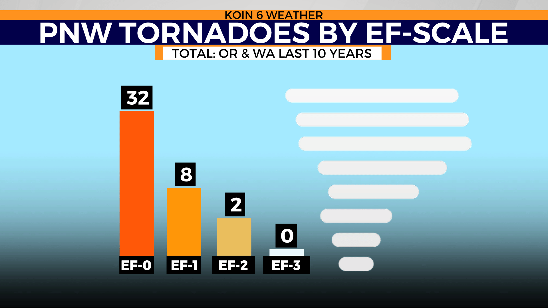
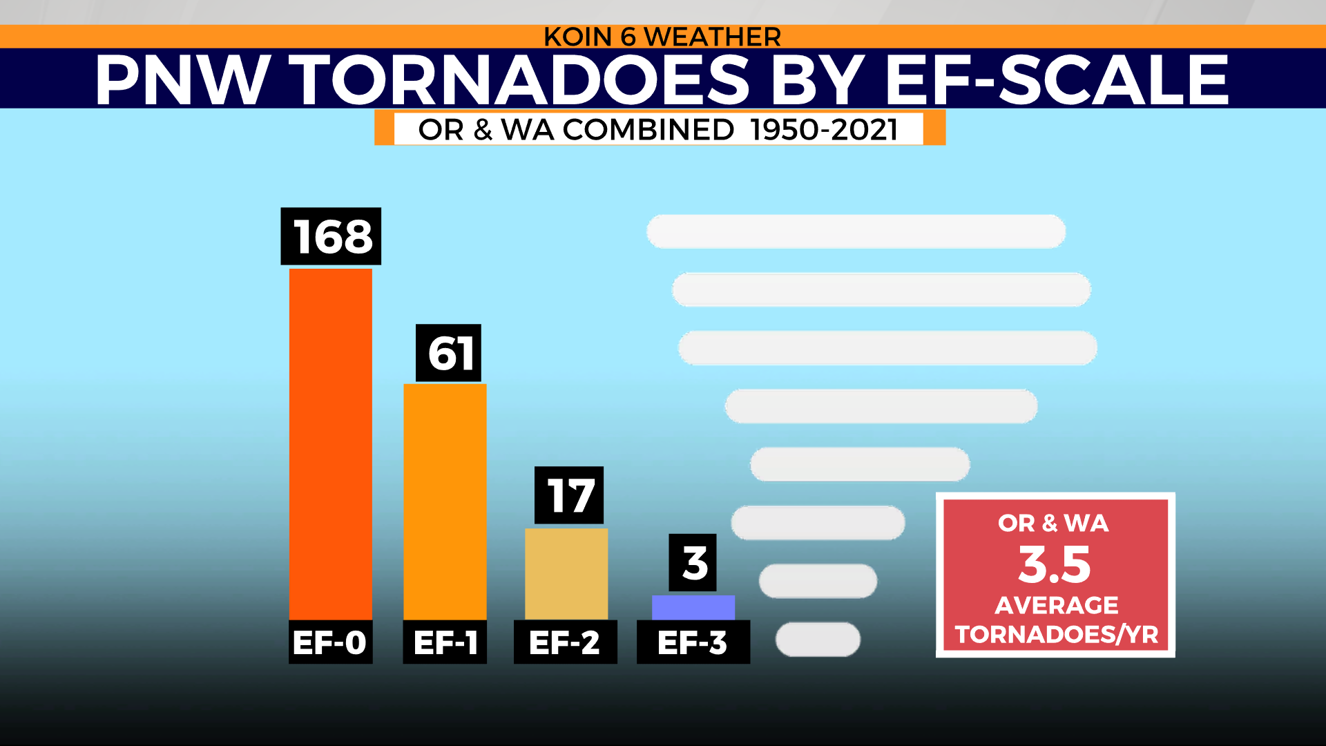
What is more obvious, is that the strength of tornadoes around the PNW tends to be in the EF-0 range more than any other category. An EF-0 tornado has a wind gust speed of 65 to 85 mph. These brief tornadoes are on the weaker scale, which may only bring in minimal damage. In the past, without video confirmation or an eye witness, a fence or tree down may have been blamed on wind gusts.
You can learn about Pacific Northwest tornadoes in our series here.