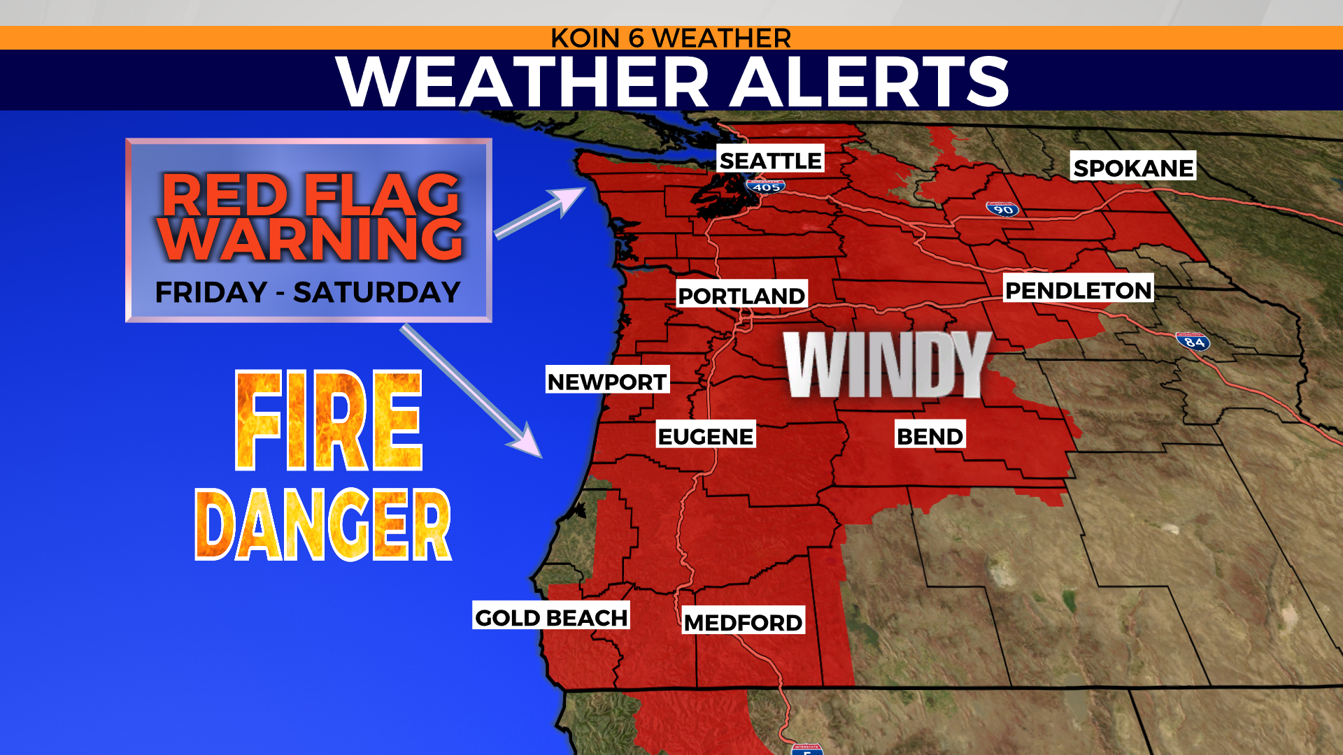
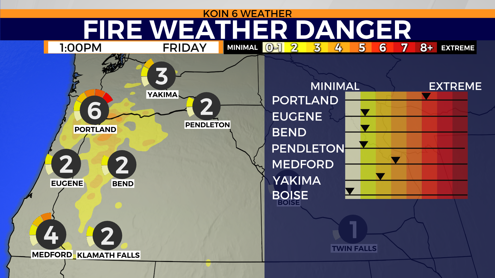
PORTLAND, Ore. (KOIN) — A red flag warning is in effect Friday through Saturday for a large portion of Oregon and Washington.
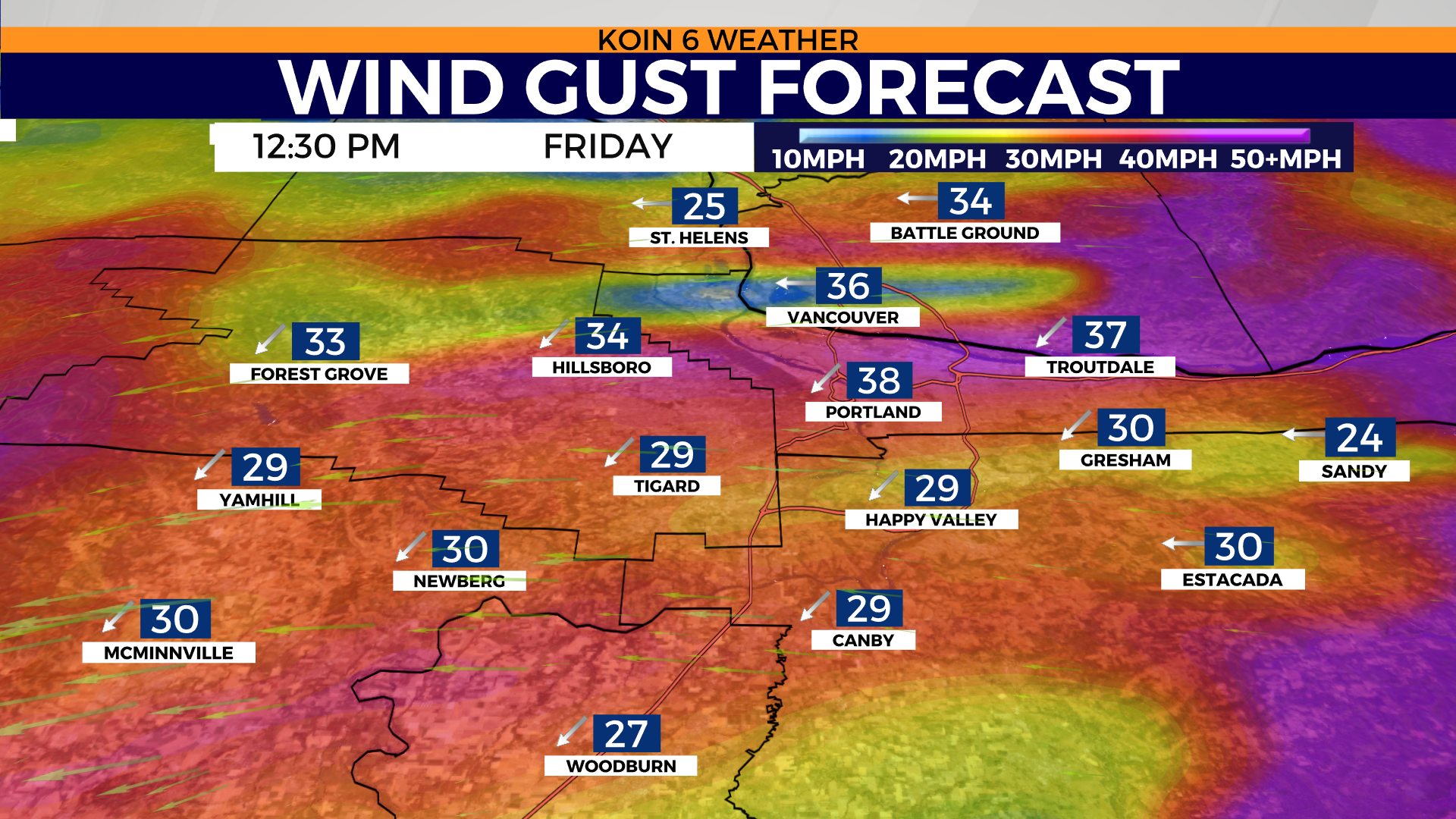
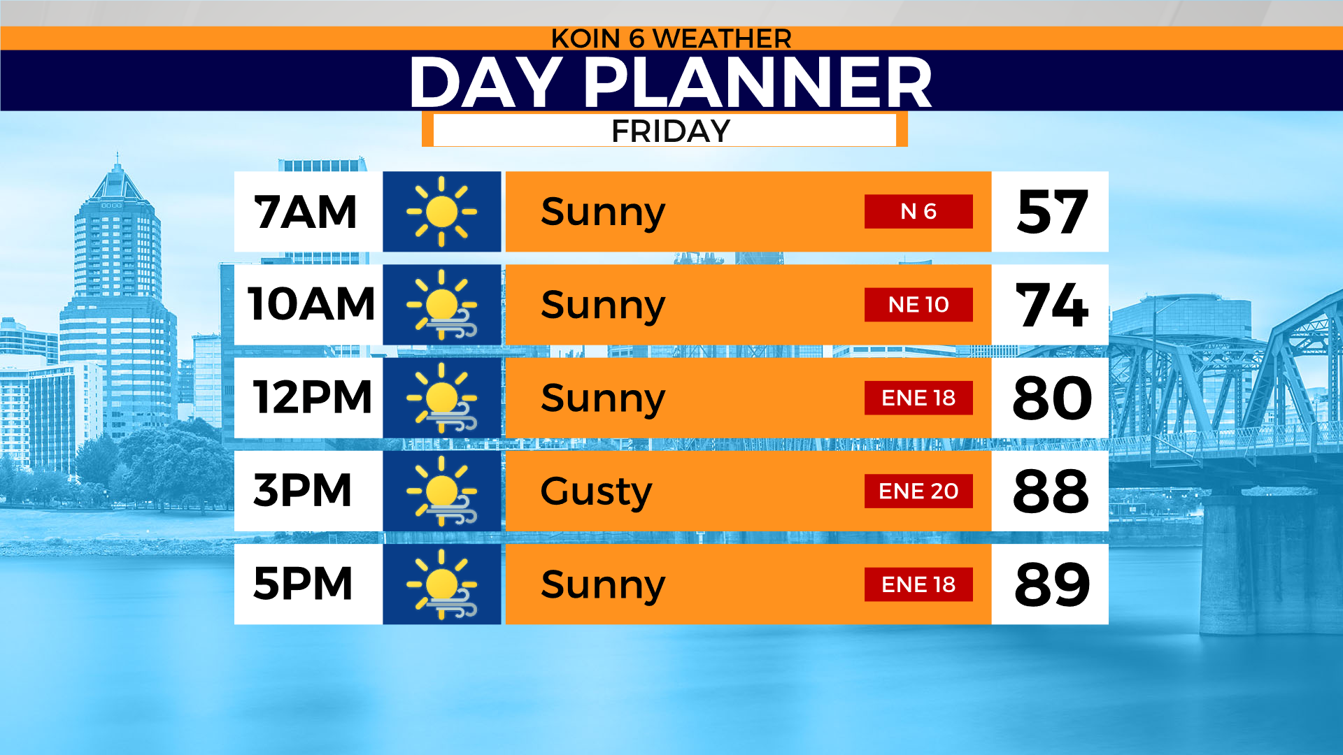
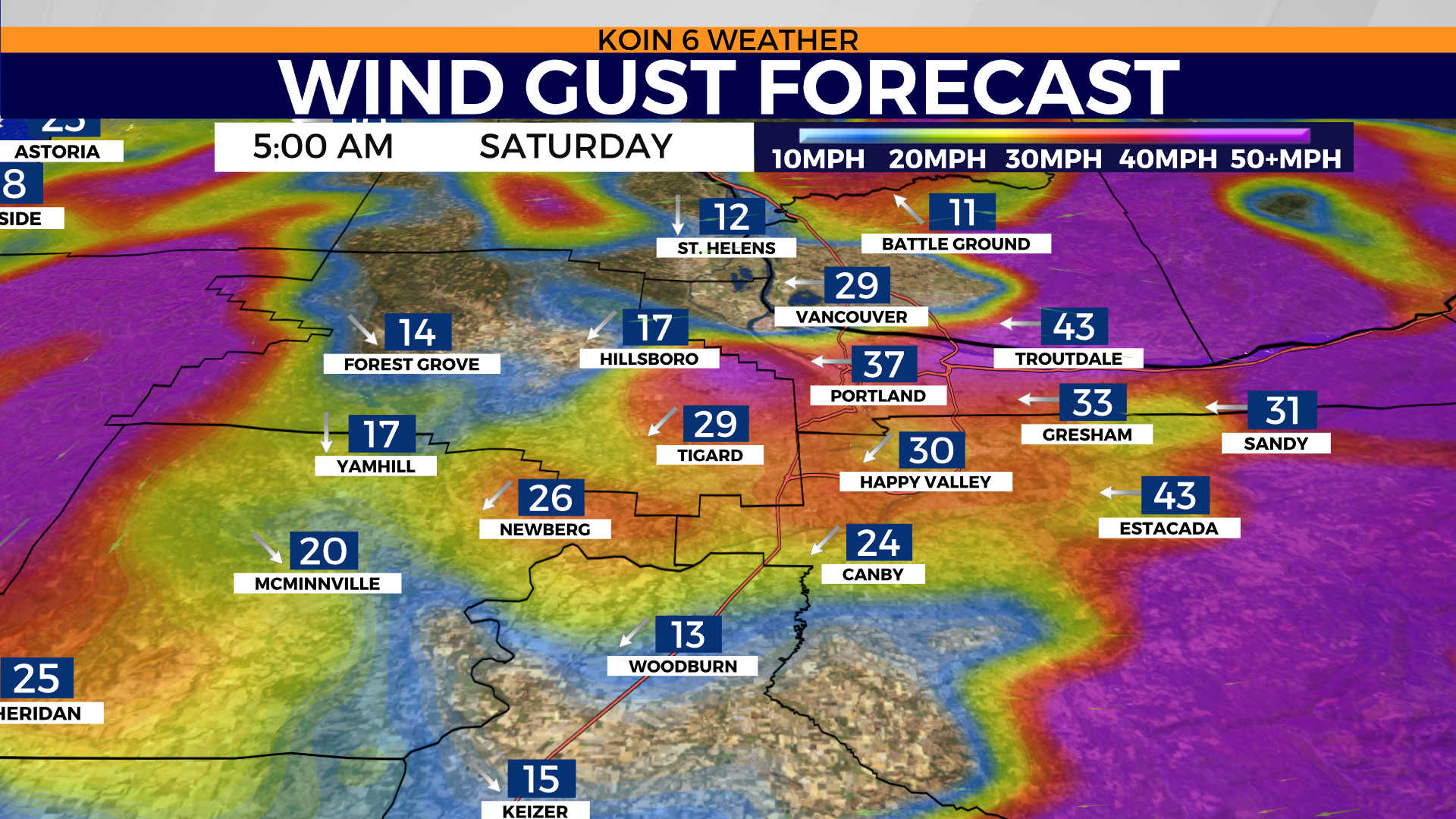
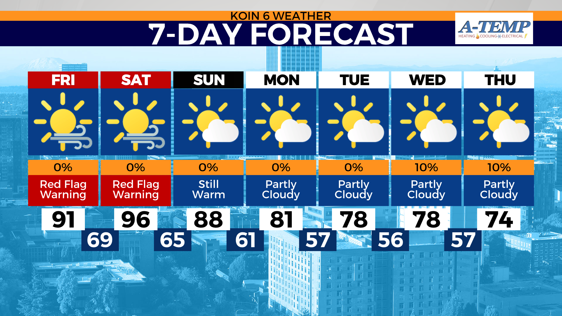
Expect east wind gusts to reach speeds up to 30-40 mph in Portland and the Willamette Valley by Friday afternoon into Saturday. Daytime highs may reach the low to mid 90s. This easterly wind event typically occurs during the winter months, not September. At this time of year, with our drought and dry, warm weather there’s nothing good coming from this wind. This means high fire danger.
KOIN Complete Coverage: Wildfire Watch 2022
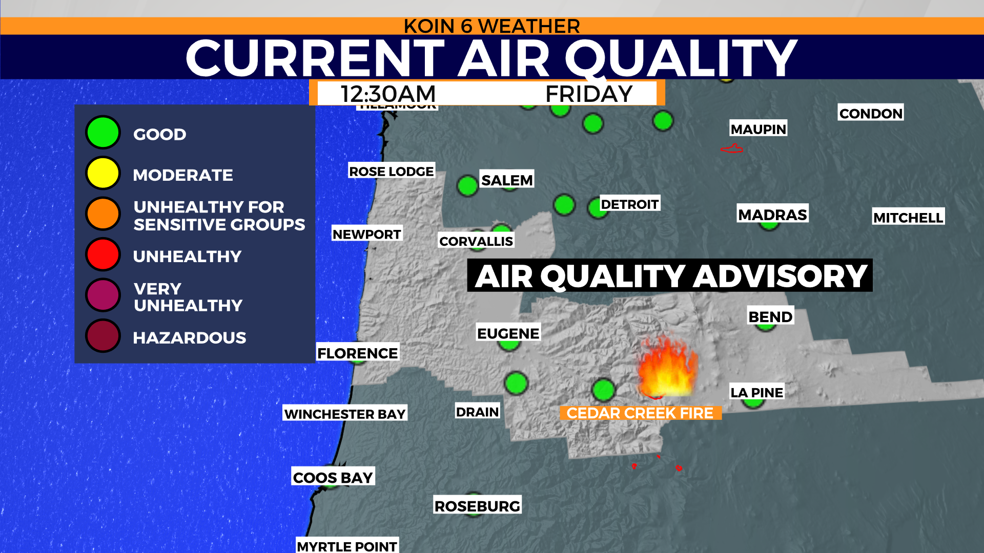
An air quality advisory is in effect for South Willamette Valley and Central Oregon Coast. If we get enough smoke in the area, that could alter the forecast highs of 91° Friday and 96° Saturday. Avoid prolonged time outdoors if you have respiratory issues.
Areas expecting the strongest wind gusts 40-50 mph: West end of the gorge, Corbett, Estacada, Santiam Canyon, Silverton Hills, really any mountain canyon gap and mountain ridges. The West Hills and higher east facing terrain may encounter wind gusts up to 35-40 mph.
Watch those coast temps rise Friday, mid to upper 80’s possible, especially warmer to the south.
When does it get better? Models are still indicating a change for the better by Saturday late night. However, as winds shift Sunday, that could push smoke away and allow more surface heating. Sunday might be uncomfortable with highs in the upper 80’s, especially if power is still out. Big relief arrives Monday, back to normal near 80°.
Pacific Power and Portland General Electric have announced power shutoffs ahead of our strong easterly wind event.

Portland records, current as of Friday morning Sept. 9, 2022:
Sep. 9 FRI
Max High: 94° – 1948
Max Low: 65° – 2020
2020 High/Low: 89°/65°
Sep. 10 SAT
Max High: 98° – 1944
Max Low: 63° – 1997
2020 High/Low: 81°/61°
Sep. 11 SUN
Max High: 95° – 2013
Max Low: 63° – 2013
2020 High/Low: 64°/53°