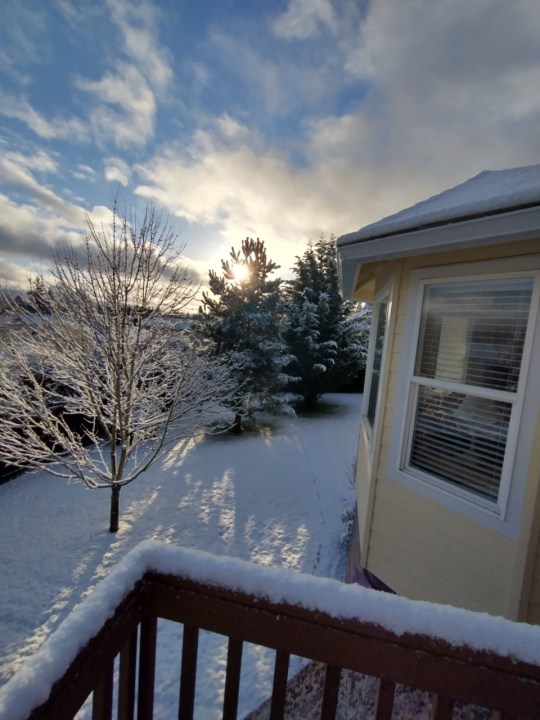
PORTLAND, Ore. (KOIN) – The snow machine keeps turning out snow for the Pacific Northwest (PNW) and we have had a fresh coat just about each morning. Tuesday started with an inch or more of snow around Portland from a quick moving area of low pressure. That has moved out through the day, leaving conditions mainly dry Tuesday afternoon.
As we head into the evening, temperatures will start to drop around here. That snow that is on the ground will stay there and the locations that have a wet ground will freeze. There have been a handful of vulnerable spots through this cold and snowy week. There have been a handful of spots over in Washington county that have needed extra attention. If you’re stepping out tonight, be weary of icy road conditions.
I do want to point out that the higher snow totals happened to be closer to Portland this time around, compared to those locations that were down near Salem from Sunday night into Monday. It was also more snowy for east Portland, compared to downtown. Mt. Tabor picking up around 3 inches of snow starting last night and wrapping up early today. Meanwhile, folks down near Keizer only saw about a half an inch.

Tonight as temperatures drop, an area of low pressure will sweep across the region. This won’t be the most direct disturbance, but it will be close enough to increase the risk for snow again tonight into Wednesday morning.
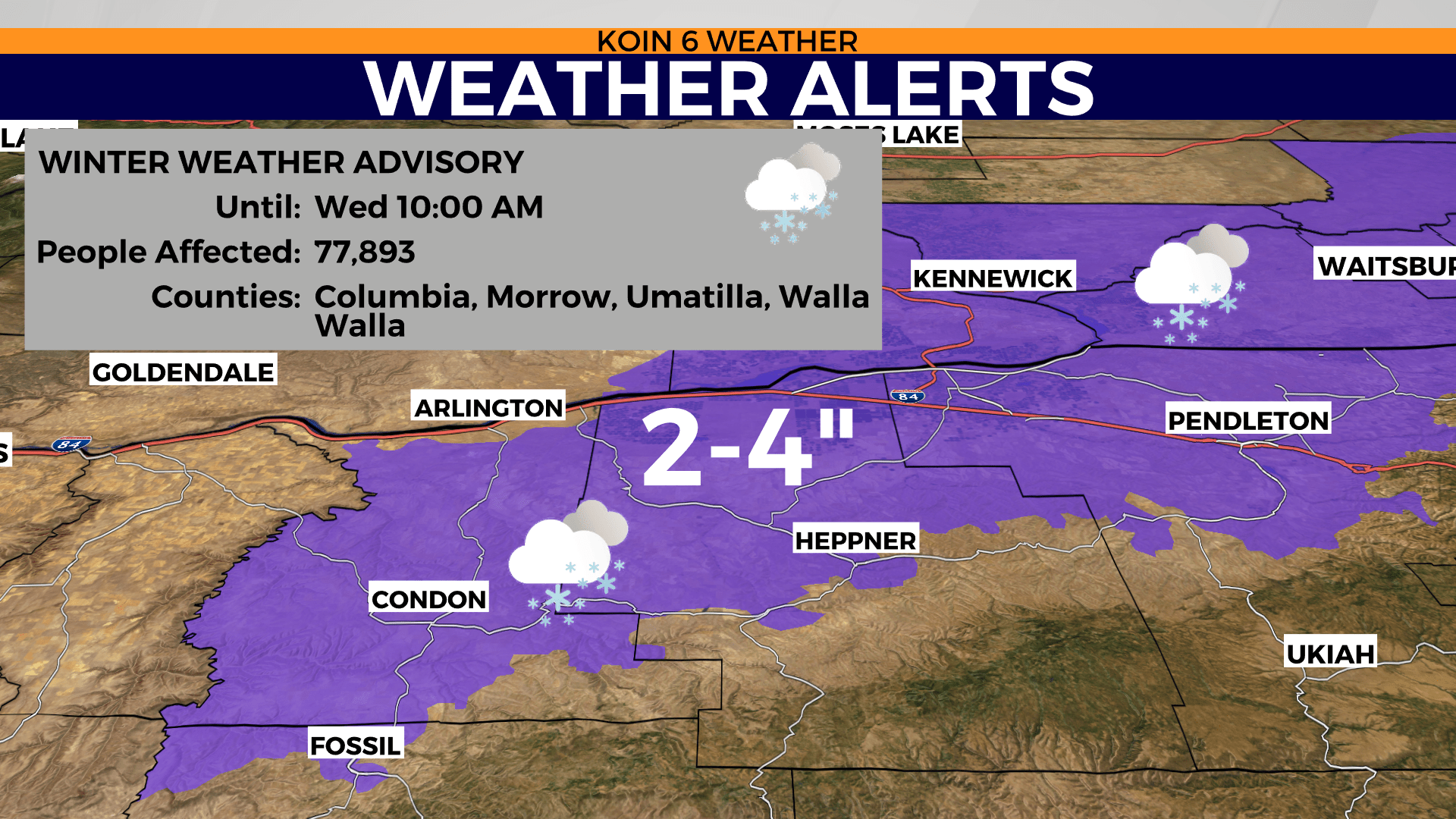
This is more of a central and eastern Oregon event, where a winter weather advisory is in place for areas like Pendleton until 10 a.m. Wednesday morning. However, we may have some of that moisture spill over into Clark, Multnomah, Clackamas, and Marion counties tonight. This looks to be more of an event for those east of I-5, with maybe some snowflakes making it to some locations to the west of the I-5 corridor.
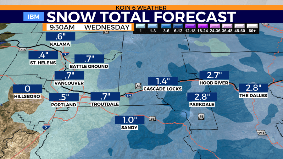
With cold air in place, it only takes a small amount of moisture to get things going. It may start late Tuesday night as early as 10 or 11 p.m., wrapping up for Portland around 2 a.m. Those on the east end of Multnomah county are going to hold on to that chance for snow through the night. If you’re going to travel I-84 in the morning, you will want to be prepared for snow.

How much snow are we expecting tonight? It should be minor, but it may be enough to cover up the areas of ice. We are expecting around a dusting for Portland and points east. Weather models are projecting up to about a half an inch to an inch of snow close to Portland.
Totals will increase as you travel east, with snow totals expecting to reach 1 to 3 inches from Cascade Locks to The Dalles. Again, not an overly impressive system, but it should be enough to slow down travel. Snow totals will be greatest up to the mountain in the higher elevation of the Cascades.
Dry time working into the forecast on Wednesday, with a cold east breeze.