PORTLAND, Ore. (KOIN) — We went from dry and warm this summer to dry and smokey — and now to wet and windy Wednesday.
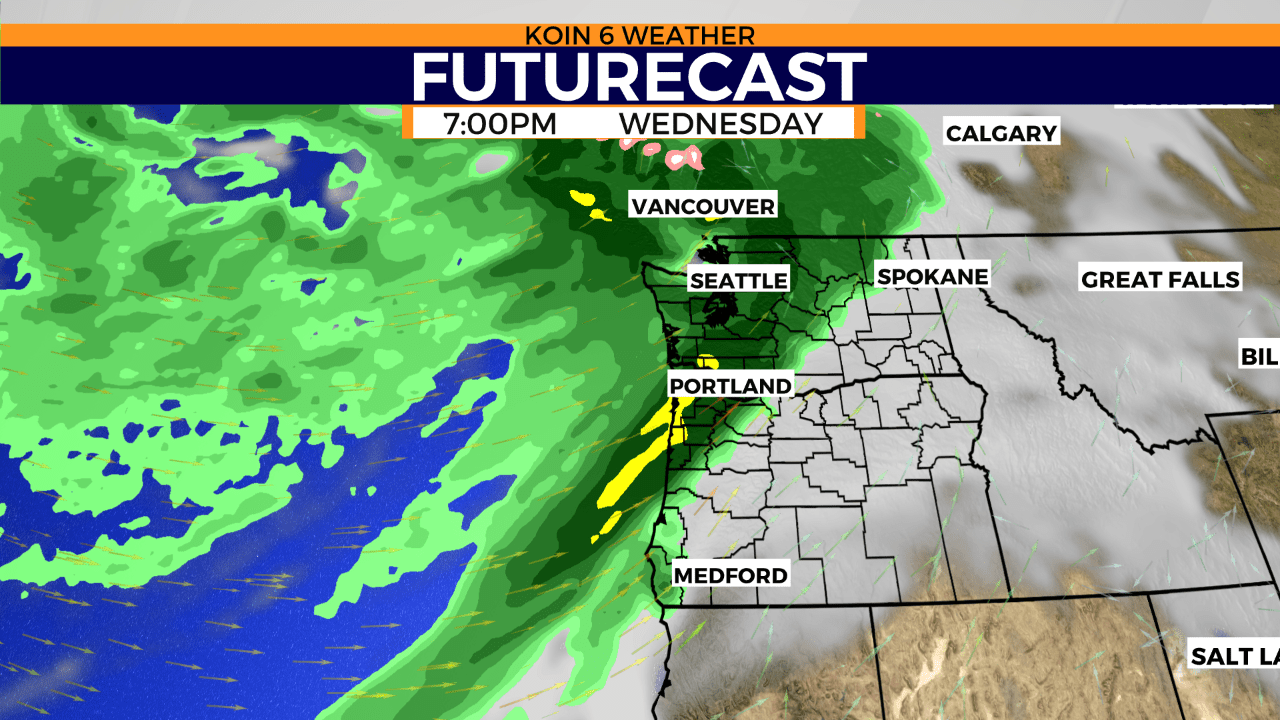
Weather models continue to advertise close to 3/4″ of an inch to 1″ inch of rain by Thursday morning, in the valley and along the coast. Elevated areas of the coast range may see even higher amounts. We’re monitoring the increased risk for landslides in recent burn areas. Winds will also be gusty along the coast, up to 50 mph.
Let’s take a look at what’s normal for rainfall in September. First, it’s important to mention that out of the last 22 days of September we’ve had measurable rain at PDX only twice. In fact our month to date total is 0.44″, that means we’re missing 0.54″ inches from the normal MTD total of 0.98″.
Looking back at records for PDX, when was our wettest September? In 2013 we had 5.62″ inches. When was our driest calendar time for the month? That was only a trace of rain in 1933.
Showers will continue Thursday with a chance of thunderstorms. Another chance for rain arrives Friday before showers taper off Saturday morning. This weekend we’re going to be a little warmer along with the hope of planning something to do outside.
How about that wind?! You’ll get a push from the south anytime today. For portions of the south Washington coast, a wind advisory will be in effect tonight. Here are the advisory details from the NWS.
North Coast-Central Coast- Including the cities of Beaver, Clearwater, Forks, La Push, Neah Bay, Ozette, Queets, Aberdeen, and Hoquiam
WIND ADVISORY REMAINS IN EFFECT FROM OVERNIGHT TO 5 PM PDT WEDNESDAY…
* South winds 25 to 35 mph with gusts up to 50 mph expected.
* WHERE…North Coast and Central Coast.
* WHEN…From midnight to 5 PM PDT Wednesday.
* IMPACTS…Gusty winds could blow around unsecured objects. Tree limbs could be blown down and a few power outages may result.