PORTLAND, Ore. (KOIN) — Our wettest and windiest time in the Portland metro area lasts through Wednesday morning.
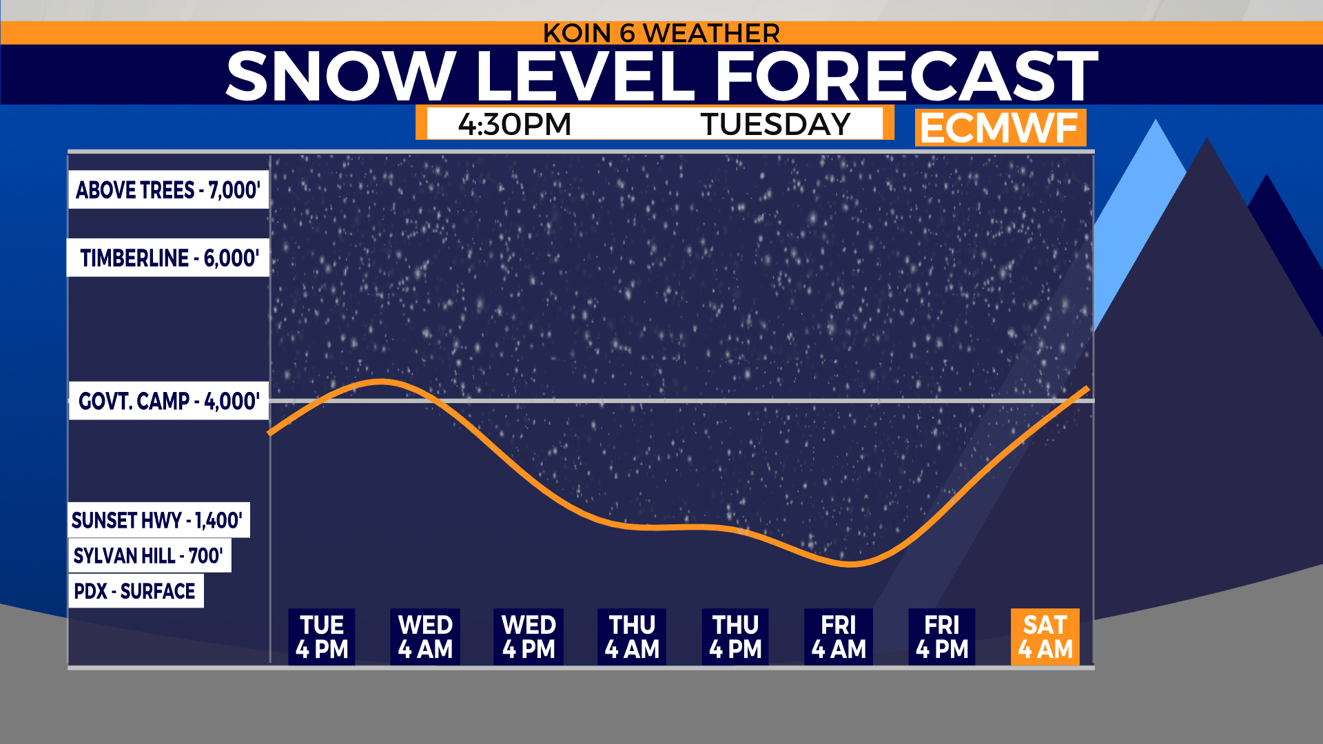
Meanwhile, it keeps snowing over the Cascades. While snow rates will slow down for the Gorge, it remains cold enough all day to keep the snow that has fallen, including on Interstate 84. Check road conditions before you go!
As temperatures drop behind the cold front, watch for snow accumulation over the coast range again. The showery nature of precipitation Wednesday means there will be breaks in the clouds, which could lead to lowering snow levels by late evening.
Swipe through the graphics below.
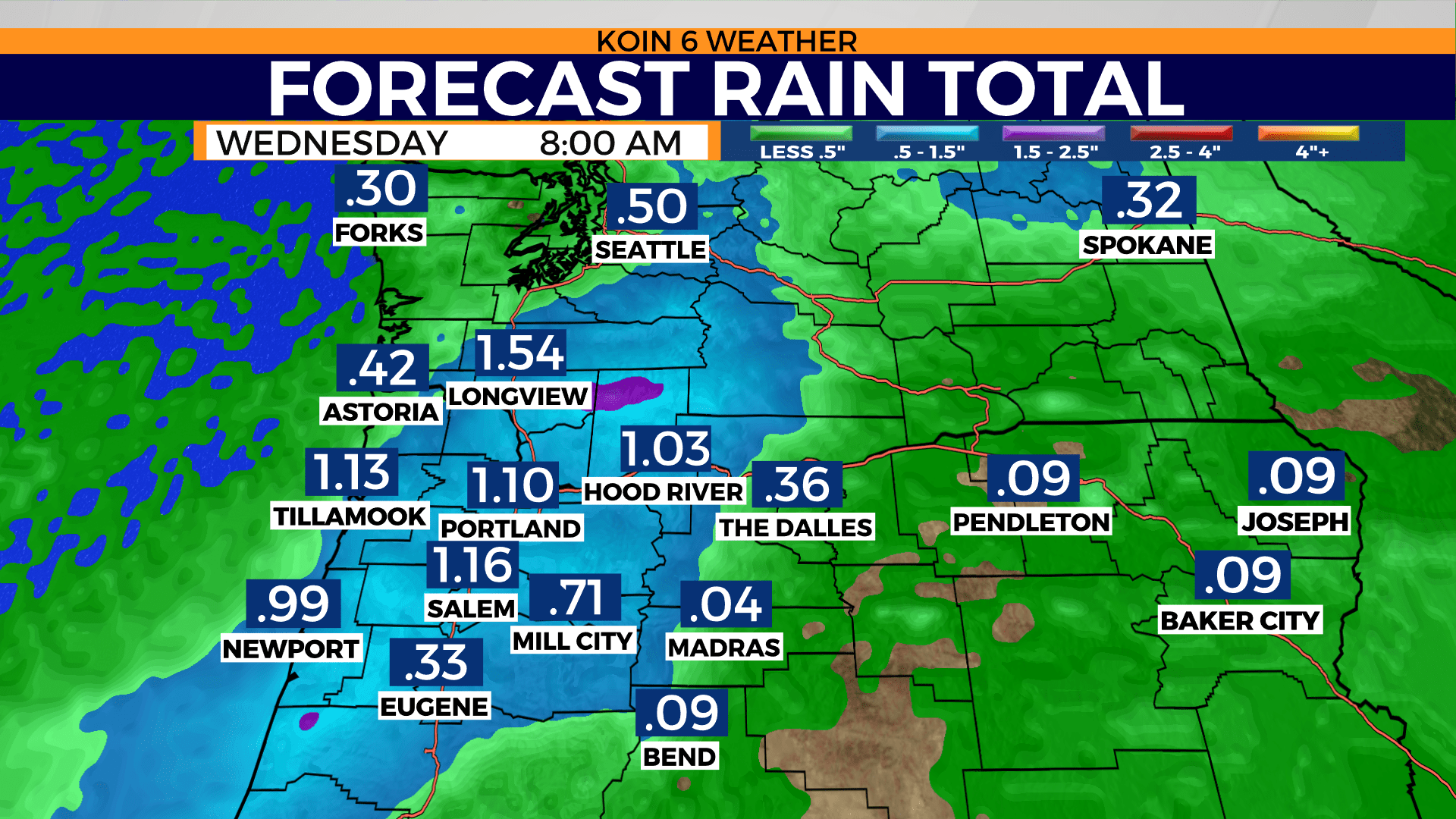
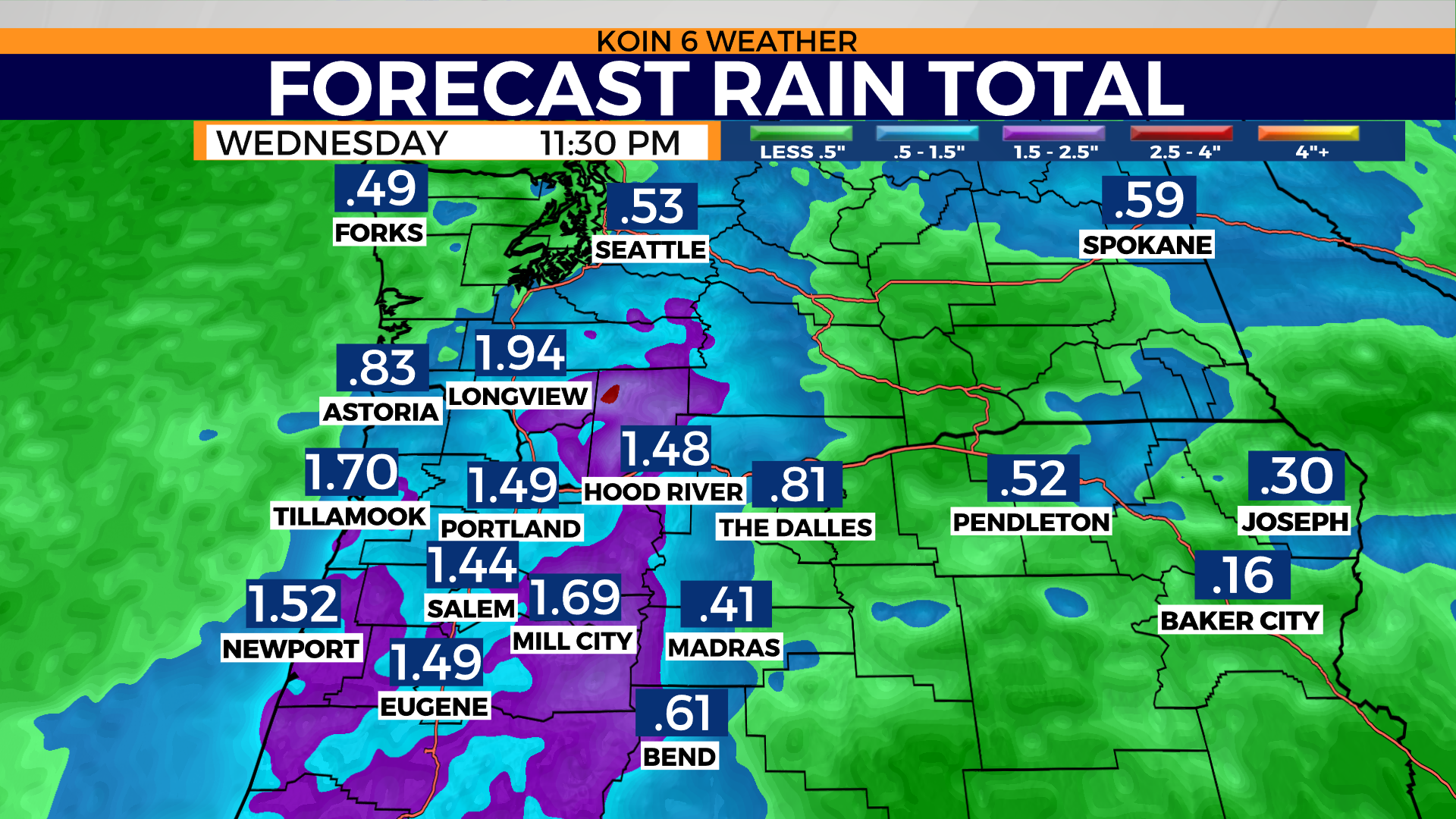


1 / 9
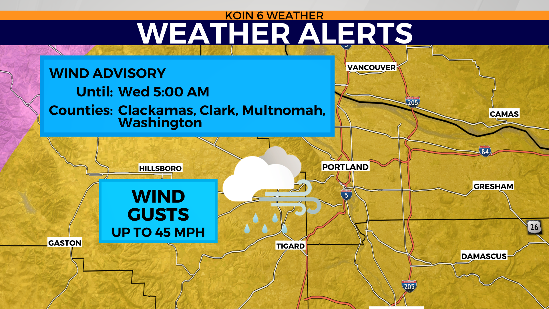
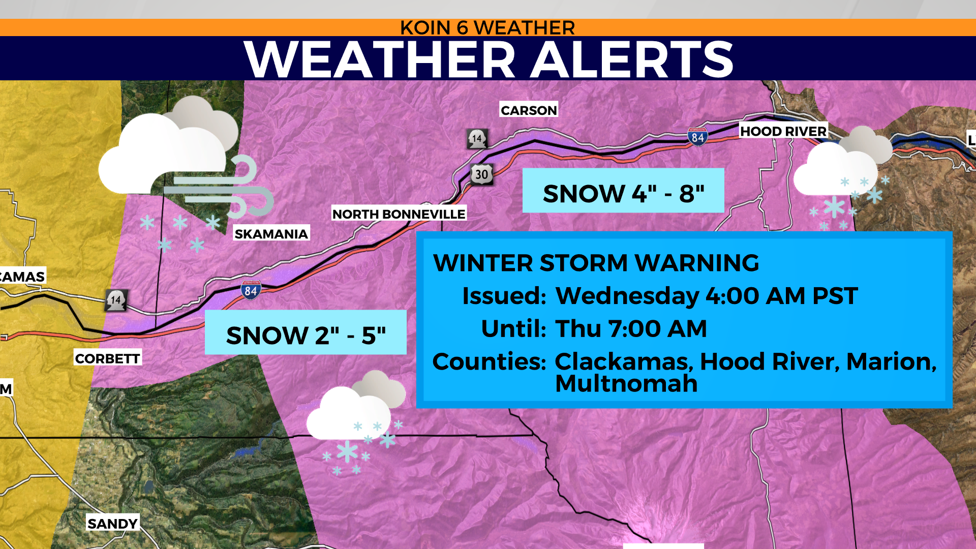
Here are the latest weather alerts issued by the National Weather Service:
VALLEY
WIND ADVISORY IN EFFECT UNTIL 5 AM PST WEDNESDAY

* WHAT...Wind gusts as high as 40 to 45 mph expected.

* WHERE...In Oregon, Lower Columbia, Greater Portland Metro
  Area, Central Willamette Valley and South Willamette Valley.
  In Washington, I-5 Corridor in Cowlitz County and Greater
  Vancouver Area.

* WHEN...to 5 AM PST Wednesday.

* IMPACTS...Gusty winds could blow around unsecured objects. Tree
  limbs could be blown down and a few power outages may result.

CASCADES
Northern Oregon Cascades-
Including the cities of Government Camp, Detroit, and Santiam Pass

WINTER STORM WARNING REMAINS IN EFFECT FROM 4 AM WEDNESDAY TO
7 AM PST THURSDAY

* WHAT...Heavy snow expected. Total snow accumulations of 3 to 6
  inches below 2500 feet, 6 to 14 inches between 2500 and 3500 feet,
  and 1 to 3 feet above 3500 feet. Winds gusting as high as 45 mph.

* WHERE...Northern Oregon Cascades.

* WHEN...From 4 AM Wednesday to 7 AM PST Thursday.

* IMPACTS...Travel could be very difficult.
COAST RANGE
Coast Range of Northwest Oregon-
Including the cities of Vernonia, Jewell, Sunset Summit,
Lees Camp, and Trask

WINTER STORM WARNING REMAINS IN EFFECT FROM 10 AM WEDNESDAY TO
4 PM PST THURSDAY

* WHAT...Heavy snow expected. Total snow accumulations of up to 8
  inches.

* WHERE...Coast Range of Northwest Oregon.

* WHEN...From 10 AM Wednesday to 4 PM PST Thursday.

* IMPACTS...Travel could be very difficult.

PRECAUTIONARY/PREPAREDNESS ACTIONS...

If you must travel, keep an extra flashlight, food, and water in
your vehicle in case of an emergency.