Editor’s note: Click here for the latest winter storm forecast blog.
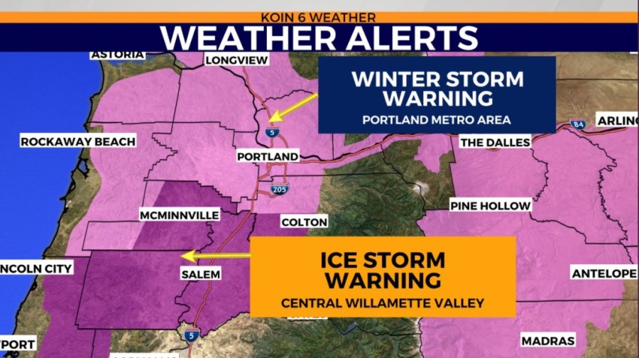
PORTLAND, Ore. (KOIN) — A Winter Storm Warning has been issued for the Portland area and SW Washington, while an Ice Storm Warning has been issued for the central Willamette Valley, including Salem and McMinnville, extending out to the central Oregon Coast.
Many areas woke up to a light coating of snow in Portland and ice from freezing rain in other parts of the Willamette Valley, but the forecast is still on track to bring an impactful round of weather starting Friday night into Saturday.
Light snow continues this morning for Portland with that bitterly cold easterly wind, gusting at times 30-40 mph. We may be able to accumulate another 1-3 inches of snow until late morning/midday. Windchill will also be in the teens Friday morning.
Snow showers will then pick up through the day as pulses of moisture arrive ahead of Friday night’s system.
All models at this time are pointing to a major storm event through Saturday as a result of loads of moisture on top of Arctic air already in place with a continuing strong easterly flow through Saturday night.
There’s an expected brief lull in between systems Friday starting around noon through 2 p.m., but by 4 p.m., increasing moisture arrives, and once again Portland will see snow, with as much as 3 to 10 inches of snow overnight Friday into Saturday.
Meanwhile, areas south and west of Portland and all the way to the coast will start seeing a freezing rain/sleet combo. Ice accumulation could be significant in some areas, especially across the central parts of the Willamette Valley.
On Saturday afternoon, the moisture decreases, and the temperature profile changes late in the day.
With the ice accumulation from an ice storm, it’s possible to see power outages across the central Willamette Valley on Saturday morning. Click here for a list of emergency resources to bookmark when the lights go out.