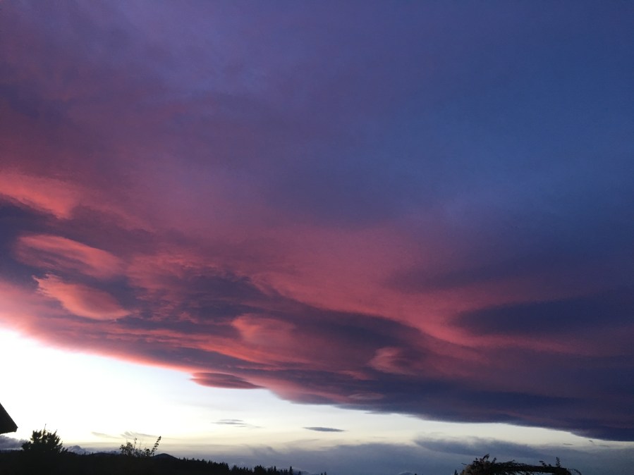
PORTLAND, Ore. (KOIN) – Have you ever looked to the sky and seen a cloud that looks like a stack of pancakes or a UFO? Those lens-shaped clouds are what we call lenticular clouds! They are very popular in the Pacific Northwest (PNW) because of the terrain across Washington and Oregon.
Now these aren’t your everyday clouds. I like to say that lenticular clouds are a bit more fancy. That is because it usually takes a certain type of conditions for these to form and it doesn’t happen as often as your happy-go-lucky cumulus cloud or ready to rain nimbostratus clouds we learned earlier in our Weather Kids lessons.
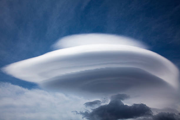
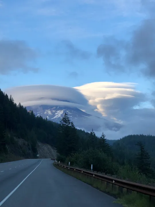
These clouds are definitely a spectacular sight when they stack up and form above the mountain tops. From time to time we may have one over Mt. Hood! That can be such a majestic view for the lucky people that live here in Oregon. Sometimes they find a way to show up in a catalog of clouds spaced across central Oregon on a relatively stable weather day. For those of you that are residents of The Dalles or Madras, you have probably seen your fair share of these UFO shaped clouds.
YOU ARE PROBABLY WONDERING, HOW DO THEY FORM?
Great question! If you had to make an educated guess, you would probably suggest that the airflow has something to do with the soft edges and the shape of these clouds. If that is what you were thinking, you would be correct!
What is occurring is the airflow, that is relatively stable and flat, is lifting because of the mountain and then descending downwind of the mountain. This creates a wave or ripple in the airflow which allows for the particular shape of the cloud. These clouds are basically motionless and with the moisture we get from the Pacific Ocean, we have just the right recipe for that air to reach saturation for those clouds to develop when they lift.
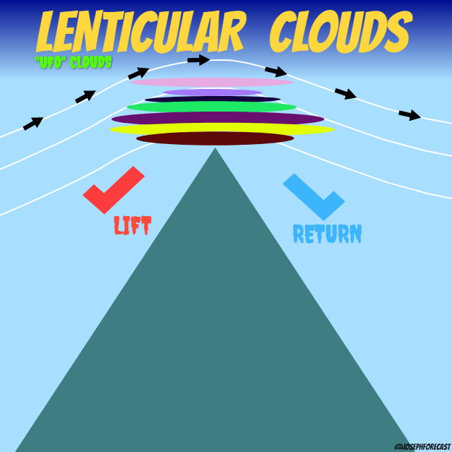
Lenticular clouds are more natural to the PNW than other portions of the United States because of the mountains. Although a lenticular cloud may form without the obstruction of a mountain, it is far less likely. That makes our location special and just right for the development of these clouds.
They are not clouds that cause precipitation but they do give off an indication of a turbulent wind. Pilots tend to avoid flying near lenticular clouds because of the turbulence that is likely closer to the ground. Lenticular clouds tend to form somewhere around 6500 feet to 16,500 feet. Mt. Hood is over 11,000 feet, so when those clouds form over Mt. Hood, they’re right in that window.
We know that there are multiple classifications of clouds based on the height of the cloud. This is the same case for lenticular clouds! There are 3 forms based on varying altitude:
Altocumulus standing lenticular (ACSL)
Stratocumulus standing lenticular (SCSL)
Cirrocumulus standing lenticular (CCSL)
Now when you see these clouds over the top of your favorite Oregon or Washington mountain, you can imagine the wind and what is causing them to form. You may also just choose to think of these as UFOs and preserve the mystery of these fascinating clouds.