PORTLAND, Ore. (KOIN) — This weather lesson is about the dreaded valley inversion.
What do you mean, Joseph? This topic is one that is highly useful for forecasting in the Pacific Northwest but sure can ruin a forecast. How so? An inversion can prevent communities at the bottom of the Willamette Valley from warming up and it can even keep us real cold for an extended stretch of time in the winter.
The reason it is considered dreadful is because it can destroy a forecast quickly. This is where experience goes a long way because an inversion that sticks around until the afternoon can take a temperature that was predicted to be 70 degrees and in reality, it turns out to be an observed temperature of 54 degrees. That’s a significant difference that people will feel swiftly into the day.
If you’ve lived here your whole life, you’ve been through an inversion or two. These are the days that it stays cool and cloudy in Portland, all the while, sunshine and warmer temperatures bliss the sky of Government Camp at 4000 feet. That may be a bit confusing because more often than not, it is colder up on the mountain than it is at sea level.
Wait…wait…wait…
HOW DOES THAT WORK?
Great question! This is where the concept of an inversion comes into play. You can think of the Willamette Valley as a bathtub with mountains and higher terrain as the barrier on the outside. Now you can think of Portland to be at the bottom of that bathtub and locations like Government Camp at the top outside of the bowl of the tub. What happens in a temperature inversion is cold dense air will sink to the bottom of the “tub” or in this case the valley. The barrier of the valley will prevent wind from reaching the surface. Cooler air may reach saturation and this will lead to cloud cover over lower elevations.
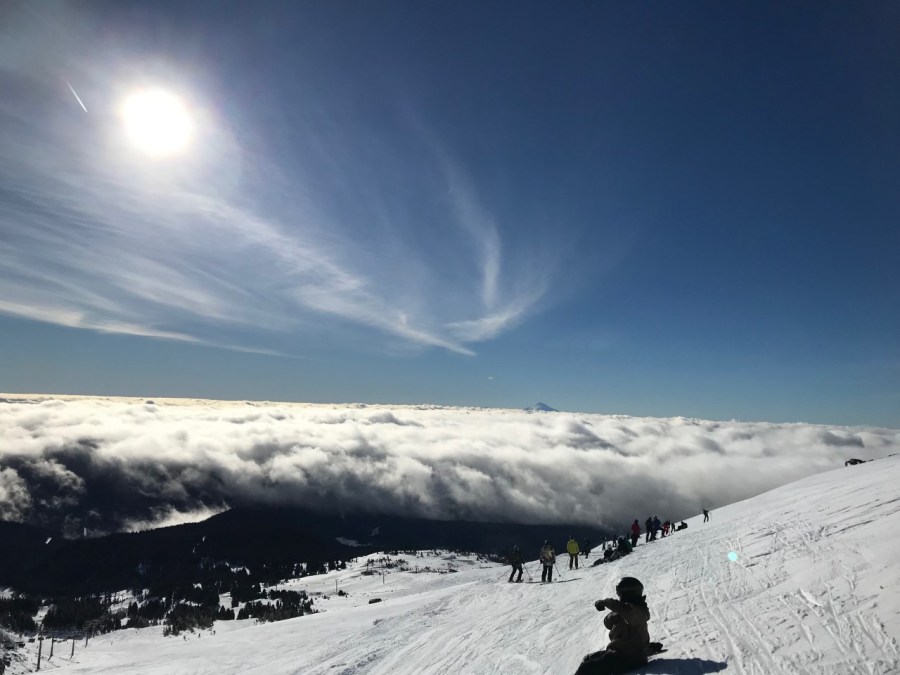
STUDY THE PHOTO:
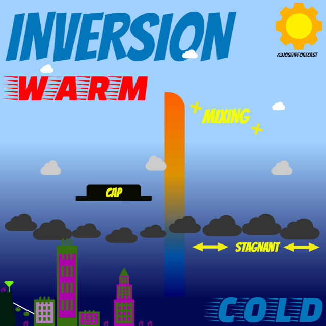
Now, warmer air will create a trapping scenario over the top of that cold dense air that has settled to the floor of the valley. That warmer air is coming off the mountains, or just politely moving across the top of the valley. That warm air doesn’t sink and there isn’t anything to help mix out that cold air from the surface. Essentially, that warm air will act as a “cap” over the top of that cold stagnant air at the bottom. With that warmer air above the valley floor temperatures will be warmer at those elevations that are located above the valley. It will also be sunny as clouds dissipate because of the heat from the sun making a larger impact.
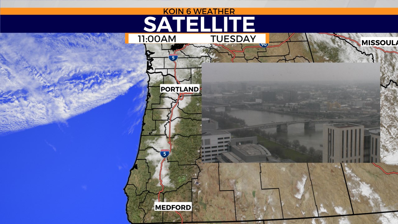
Here is one example of a day where we had to battle an inversion for the valley. Notice the clouds layered over the top of the Willamette Valley. Check out the photo of Portland at that time! If we had a side by side of the mountain on that day, it would be a nice blue mid-day sky.
Lastly, this is a vantage point that will help show you the mountains and elevation change across the state. Notice that those higher elevations peek over the top of the clouds that are stuck down in the valley or basin.

How do we change the pattern up and get out of an inversion? The best bet for that is to have another system move in that can help change the air mass. If we get a strong cold front moving through, it will cool the air aloft and also help generate wind to the surface to help mix things out. Depending on the time of the year, hours of afternoon sun can help the process of kicking out the clouds but that doesn’t always fix a persistent inversion.
Way to stick out the lesson! Another weather topic to tuck away for trivia in the future!