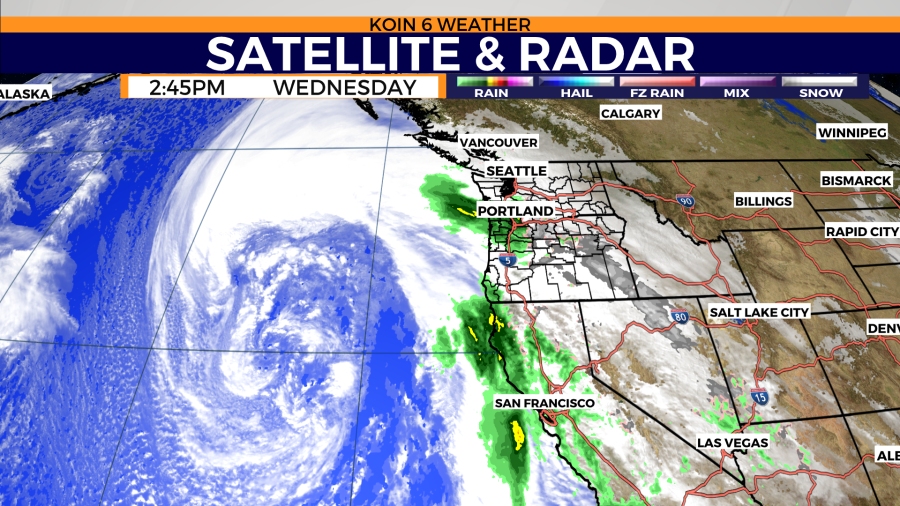
PORTLAND, Ore. (KOIN) — Rain and wind are already starting to pour into the Portland area Wednesday afternoon due to the bomb cyclone rotating offshore. But what exactly is a bomb cyclone?
KOIN 6 meteorologists Kelley Bayern and Josh Cozart explain that bomb cyclones are simply storms that intensify at an especially rapid rate.
Derived from the term “bombogenesis,” a bomb cyclone happens when an area of low air pressure, also known as a storm, drops even further, or intensifies, by a rate of at least 24 “millibars” in 24 hours. Millibars, the National Oceanic Atmospheric Administration says, are units of measurement used by meteorologists to detect changes in atmospheric pressure, which is a vital way to predict the weather.
“Although the changes are usually too slow to observe directly, air pressure is almost always changing,” NOAA said. “This change in pressure is caused by changes in air density, and air density is related to temperature.”
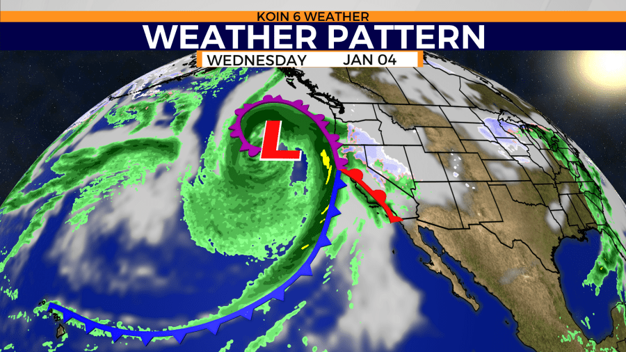
The extreme drops in air pressure that create bomb cycles, Cozart said, are often caused by warmer ocean waters warming up the air near the ocean’s surface.
“The warmer air comes into contact with colder air, and that helps speed up the intensification process,” Cozart said. “Warm air likes to rise. So, when the cold air moves over the warm air and water, it forces the warm air to rise even more. In doing this, that helps to drop the pressure.”
This rapid drop in pressure creates an explosive release of energy that can cause intense winds, heavy rainfall or even blizzard-like conditions.