PORTLAND, Ore. (KOIN) – Each and every day that we start to get closer to winter, the likelihood of a wind event starts to increase.
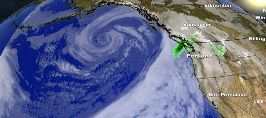
First off, what is going on to trigger this? Largely, the summer is very tame in the Pacific Northwest and the ability for widespread active weather is almost put on hold. Mid-latitude cyclones or extratropical cyclone, which are large systems that occur between 30 and 60 degrees north or south of the equator, are more vigorous when we reach the cooler months. Why? Mid-latitude cyclones are the result of interacting with the warm tropic and cold polar air at the polar front. This clash between two air masses is more evident when we approach winter.
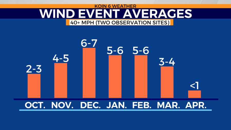
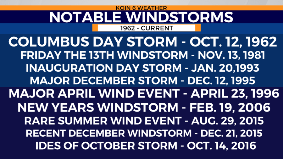
If you take a look at the graphic above, you’ll see that the average for wind events starts to increase by November. A list of some of our notable windstorms below has some of the dates.
Most of them tend to fall in that window of winter weather, with the exception of some outliers. You might notice that I haven’t included months between May through September, because seldom do we have a widespread wind event during those months. However, Aug. 29, 2015, was one rare exception on the notable windstorm list below.
Each and every windstorm is a bit different, but there are criteria that you look for when forecasting the potential for a damaging windstorm.
First, you’re absorbing all of the characteristics of this disturbance. One of the first variables that a meteorologist will look at is the atmospheric pressure or the force per unit area exerted against a surface by the weight of the air above that surface. Typically these strong windstorms may have a central core about 970mb or deeper. The lower the pressure, generally the stronger the wind.
The next step is paying attention to the tracking of the area of low pressure. Depending on the scenario, the closer the storm track takes towards Oregon and the Pacific Northwest, the larger impact the storm will have. Below is an idea of the classic path of a windstorm, where it moves inside the 130° longitude line that rides just outside the Pacific Northwest coast. In fact, that arrow resembles the Columbus Day Storm track in 1962. Many will refer to these systems as “southeasters,” a play on the eastern seaboard’s “nor’easter/northeaster.”

Now, not all windstorms take this type of path. Some windstorms will fall outside of that 130° line or will move in and then travel back outside to the west. Many windstorms will come in from further north and move east and make direct contact with Oregon or Washington. However, the graphic above represents the ideal path for a strong windstorm in the northwest.
Questions? Find the KOIN 6 Weather team on social media. Follow Joseph here.