PORTLAND, Ore. (KOIN) – It goes without saying that we have been fortunate to have a slow start to the wildfire season in both Washington and Oregon; however, this hasn’t been the case for those states surrounding the Pacific Northwest.
Wildfires are growing in California and Utah, with other significant large fires strewn about the United States. We know that with the summer in PNW, we get heat, but we also tend to find a window that comes in a bit hazy due to wildfire smoke. We may have our first veil of smoke moving into Oregon by Tuesday.
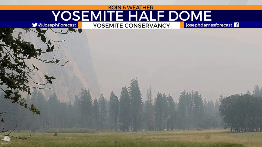
Right now, there is a wildfire in the Yosemite National Park producing enough smoke to get funneled across the West Coast. An image from the live camera coming from the Yosemite Conservancy shows the wildfire smoke causing a thick cloud in the view of the iconic granite slab “Half Dome.” This wildfire is called the Washburn Fire and it is currently over 2,000 acres and is at 25% containment.
We took to the weather data which will show the high-level smoke forecast for the coming 24 hours. Right now, this wildfire seems to be far enough and the wind pattern should only impact the higher levels of the atmosphere.
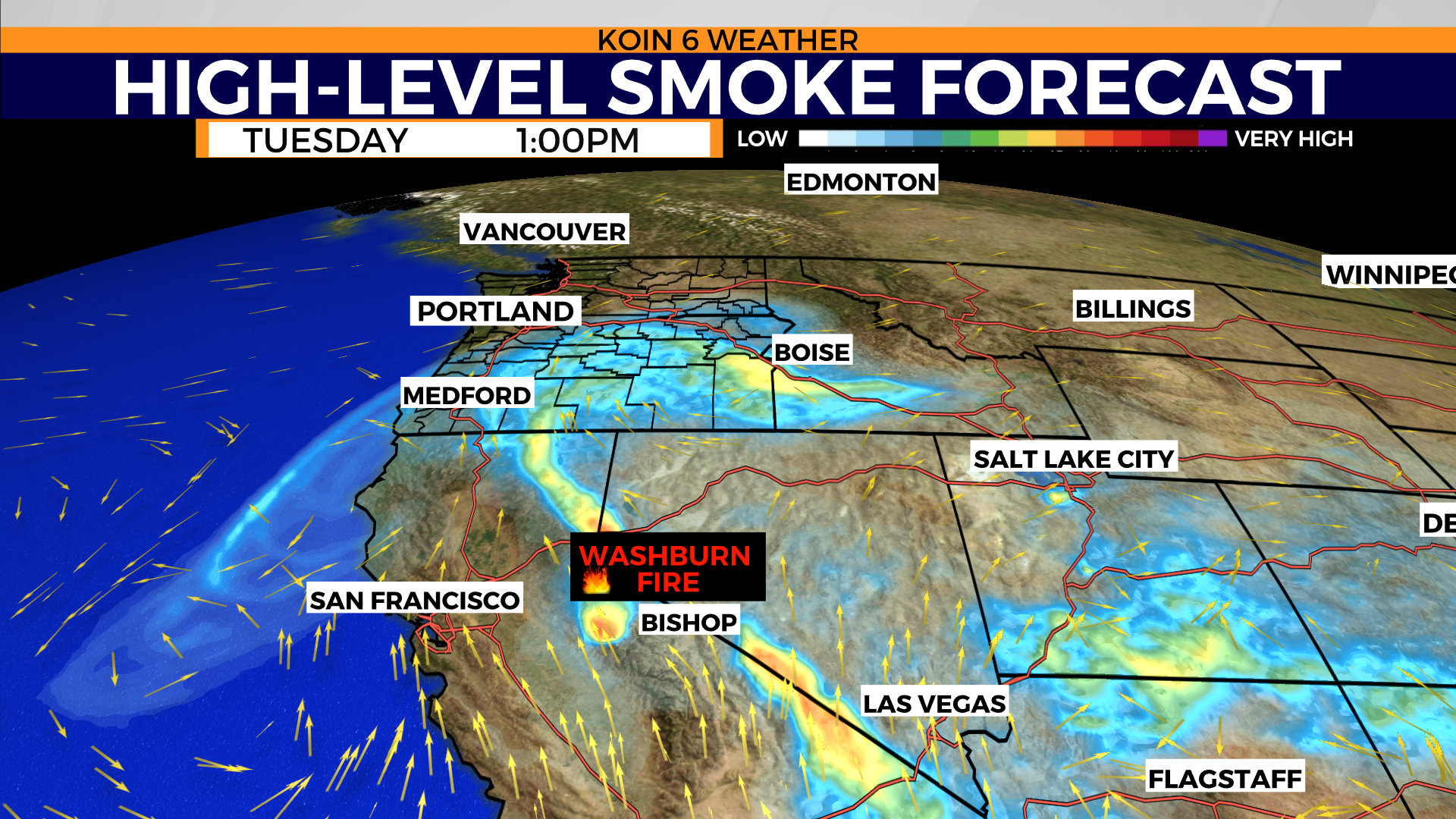
However, that doesn’t mean it won’t create a haze for us here in the Willamette Valley. If you maneuver the slideshow below, you will notice the increase in smoke by Monday night for southern Oregon. By Tuesday, that high-level smoke is expected to peel over central and eastern Oregon as well. At this time, there may be some notice of smoke in the central or southern Willamette Valley. We are not expecting an impact on air quality at the surface. We may avoid the smoke altogether in the valley.
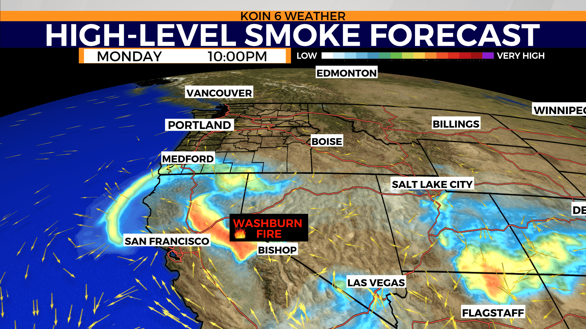
Why now? For one, the growth of the wildfire to the south has been steady. It is large enough to have more of an impact than just the nearby skies.
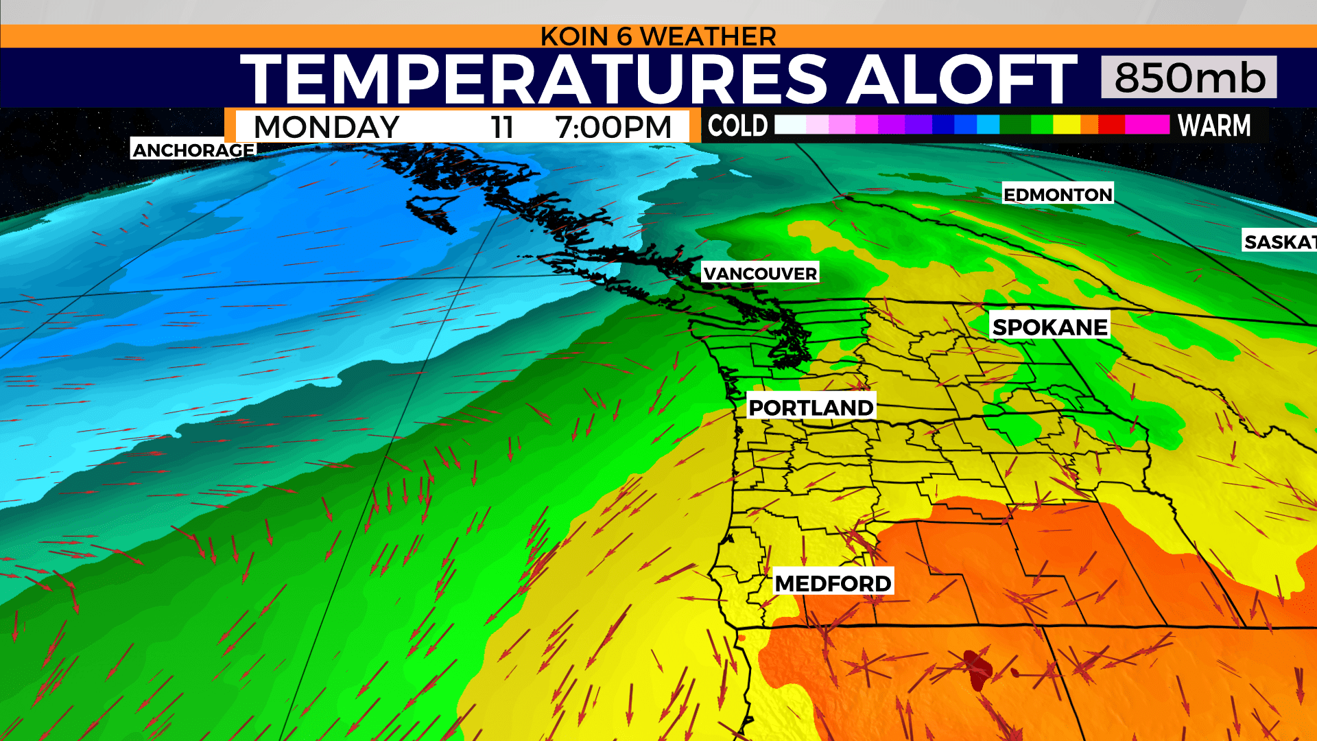
The next reason? Well, the wind is going to pull more out of the south on Tuesday. This is the wind pattern well above our heads where airplanes fly. Closer to the surface, the wind is actually going to be flowing from east to west (~4,500′). At the surface, the wind is going to be blowing out of the north. That means we will have a clean slate near the ground. You will notice in the image that is labeled “temperatures aloft”, that we will have some warm air around, but also, a northeast wind represented by those arrows. The wind pattern is something we refer frequently when we discuss air mass and temperatures. In this instance, we are focusing on the wind for how much it will impact the transportation of smoke!
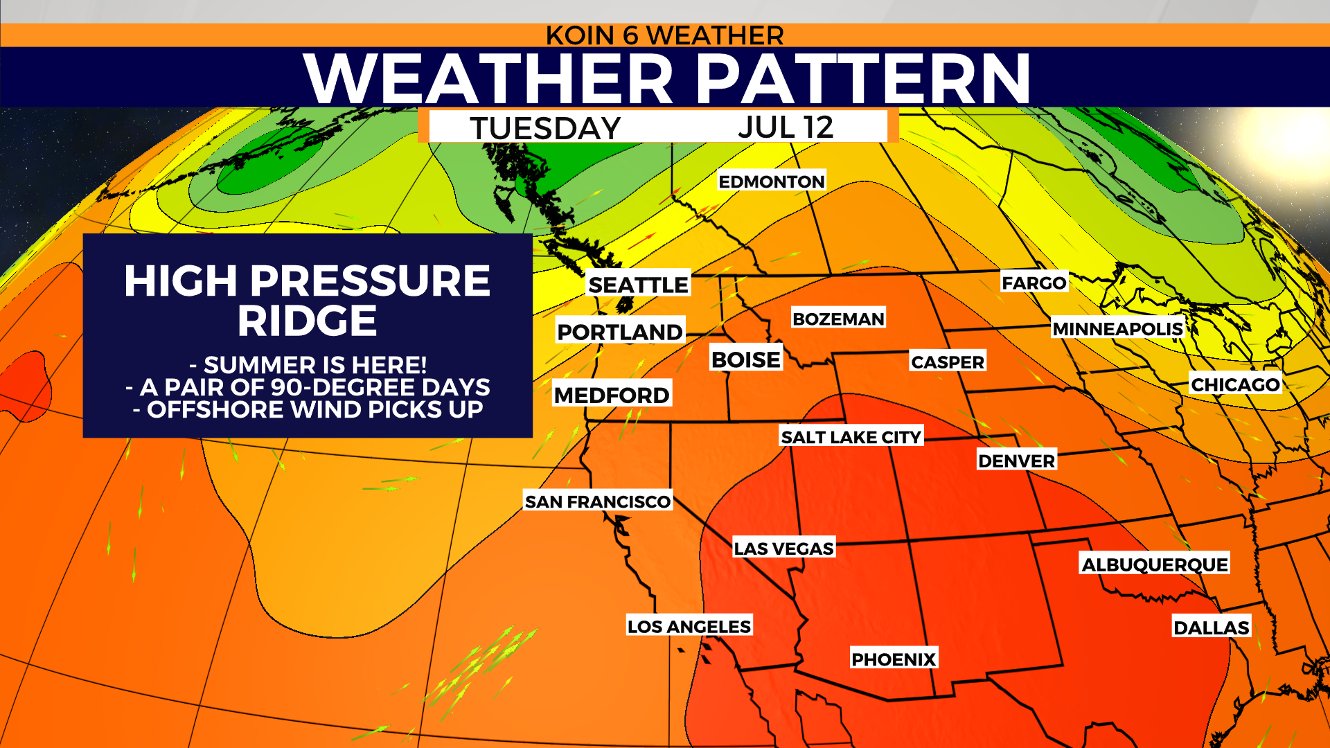
FROM SMOKE TO HEAT
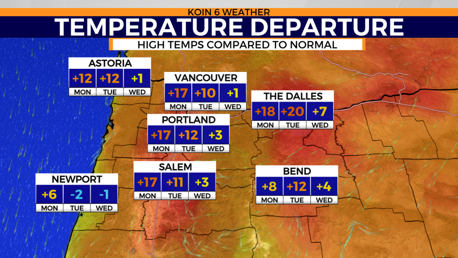
It is starting to feel more and more like summer around Portland. We are entering our second dry spell of the summer season. We have no rain in the forecast for the next seven to 10 days. We are starting to feel some more consistent heat around here as well. We are tackling temperatures that are going to be nearly 10 to 15 degrees outside of our average for the next two days (Monday and Tuesday). The temperature departure graphic below is advertising well above normal temperatures for a few days. Only Newport is expected to cool down on Tuesday and Wednesday.
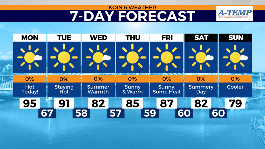
What does +17 actually look like? Well check out the 7-day forecast below. Temperatures in the mid 90s is going to be 10 to 20 degrees above the normal. We should typically be in the lower 80s this time of the year. We will get there, we will have a break from the heat on Wednesday.
That shift in wind is going to cool us down, it will also prevent most wildfire smoke, even at the high levels, to stay south and east of Portland.