PORTLAND, Ore. (KOIN) – We start the new week of the new year with a soaker. Another strong cold front moves through, creating some massive rain totals for the region by Monday night.
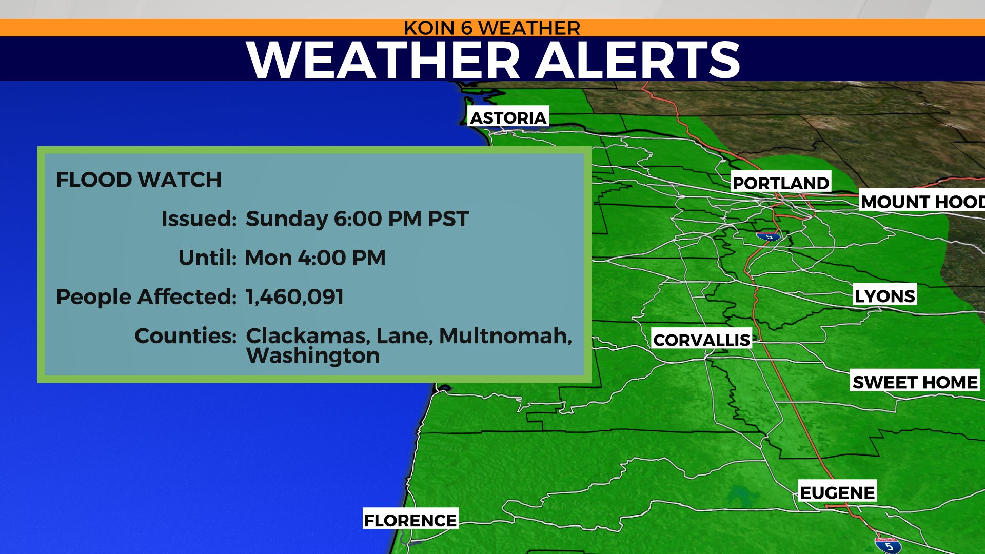
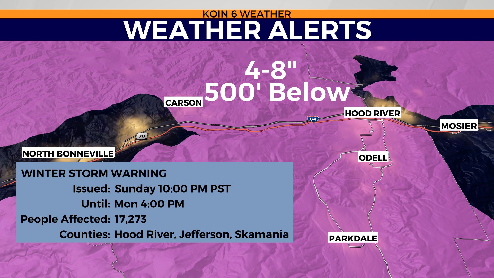
A flood watch is in place until 4 p.m. Monday, with the wettest part of the day to be early. You should be ready for a slower commute, especially if you’re thinking about traveling up to the mountain or into the Gorge.
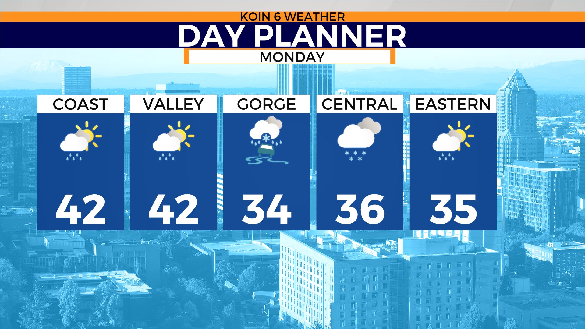
Portland will start with temperatures in the upper 30s and we will top off around the lower to mid 40s. You will want your rain jacket with all of your other rain gear.
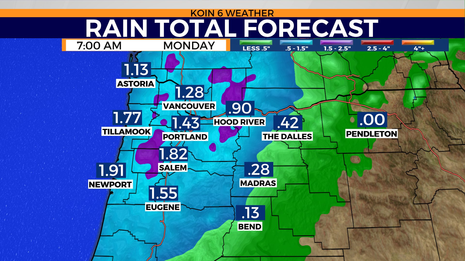
Weather models are projecting 1-2 inches of rain from Sunday night through Monday night. There is a chance that we have record rainfall on Monday. The previous record at the Portland Airport is 1.32 inches in 1966. We will have some local flooding issues around the valley and out to the Oregon coast.
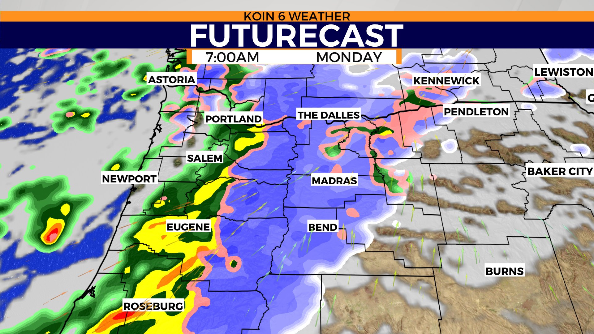
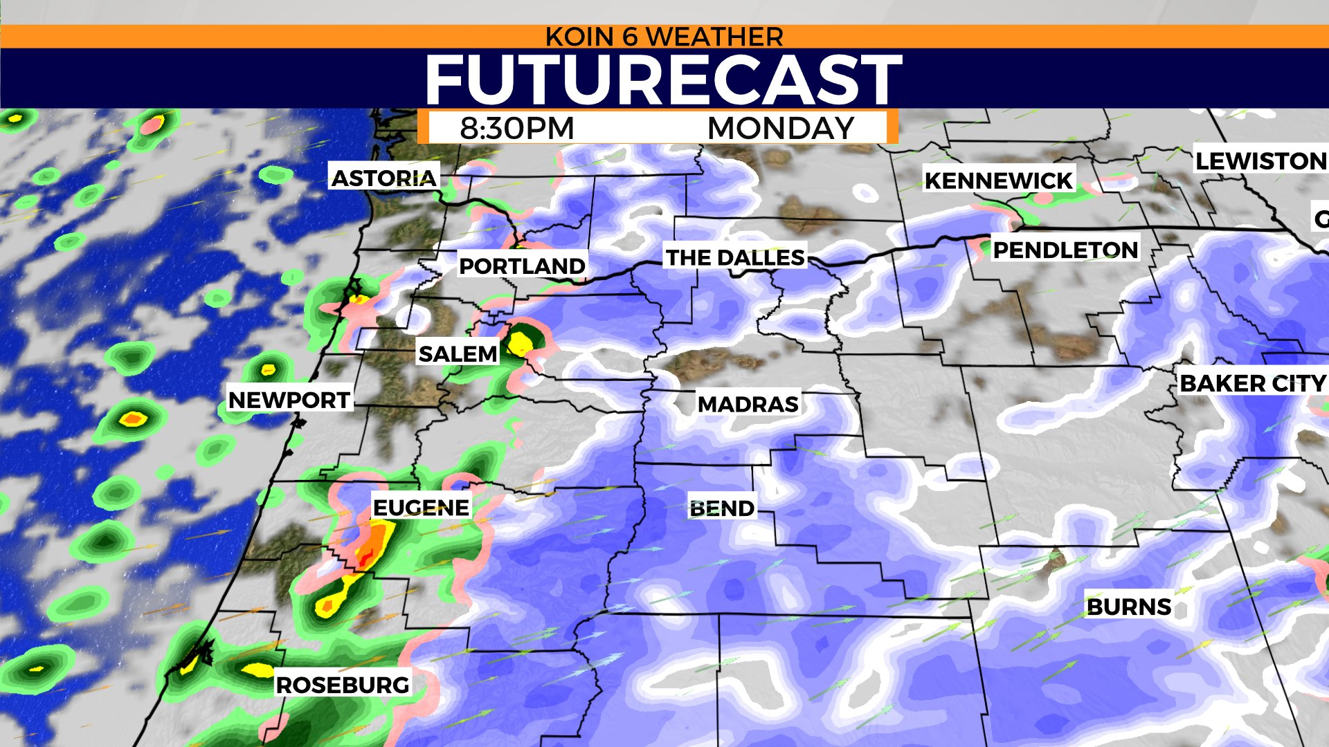
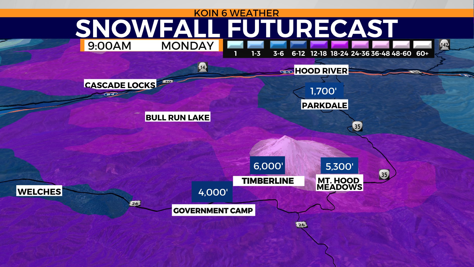
Swipe through the graphics to get a visual representation of what the forecast is going to be Monday.
The bulk of the moisture will be around the I-5 corridor and east by morning, with heavy snowfall at this time for the Cascades and the foothills. It will be very snowy if you’re trying to drive up to the mountain on Monday. We are expecting over a foot of snowfall.
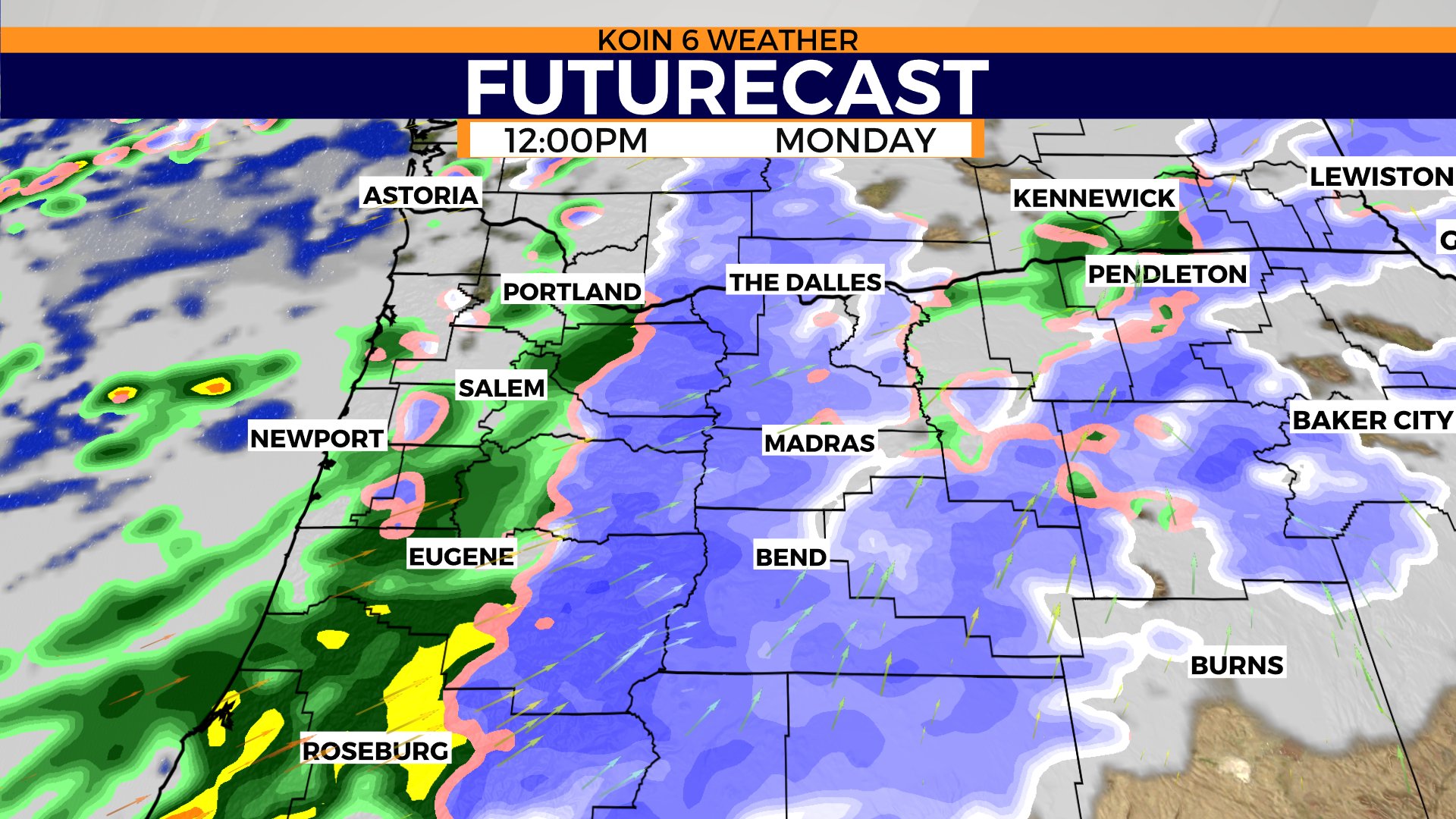
You will need to give extra attention and be familiar with mountain driving. It’s still going to be fairly wet by mid-day, but we will have some breaks for the Oregon coast and around the western valley. Still snowy for the mountains, including areas of central and eastern Oregon. This holds until the night. Expect temperatures to be in the 30s all day for Hood River east. We should warm to the lower 40s around Portland.