PORTLAND, Ore. (KOIN) – After a rude awakening Monday, there is a lull in weather activity late Monday night before a round of scattered rain showers and snow showers brew early Tuesday morning.
Expect conditions to be mainly dry and quiet until 2 a.m. or 3 a.m. Temperatures will drop to the mid 30s around Portland, with some outlying areas closer to freezing.
Some bridges may be icy, but a widespread freeze is not expected.
Onshore flow picks backup after 3 a.m. , which will help ignite some showers. The Willamette Valley is expecting rain, but there may be a few snow showers.
We are not anticipating any measurable snow for Portland on Tuesday morning. There may be some minor accumulations for the hills. Snow levels around 500 to 1000 feet.
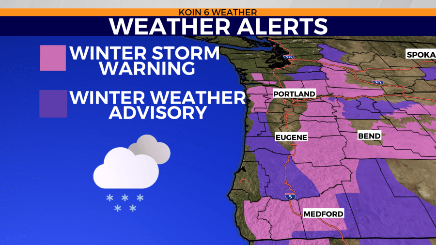
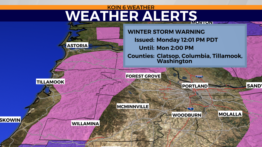
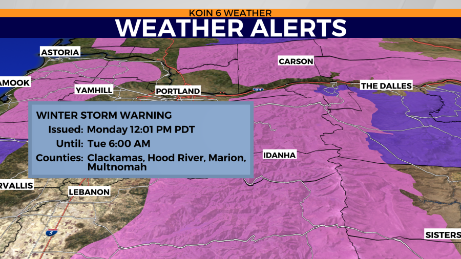
There will still be some lingering bursts of snow for the Cascades. A winter storm warning is in place until 6 a.m.
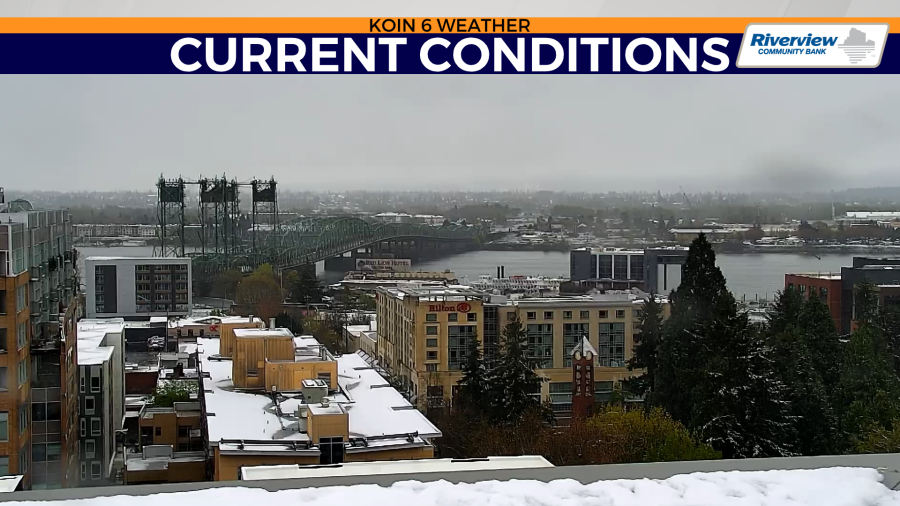
The winter weather Monday hampered the morning commute, delayed or closed schools, and knocked out power for thousands.
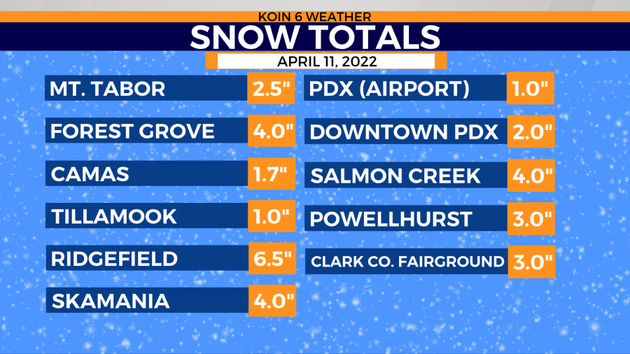
The temperatures will warm to the 40s, eliminating the snow threat. That will occur from now until sundown. We have plenty of snow to melt. Check out the totals in the slideshow below.
Snow will be in abundance for the mountain passes on Monday, too. If you have to travel up to the ski resorts, or just over the passes, you will want chains. The ski resorts collected over a foot of snow Saturday into Sunday afternoon. We are expecting another foot of snow overnight through Monday morning. Windy conditions can cause some trouble up on the mountains as well.
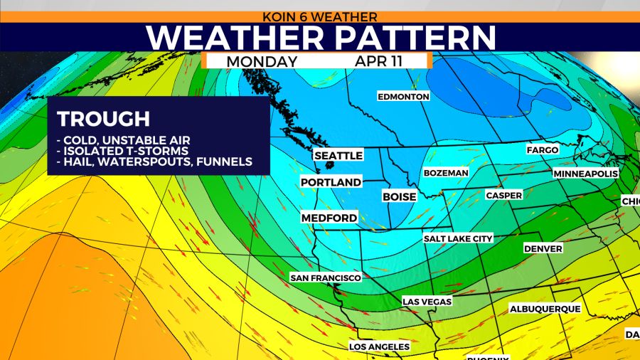
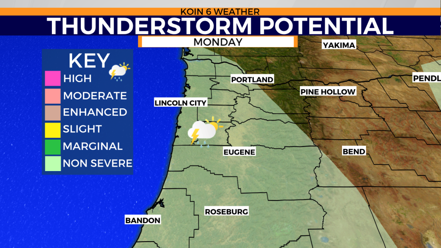
Outside of the snow threat, we will have a lot of rain Monday. A few scattered thunderstorms are possible, too, as conditions remain off-kilter. There is potential for hail, gusty conditions, and even the isolated chance for a funnel cloud or waterspout.

Expect conditions to be cool and showery for the afternoon.