PORTLAND, Ore. (KOIN) — If your Mother’s Day weekend plans include getting out of the metro area and heading to central Oregon or up into the mountains, you should gear up to deal with snow.
The KOIN 6 Weather team has been tracking a cold, wet, and winter-like system headed into the region for several days and the rainy conditions that arrived in the region Thursday morning will likely turn into snow above 2,000 feet by Sunday morning.
The snow will fall across the passes and may accumulate during the colder morning hours as soon as Saturday and last through Monday morning.
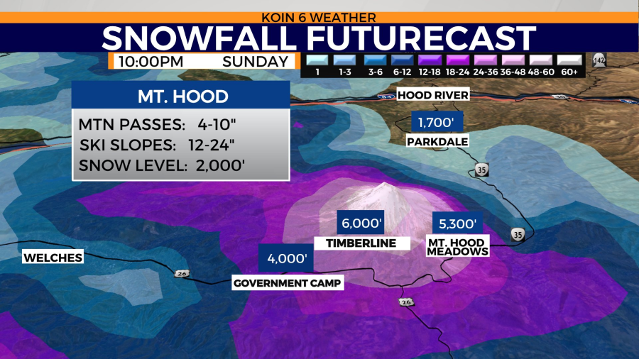
“Folks should prepare for winter driving conditions and light accumulations on roads,” KOIN 6 Meteorologist Kelley Bayern said. “By the end of weekend, we could have snow accumulations on roads with 4-10 inches of total snow near passes. Ski slopes could receive 1-2 feet.”
A Winter Weather Advisory is in place starting tonight and lasting through midday Saturday for elevations in the Cascades above 4,000 feet.

Drivers headed to and through the Columbia River Gorge may not be able to avoid the late-season snow either. Forecasters say some of the hills around Hood River could see a dusting and maybe as much as an inch.
For those who are spending the weekend in the metro area, the Willamette Valley or headed over the Coast Range, it’s going to be a cool and wet weekend, but there isn’t much of a chance of seeing snowflakes below 1,500 feet.
“Highs continue to hover in the mid-upper 50s through the weekend,” Bayern said. “Expect a few sun breaks sprinkled into our days ahead, but all the moms and families out there will dodge showers all weekend.”
Bayern said there is a chance for some isolated, weak thunderstorms in the region throughout the weekend.
If you would like to know about severe weather in the region as soon as the KOIN 6 Weather Team does, click here to sign up for our Severe Weather Alerts.