PORTLAND, Ore. (KOIN) – Portland is now a few days removed from one of the warmest stretches of heat on record.
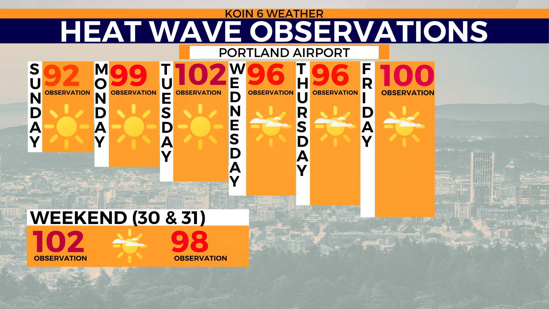
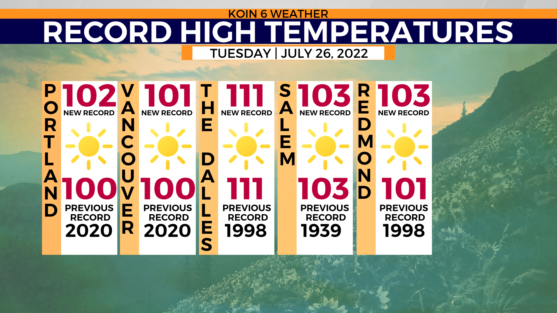
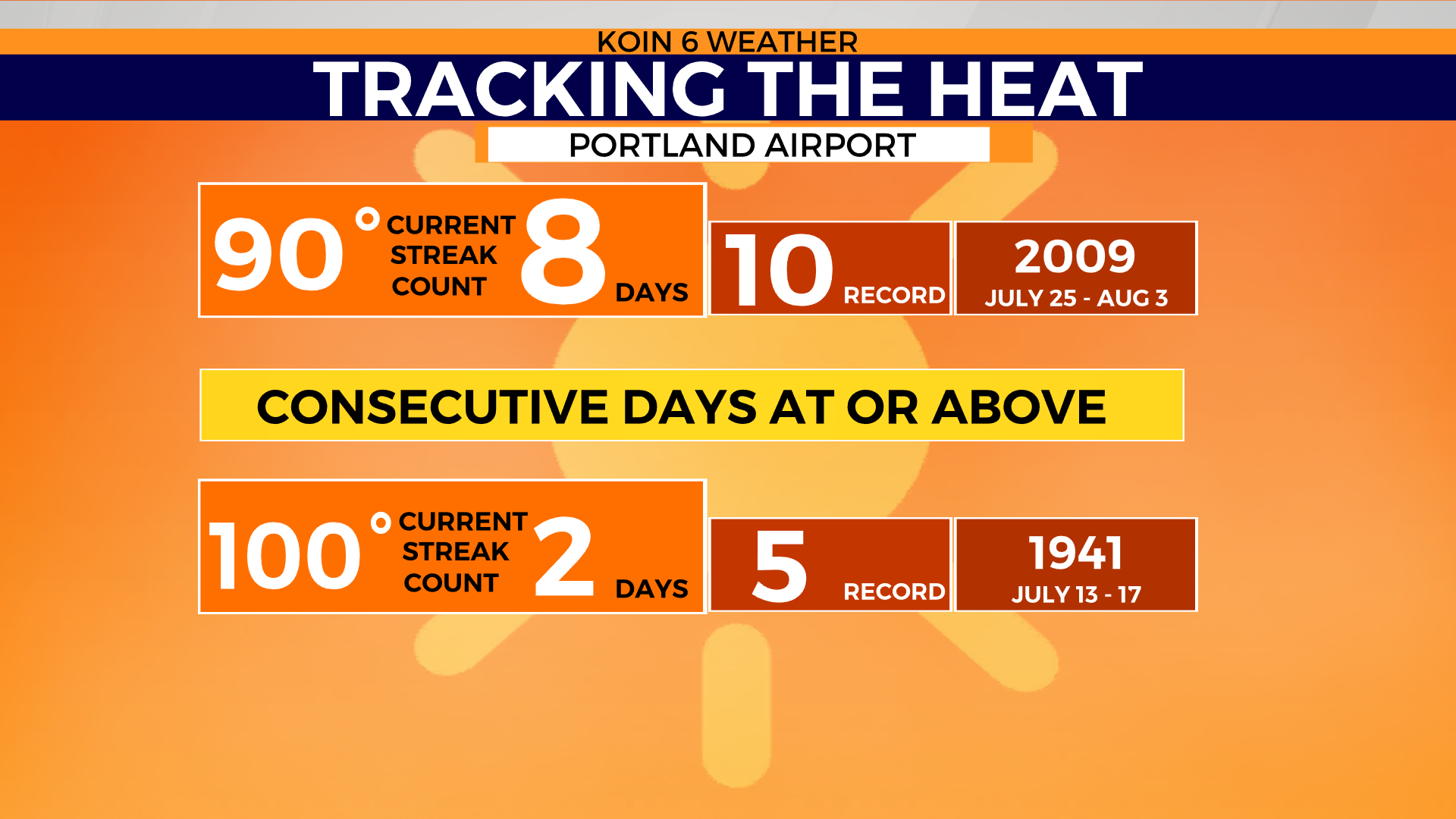
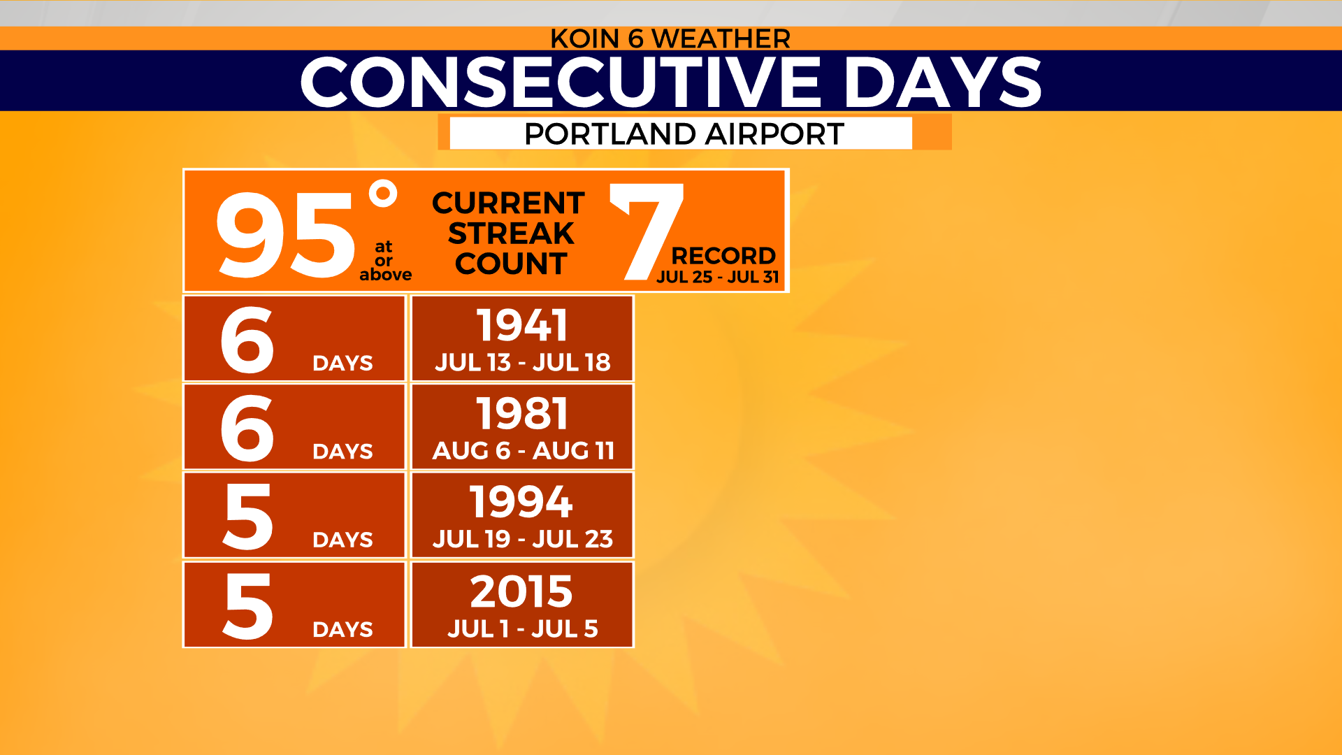
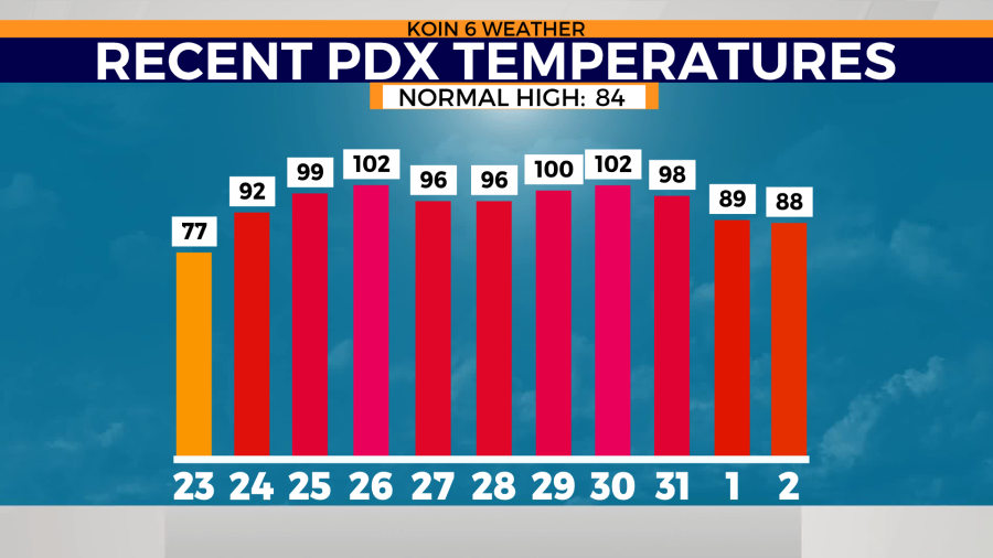
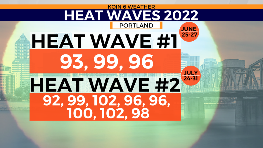
This heat wave brought in eight days at 90 degrees or more, and a new record for consecutive days of 95 degrees or above at seven days, besting the six-day record from 1941 and 1981. The heat wave started on Sunday, July 24, but we didn’t reach the excessive heat warning criteria until July 25 when we pushed into the upper 90s. We jumped up to the triple-digits on Tuesday, July 26, also breaking a record for the daytime high.
There were a handful of broken records throughout the heat wave with pressing heat in The Dalles and south into Medford.
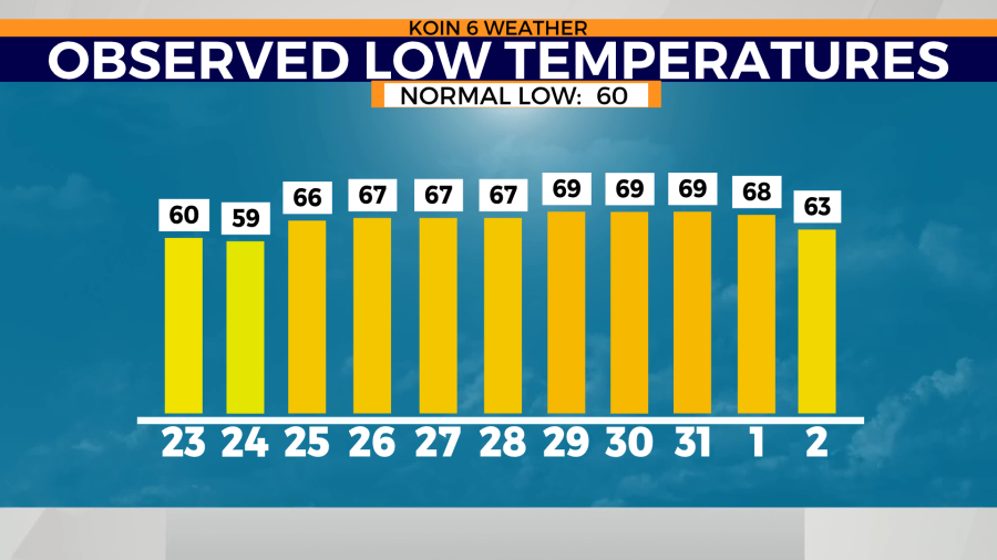
We then had two days that hit the mid-90s, with humidity levels that jumped. Dew points around the valley reached the upper 60s, creating a “feels like” temperature that was in the lower triple-digits. That was both on Wednesday and Thursday, which also limited the overnight temperatures from falling much lower than 70 degrees. This was moisture that was pulling in from the Pacific as a southwest flow kept conditions moist.
Usually, during these types of heat waves, we have a dry east wind that will warm us up. That shows you the strength of our air mass that was over the top of us.
It should also be noted that there was a thin veil of wildfire smoke moving through the upper-level layers of the sky from the wildfires in California.
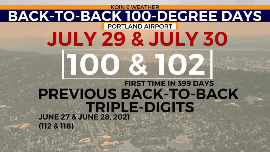
Right behind that stint, we brought back the triple-digits. This was the first time that we had back-to-back triple-digit days in 399 days. Both Friday and Saturday hit marks that were impressive, but they weren’t record-breaking. Yet, the last time we had adjacent 100-degree days was during the heat dome of 2021! The excessive heat finally broke Monday, albeit not a drastic cooldown. Daytime highs hit just below 90 degrees both Monday and Tuesday this week. Not only did we live through some serious afternoon heat, but we didn’t get the cool summer air in return. We had both ends of the stick, where it was sweltering in the afternoon and warm overnight. This didn’t allow for most buildings around Portland to cool down. Temperatures stayed above 66 degrees from July 25 through August 1. We finally broke the warm overnight temperatures Tuesday morning, as lows dipped back to the lower 60s.
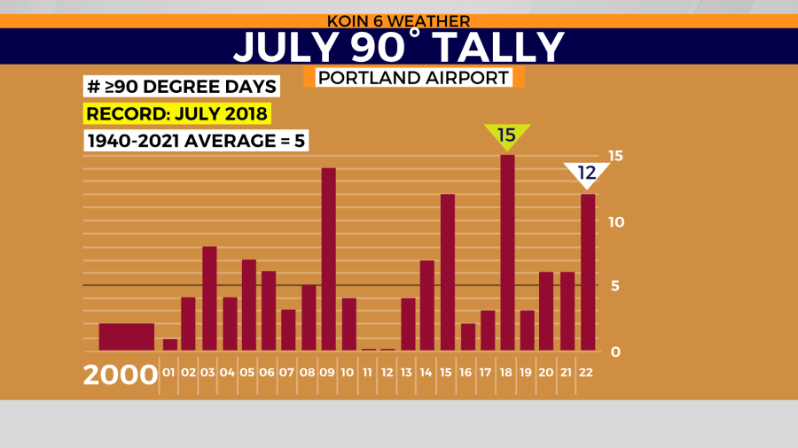
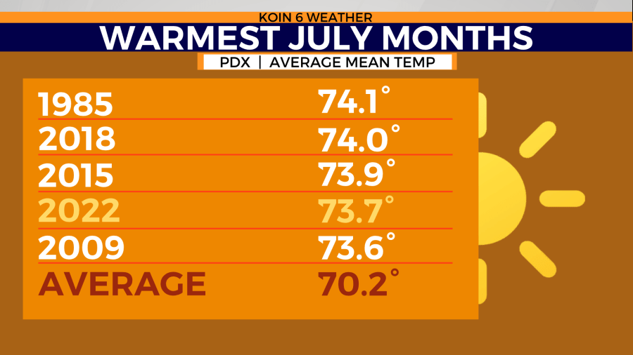
When it was all said and done, Portland completed the month of July above average. We wrapped up the month with 12 days at 90 degrees or above. That was the most since 2018, when we had 15, which was a record total for the month of July. If you’re wondering, Portland usually averages about five. That data is going all the way back to 1940.
Another Pacific Northwest heat wave
Portland has tackled two heat waves this summer. One was a three-day stretch at the end of June, the other, the prolonged serious heat that we just endured. If you’re wondering, a heat wave is generally described as three days of 90 degrees or above around here. Most of the time we have one hot day, with the hottest on day two, then a third day when we bring the heat back down. That was not the case for our second heat wave, as temperatures seemed to get warmer more than once, creating two peaks.
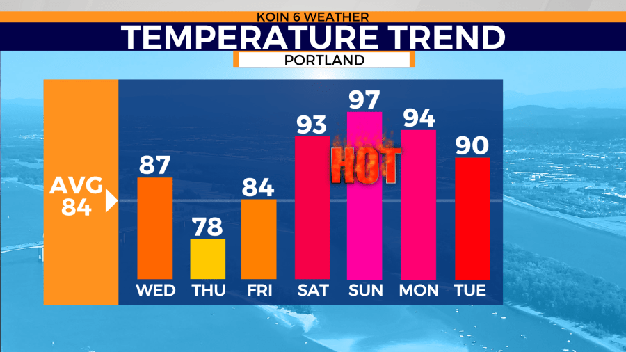
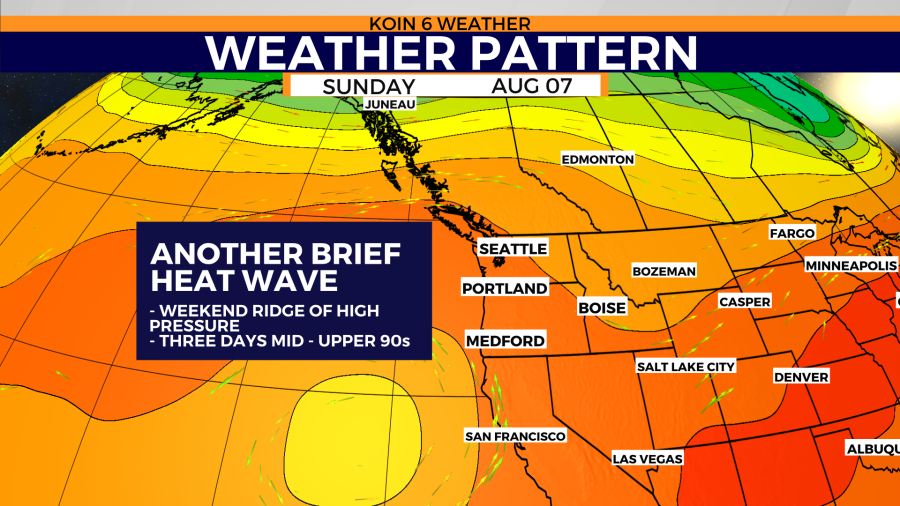
The forecast for our upcoming heat wave is expected to resemble more of a traditional heat wave than a drawn-out heat wave. It is possible the back end of this heat wave is still going to be on the warm side. The forecast is calling for lower to mid-90s Saturday through Monday. We didn’t have to wait long for our next period of heat. It’s possible we work some of our warmer days of August out of our system now, but August is still our warmest month of the summer, with an average mean temperature of 70.6 degrees (an average of the high and low). It will be a ridge of high pressure that returns this weekend that will scoot the temperatures into uncomfortable territory.
We nearly have a rex block setting up as well, as a fairly stationary upper-level low holds west of California and the ridge develops over the top. This is one reason for the slow cool down on the back end of the weekend heat.
