PORTLAND, Ore. (KOIN) — Thunderstorms in the summer are few and far between in the Pacific Northwest — but the region may see one this week.
Portland and the PNW spend most summer days dry. Nearly all systems that do provide some rain are cooler patterns that clip us from the northwest. The summertime pattern that brings in thunderstorms, well that typically pushes storms over the Cascades and across the high desert.
From time to time, we do find a few booming thunderstorms here in the valley during the hot months. In recent years we have had early morning storms and even some nocturnal hits of action. Our current setup may be enough to bring in a stray thunderstorm Tuesday west of the Cascades.
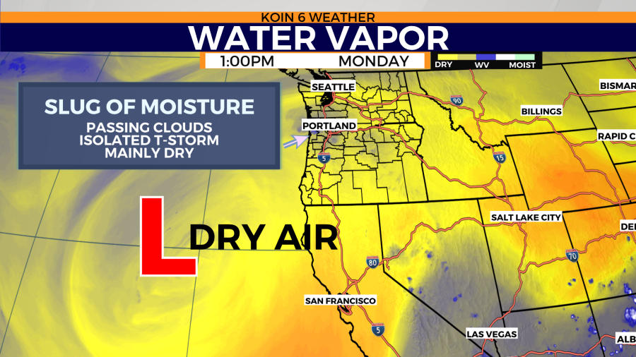
The configuration right now has multiple pieces at work. There is monsoonal moisture moving up through the Great Basin as conditions remain mostly warm and dry locally. A cut-off low is holding west of California, which will eventually travel northeast over the next two to three days. That will enhance our chance for storms and it is essentially controlling the air pattern in our region as well.
As the trajectory of this disturbance moves north, it will create some lifting opportunities for thunderstorms. Unfortunately, we do not have a lot of moisture to drop much rain. Cells developing over the Cascades and east are going to be more dry than wet.
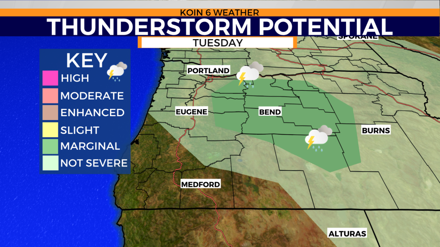
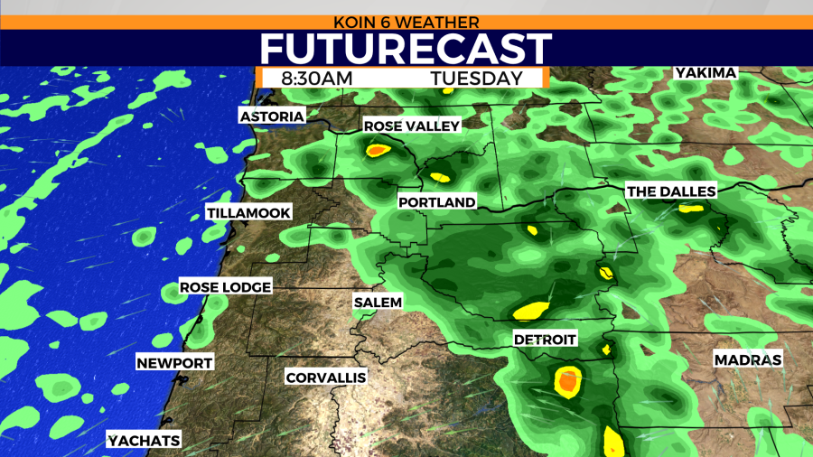
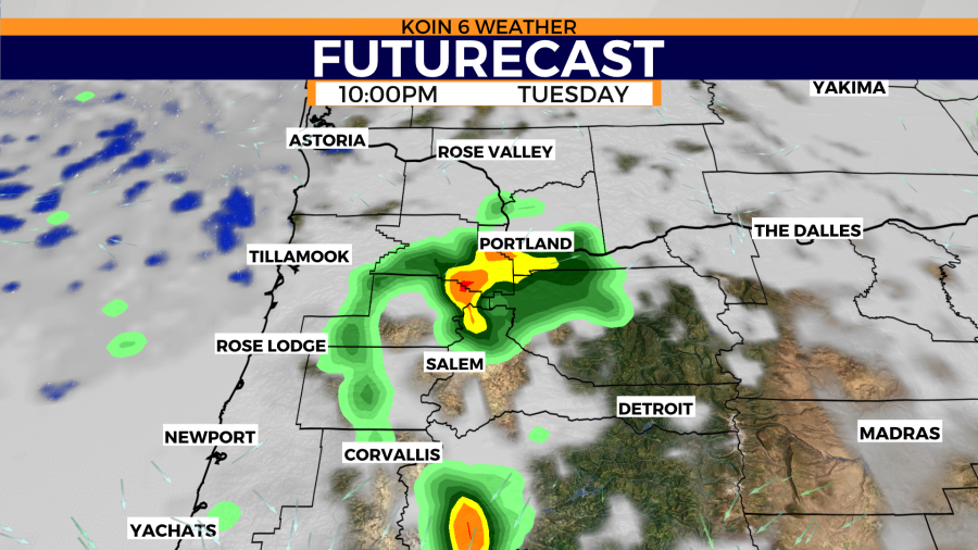
Swipe through the slideshow to see the storm boundaries Monday and Tuesday.
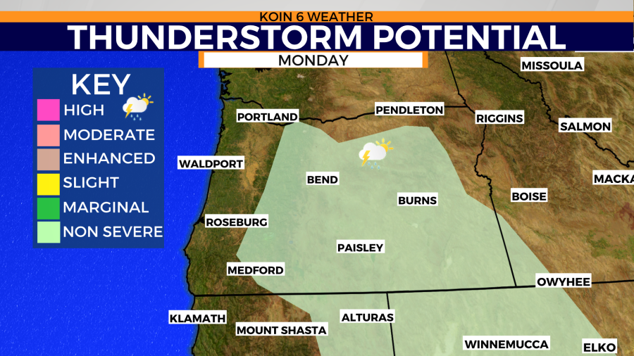
The upper-level wind pattern will be flowing from the southeast up to the northwest on Tuesday. That may steer any storm development from the Cascades right down into the valley. We will also have enough energy to produce some of our own storms without the help of the mountains and the heat to the east.
You can see how the boundary shifts west on Tuesday in the thunderstorm potential graphic above. The greatest risk for storms will be through central Oregon and the central Cascades, dipping down into the foothills of the Cascades.
TIMING
- Expect isolated showers in the vicinity come Tuesday morning. These showers should be in and out, without the type of energy that the afternoon or nighttime cells may bring. Rain is likely to appear before sunrise and it will be around until 9 a.m. or so. From about 9 or 10 a.m. to late afternoon, it is mainly dry and sunny until the next batch. This is a chance to bring in some measurable rain.
- We then have a chance for a few cells to start dropping over the Cascades into the foothills and eastern Willamette Valley. Weather data has one or two storms moving into eastern Multnomah county by dinner. At this time, these will be isolated.
- The busy hours are likely to come closer to sunset or even after. Futurecast is painting a smattering of cells over the Portland metro area by 10 p.m. with a few to the south as well over Marion county and points closer to Lebanon. This is when we may have a few thunderstorms around the Willamette Valley.

WHAT TO EXPECT
Portland hasn’t had measurable rain since July 6. That makes 33 days of mainly dry conditions (a few spots saw a trace here or there.) We haven’t had any thunder in Portland since June 2 — and that was the closest that we have come to seeing a summertime thunderstorm.
With all that in mind, you may be putting the pieces together that the chances are slim. Although that is seemingly true, this is also the greatest chance we have had in some time.
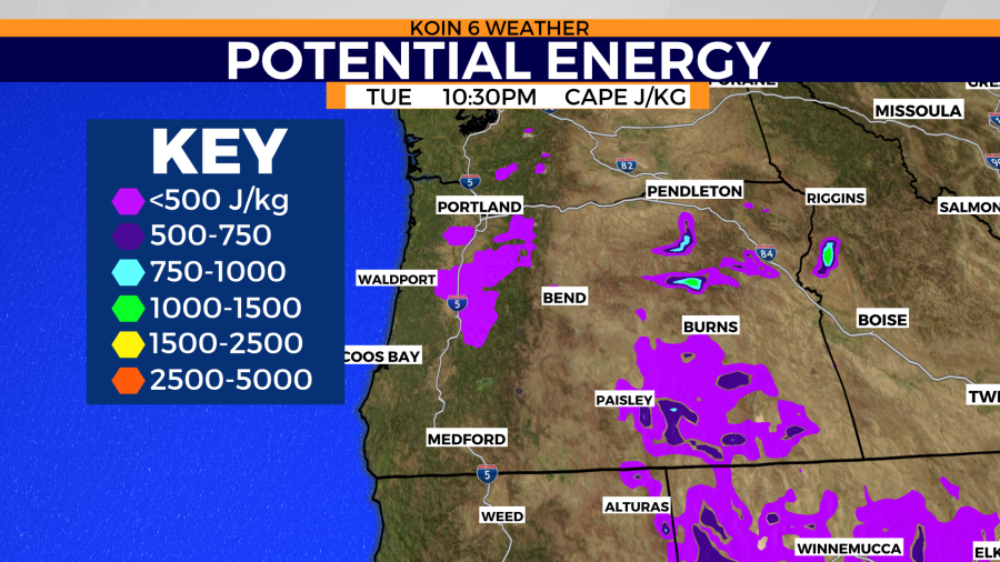
Weather data keeps the energy fairly low Tuesday, but there will be some leftover energy late Tuesday night. This will pair up with the futurecast results in the slideshow above. There is the possibility that we just have a few showers and the energy isn’t there for anything more significant by night.
What we can definitely expect is the ongoing fire weather danger there for central Oregon and southern Oregon. The storms that do develop will produce more lightning and it may also produce gusty outflow. This could set off a new string of wildfires in the coming days. Of course, this is the type of weather we would want to avoid than greet with open arms.
This is your friendly reminder that you should head indoors if you hear thunder.