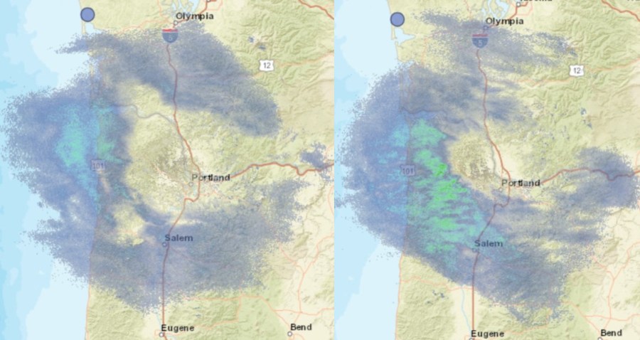
PORTLAND, Ore. (KOIN) — A ring of cold, dry air blowing in from the east created a lasting forcefield of dryness around the Portland metro area Thursday as snowfall circled the region — but freezing rain has now made its way in, causing slick conditions.
Freezing rain began hitting the metro around 5:30 p.m. It’s been the light variety of freezing rain, but that’s expected to accumulate over several hours, leading to icy roads throughout the area.
National Weather Service Meteorologist Colby Newman told KOIN 6 News that high-elevation snow has been falling above Portland throughout the day. However, Portland’s low-lying air had been so dry for most of the day, that the snow was being transformed into a gas before it reached the ground. This process is known as sublimation.
“The moisture has to fall through that dry layer and moisten it up to reach the ground,” Newman said. “If it doesn’t moisten the air enough, it ends up going from [precipitation] to a gas state.”
This transformation can also occur with rain. However, when a liquid converts into a gas, that process is known as vaporization. In this case, Portland’s would-be precipitation is falling as snow, skipping the liquid state and going straight to gas: Sublimation.
While this allowed Portland to stay dry for a few more hours than initially expected, that ring of precipitation is gradually expected to close in on itself as the localized, lower-elevation air becomes moister and moister.
This means that the Portland area will likely see a light dusting of snowfall this evening before heavier amounts of precipitation begin to break through tonight, weather officials say.
“At some point between 4 and 7 p.m. some flurries will start making it to the surface,” Newman said. “As we go into that 6, 7, 8 p.m. time frame, it should increase enough that it will start to impact travel a bit.”