PORTLAND, Ore. (KOIN) — Drier skies are expected Monday as the Pacific Northwest prepares for a super soaker Tuesday.
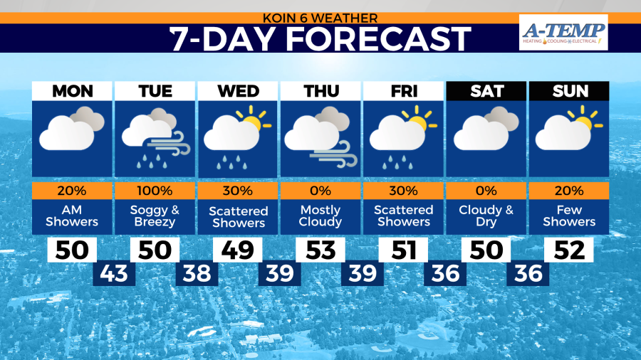
Monday won’t start off completely dry for everyone. A stray rain shower or two is possible for the Portland metro area before sunrise Monday. Overcast conditions will replace the rain potential by the mid-morning hours.
Despite widespread clouds, temperatures will remain near average Monday afternoon. Highs in the low 50s are expected from the coast to the Willamette Valley.

Winds will also start to increase as Oregon and Washington’s latest front moves on shore Tuesday morning. Some locations could see gusts as strong as 30-35 mph. Very little impacts to the temperature will be felt Tuesday with the increase in wind speeds.

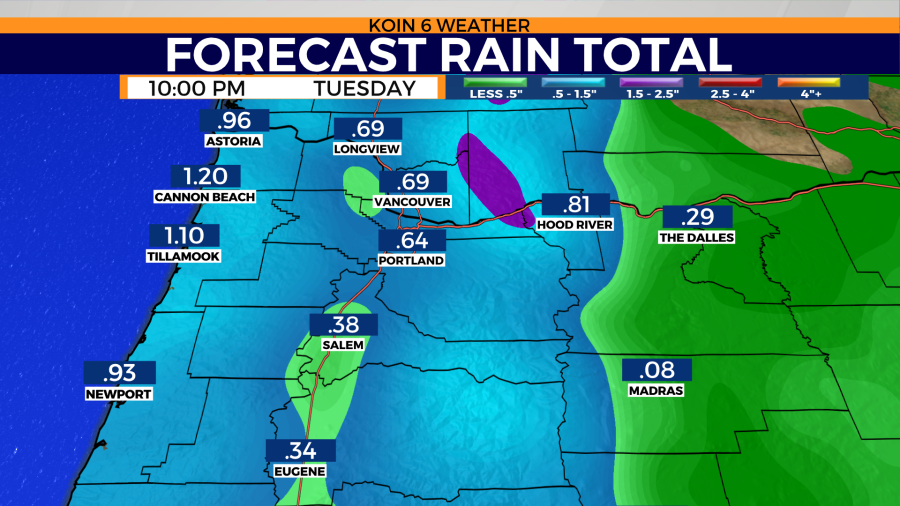
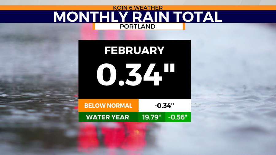
Rainfall totals Tuesday could near 1-1.6 inches along the coast. Willamette Valley rainfall totals will be slightly less, ranging anywhere from a half-inch to three-quarters of an inch. This comes as Portland’s rain deficit continues to grow for February due to the relatively dry conditions.

Snow will remain over the Cascades at and above 3,500 feet through Tuesday.
Skies will slowly start to dry come Wednesday and Thursday across the region. Temperatures will also begin to warm as high as the mid 50s come Thursday.