PORTLAND, Ore. (KOIN) — Just when western Oregon and Washington thought the winter weather was over, another snow potential returns to higher elevated areas.
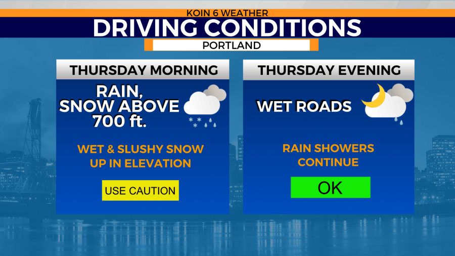
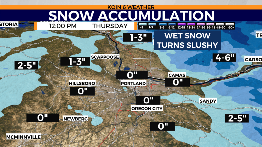
This latest blast of snow isn’t expected for lower locations. Snow levels will drop to nearly 700 feet early Thursday morning. A stray snowflake or two could find its way into the Portland metro area but will melt on contact.

Very few impacts should be felt when commuting with this latest chance of snow. Higher elevations could see some heavy snow showers, but snow will be wet and likely melt on contact. Lower elevations like Portland, Vancouver, and other communities along the Willamette Valley will see rain.

Snow accumulations have the potential to grow with an elevation above 1,500 feet early Thursday morning. That’s where temperatures are colder and the chance of snow melting on contact is lower.
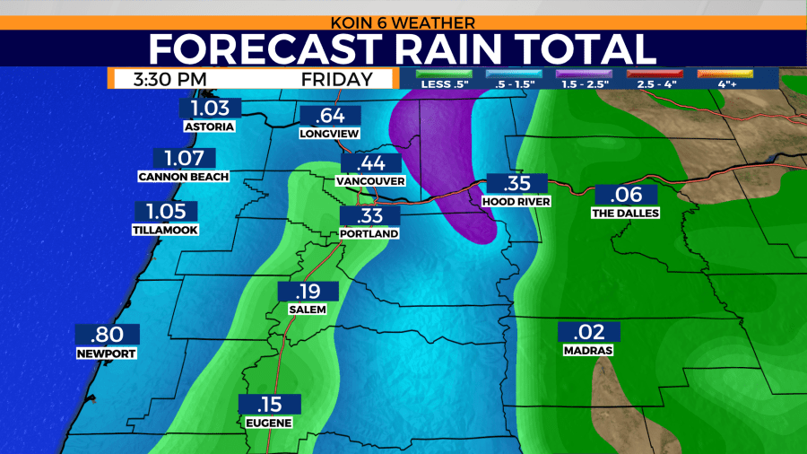
Two cold fronts are expected to move through the Pacific Northwest Thursday and Friday. That will keep the flow of moisture coming into the region through the weekend. Rainfall totals will continue to grow to nearly a tenth of an inch to a quart of an inch for the Willamette Valley. Coastal locations could see closer to an inch by the end of the day Friday.

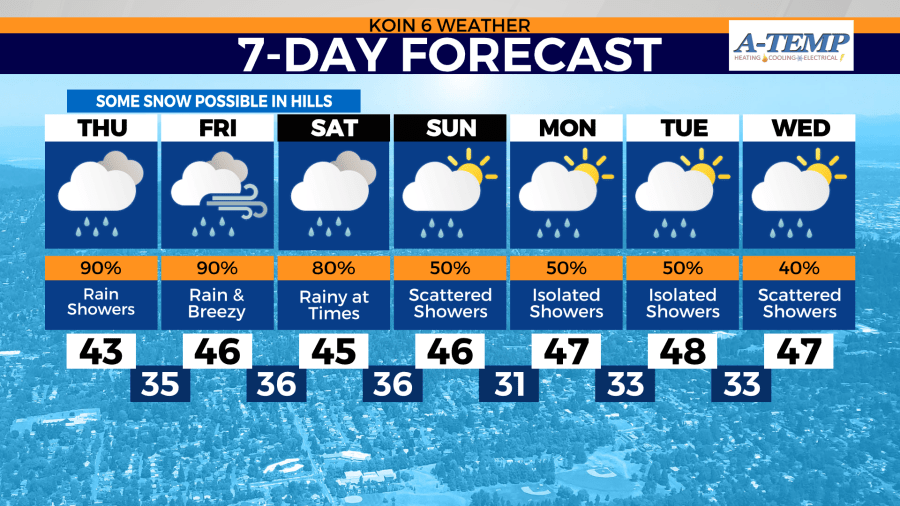
Temperatures continue to trend colder than normal over the next week.

Average afternoon highs typically sit in the mid 50s for the start of March in Portland. Afternoon highs are expected to sit nearly 10 degrees below that average through the middle of next week.
This comes as the first day of astronomical spring is 18 days away.