PORTLAND, Ore. (KOIN) — Despite the calendar saying March, snow chances remain for parts of western Oregon and Washington Wednesday morning. Early morning lows will fall close to freezing as moisture moves through the area. Snow showers will remain above 600 feet Wednesday morning.

A stray snow flurry or two could possibly fall lower than 600 feet but will melt on contact. Higher elevations around Portland might see a dusting of snow on grassy areas and on trees, but accumulation will melt quickly. A few spotty showers are possible later in the day with a few sun breaks.
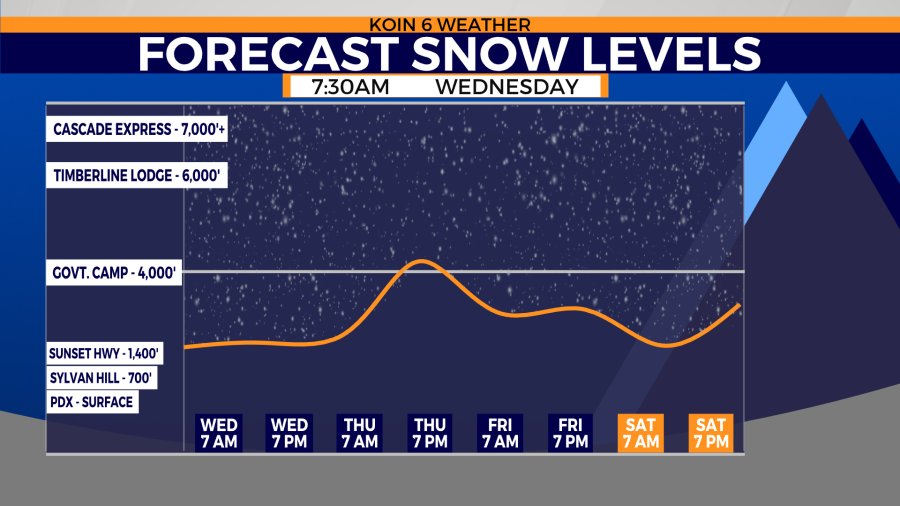
Temperatures will warm rapidly after sunrise. That will decrease the snow potential and melt any snow that may have fallen.
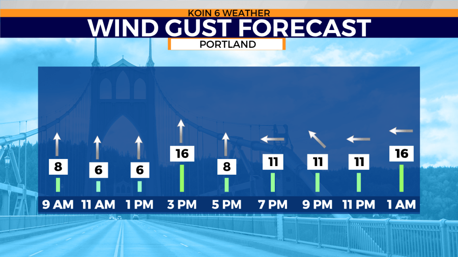
Those warmer temperatures are due to a southerly wind during the morning hours. Winds will continue to increase across the region Thursday and Friday. That’s where some gusts could reach 20-25 mph through Friday.
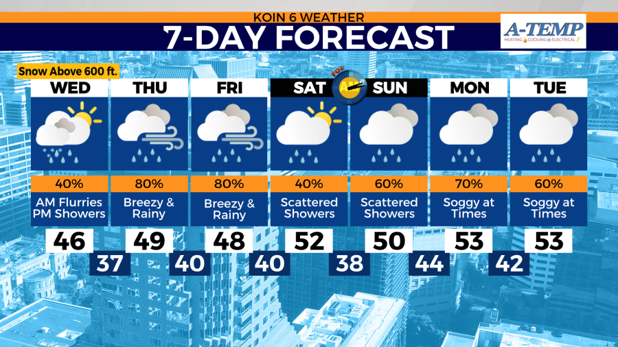
Temperatures will continue to warm throughout the rest of the week. That comes as an atmospheric river returns to the West Coast. California will see the biggest impacts, but western Oregon and Washington will see rain and wind Thursday and Friday.