PORTLAND, Ore. (KOIN) – After a week of arctic air and the concern for lowland snow, we have warmed up and removed the threat for snow in Portland — at least for now.
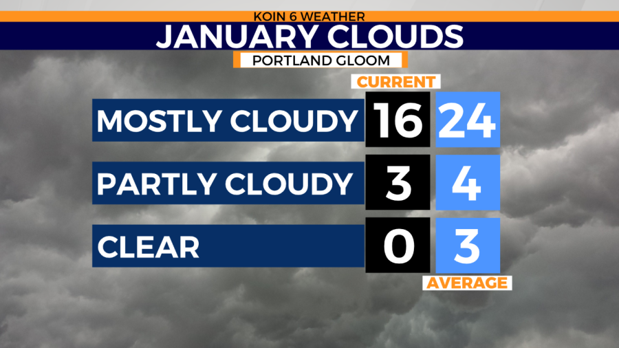
It’s still going to be a busy week, with multiple fronts will trigger rain and mountain snow. Yet it’s the clouds that may start getting to you after very little sunshine and blue sky this month. We have had 16 mostly cloudy days, where the sky coverage has been at least 80 to 100 percent covered with clouds. You know those who aren’t used to it will be using their happy lamps and looking to vitamin D as much as possible this month. However, on average, cloudy days come to about 24 days in January. We also finish out with around three clear days, but it’s not looking good for us.
With a series of systems developing in the Gulf of Alaska and over the Pacific this week, cloudy conditions will continue. Sun breaks are possible this week, but I would count on mostly cloudy conditions as a whole with no signs of stable and dry conditions for the next three to five days.
Notice there may be a few pockets in Central Oregon come Wednesday. The result of a rain shadow and proximity will help bring in some sun breaks for those locations there.

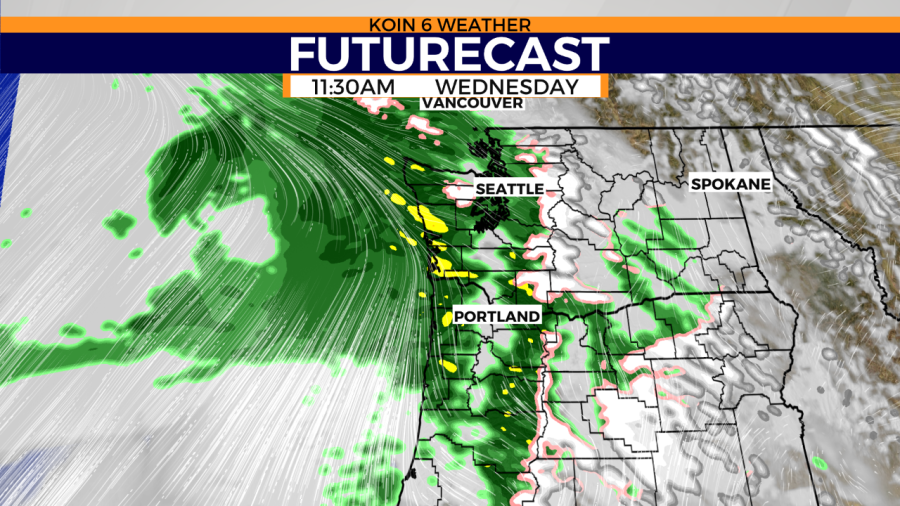
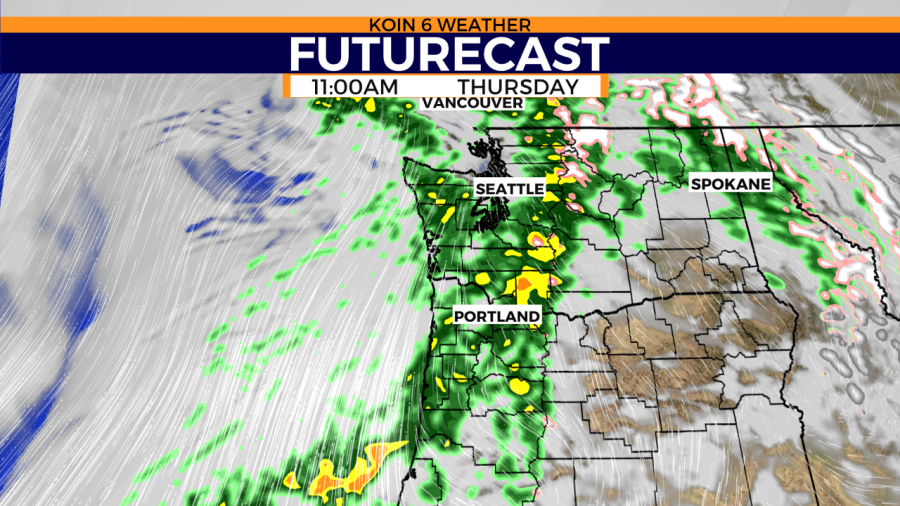
Here are two views of our next disturbances to bring in the clouds and rain. Thursday could offer some spotty sunshine after a front passes through and there is a moment of reprieve. For now, we will keep it a bit gray and dreary!