PORTLAND, Ore. (KOIN) — Monday marks 40 years since Mount St. Helens erupted but even though four decades have passed, nearby communities are still at risk of catastrophic flooding.
Prior to the 1980 eruption, Spirit Lake was a beloved summer destination for swimming, camping and boating with the symmetrical mountain looming in the background. The lake was also famous for its lodge and its owner’s defiance in the face of the impending eruption.
“I had some people yesterday ask me why the hell I stay there and what I’ve been doing up there,” lodge owner Harry Truman said days before the eruption. “That’s my life. Spirit Lake and Mount St. Helens is my life.”
Photos: Mount St. Helens eruption, 1980
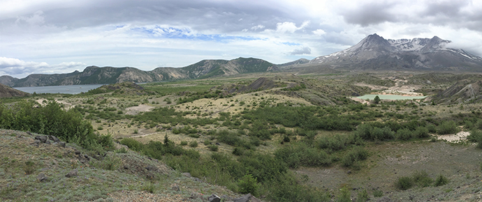
Today, the thousands of acres surrounding St. Helens still resemble a moonscape. But threatening to destabilize the stark tranquility of the region is something scientists weren’t aware of in the 1980s: the magnitude-9 earthquake predicted to rock the West Coast.
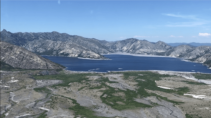
Chris Strebig with the U.S. Forest Service said the quake could take a massive toll on Spirit Lake’s southwestern shore, which was formed by the eruption and the unprecedented landslide that followed.
“Spirit Lake is a 4-mile square lake, it’s billions of gallons of water,” he said. “If there were to be a failure of the debris blockage much similar to the 1980 eruption, you would have a flood down through the small communities all the way down to the large communities in Longview/Kelso and Interstate 5 as well as Columbia River shipping would be impacted.”
Strebig is managing a Forest Service project that involves drilling deep into the landslide debris blockage. Scientists want to test the shore at its low point to figure out how strong it is and if something needs to be done.
“When the mountain erupted basically it dropped a landslide of debris into the valley and, on top of that, pyroclastic flow which is highly erodible,” said Strebig. “And on top of that an ash layer—kind of like a layer cake. So the lake is held back by that rockslide debris.”
The eruption landslide also blocked the flow of water out of Spirit Lake to the Toutle River.
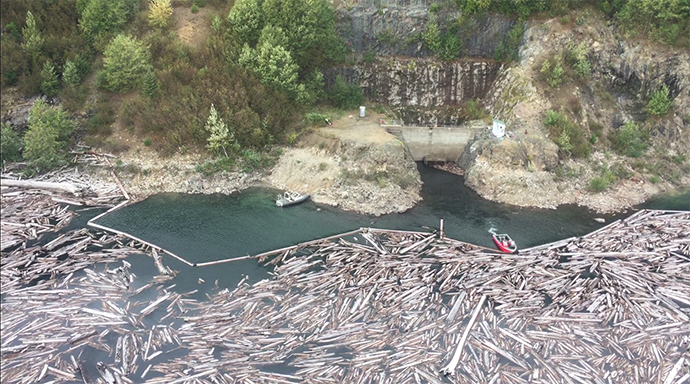
The Army Corps of Engineers built an outflow tunnel 35 years ago to maintain a safe water level. The lake is kept 30 to 35 feet below its banks to reduce the risk of catastrophe. KOIN 6 News tagged along four years ago when crews traveled a mile up the tunnel to remove a rock blockage.
The tunnel now needs more attention. Behind the lakeside inlet—blocked from view inside the tunnel—is a gate that regulates how much water goes in.
“You can’t have open flow going into the tunnel,” Strebig said. “It would pressurize and collapse the tunnel.”
Officials plan to replace the old gate and install a second one for the safety of crews having to work inside. But workers will need to bring in barges and drilling equipment so the plan is to recreate an old road to the lake originally carved through the ash shortly after the eruption. That road has been mostly reclaimed by nature and is now just a trail: Truman Trail.

Truman Trail along crest of debris blockage with Spirit Lake in the foreground. (US Forest Service) 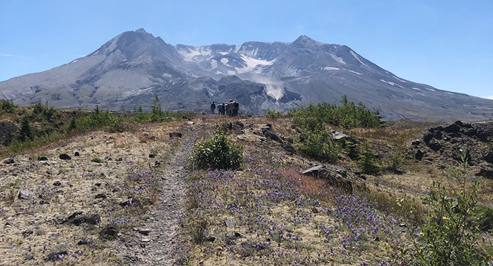
Truman Trail looking south toward Mount St Helens. (US Forest Service)
A map of the project shows the new road would take construction crews from the south the north in order to access the western shore of Spirit Lake. Experts devised the plan to have the smallest possible impact on the unique environment while still protecting people downstream from potential floods.
“At all costs, we have to keep that from ever happening again,” Strebig said.
The public has until May 22 to weigh in on the plan. If it’s approved, the Forest Service and Army Corps of Engineers will work on the project over the next few summers.