
PORTLAND, Ore. (KOIN) – Are you scared of those loud booms and lightning flashes? Or maybe you find it thrilling to watch a storm move in from the Pacific Ocean.
It’s helpful to understand severe weather for your own safety. In this lesson you’ll learn how thunderstorms are born, what kind of damage they can do, and what to do when you hear the roar of thunder.
Let’s begin with our basic weather-makers called mid-latitude cyclones. A mid-latitude cyclone is a large scale area of low pressure that, you’ve guessed it, forms along weather fronts in Earth’s mid-latitudes. This is not a hurricane or tropical storm and this does not mean tornado.
A mid-latitude cyclone resembles the setup in the image below. Where you have an associated warm front and cold front with an area of low pressure. This is just one phase or stage of a mid-latitude cyclone. We will dive into the stages in a future KOIN 6 Weather Kids lesson.
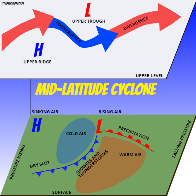
It is important to note the separation of air masses and the areas of rising and sinking air. If you look at the graphic it also has an idea of what is going on aloft in the upper-level regions of the atmosphere.
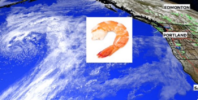
We have a satellite image of a mid-latitude cyclone in a later stage over the Gulf of Alaska below. Notice the “dry slot” working into the core of that system. Many mid-latitude cyclones resemble a comma shape or some may say it looks like a shrimp.
Although mid-latitude cyclones aren’t always the cause of severe weather, they definitely are the foundation to what may lead to severe weather. There are a lot of dynamics and parameters in charge when you’re preparing and forecasting severe weather. Heat, wind, and moisture are some elements that will gauge the strength or ability for severe weather.
This particular lesson, I want to focus on two specific acts of nature that can cause major damage. They resemble each other, but they are not the same. This lesson will discuss straight line wind versus tornado damage.
NOW IS THE TIME TO LOOK AT THE GRAPHIC BELOW:
After a major storm with damage, the National Weather Service will send out a storm survey team to assess the damage. This is to determine the strength of a tornado and/or discuss if the damage was caused by another act, such as straight line wind damage. It is important to be able to recognize and understand the differences and one sign that is evident is the pattern to the damage.
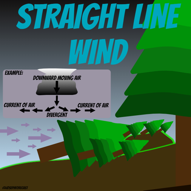
What exactly is straight line wind? These are powerful currents of air from a thunderstorm because of a very strong downdraft or downburst. This is usually paired with heavy rain in a severe event.
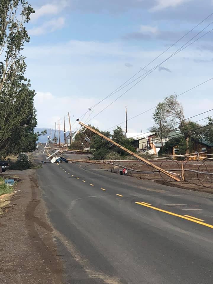
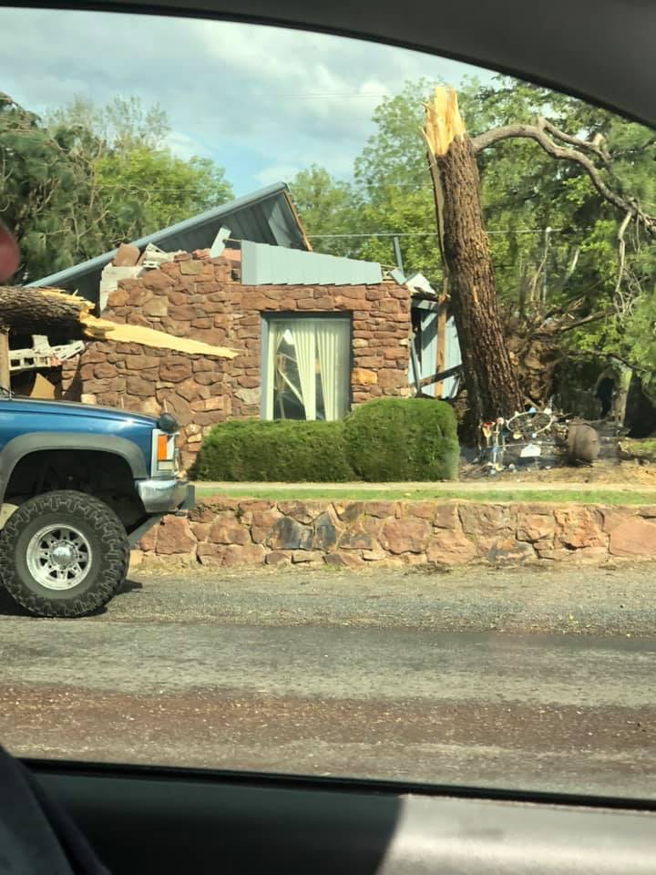
When that current of air is rushing to the surface, it then fans out in a divergent outflow. This typically leads to damage to an area where most of the debris is leaning or broken in the same direction. Think a row of power lines or trees that are all knocked down in the same pattern from south to north or potentially west to east. These straight-line winds may be just as strong as a tornado and reach triple-digit wind speeds. Below are photos of a storm out of Culver, Oregon on May 30, 2020.
NOW IS THE TIME TO LOOK AT THE GRAPHIC BELOW:
Without getting into the complete formation of a tornado, which we will also tackle in a more detailed weather kids, we can take a look at some of the elements and patterns from tornado damage that differentiate from straight line wind.

In a scenario where a thunderstorm produces a tornado, you need to have a change of speed and direction of the wind with height. This is what we refer to as wind shear. A tornado is a rotating column of air that touches the ground.
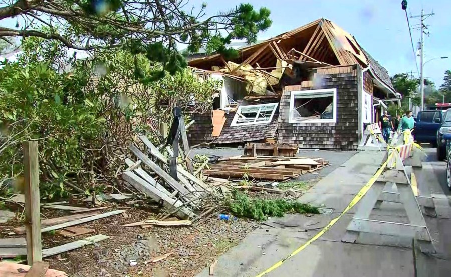
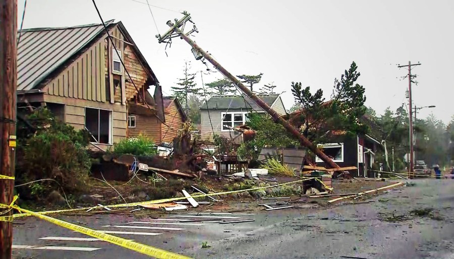
With that knowledge, it’s understandable that the pattern of the damage may resemble that of a rotating column of air. Converging trees and debris that is strewn about is more representative of tornado damage than that of straight-line wind. Below are photos from the EF-2 tornado coming out of Manzanita, Oregon, on Oct. 14, 2016. You can tell from the photos that the pattern to the damage is more chaotic than that of the straight-line wind.


That is just the tip of the iceberg, as they say! We will break down more advanced lessons in severe weather in our “Severe Weather” suite.