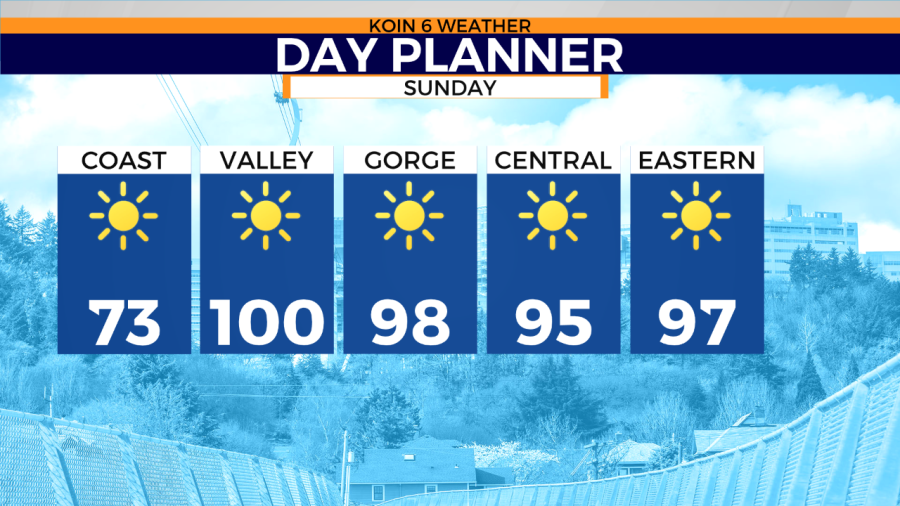
PORTLAND, Ore. (KOIN) – The next two days will bring triple-digits into the Willamette Valley. That is going to be a solid 15-20 degrees warmer than Saturday afternoon.
We’ve been expressing the bump in afternoon temperatures for some time, but we haven’t quite had temperatures like this yet. This is also going to be an extended stretch of heat that will bring in some mild overnight temperatures too. We will likely be above average until Friday of the upcoming week.
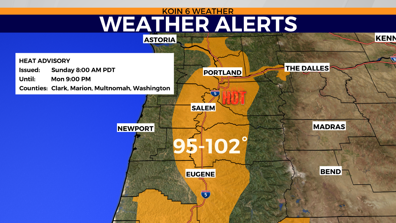
A reminder that a Heat Advisory is in place from 8 AM to 9 PM on Monday night. That includes everyone in the graphic below that falls in the orange from Longview all the way south to Eugene. Stay cool and do your best with the water!
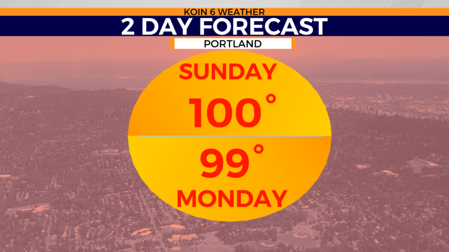
This is the forecast for Portland on Sunday and Monday. Both are going to be pretty similar but I have the mighty one hundred forecast for Sunday and just shy on Monday. We know the summer can bring some heat for the Oregon coast too, but if you’re hoping to stay “cool”, you’re going to want to be near the ocean the next few days. Newport will likely have temperatures in the 60s.
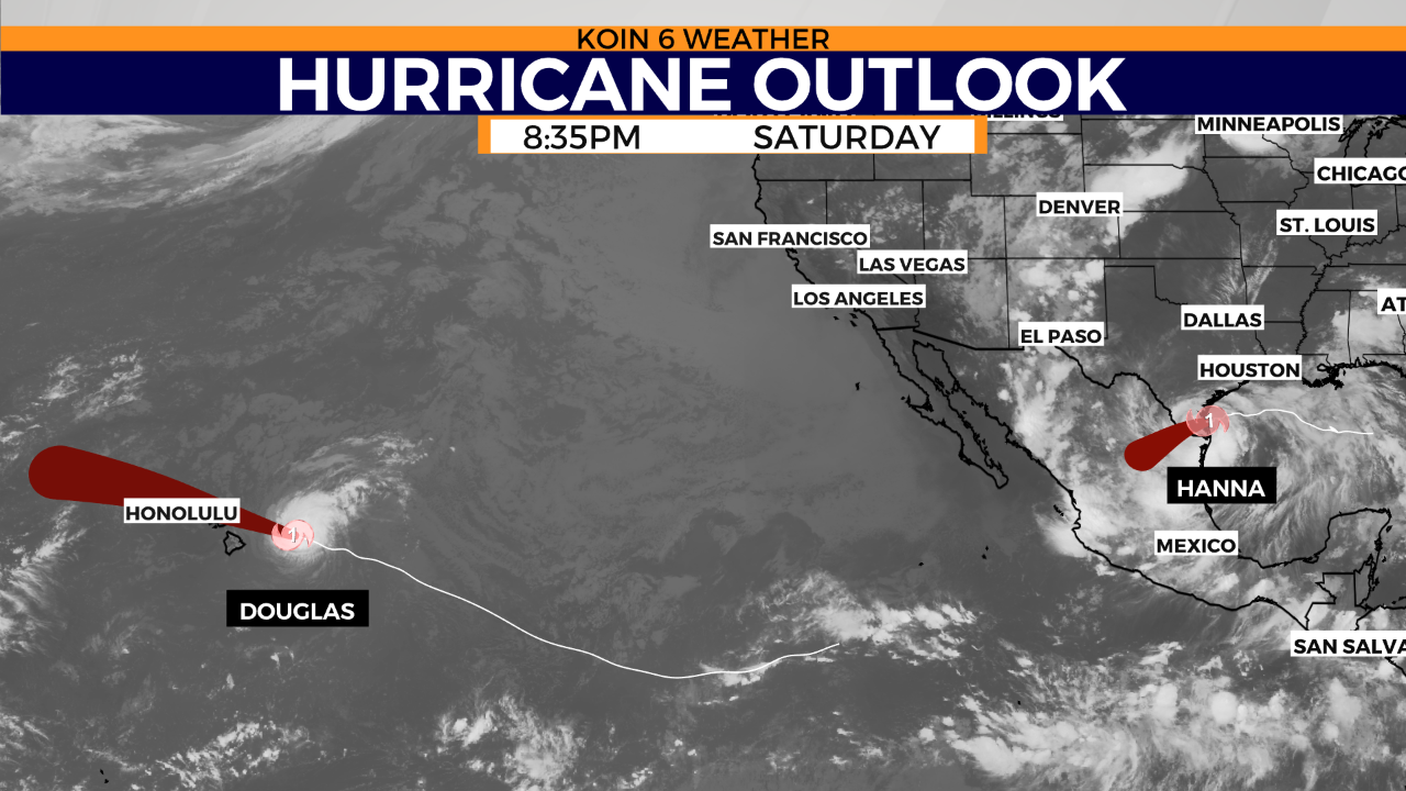
Outside of the heat that is taking over for the Pacific Northwest (PNW), we have Hurricane Douglas and Hurricane Hanna. Hurricane Douglas is moving in towards the Hawaiian Islands and will likely impact Honolulu with wind and rain. It’s possible that Douglas pushes farther north and is more of an event for the northern islands and points north of Honolulu. You can read more about Douglas here. Meanwhile, Hurricane Hanna, which will likely be a tropical storm or depression Sunday, has been pushing inland and creating issues with power for residents in Texas.