PORTLAND, Ore. (KOIN) – Right now the fire danger is very high. It’s fire season and this is a concern every summer. However, we are about to experience a wind event that isn’t common for this time of the year.
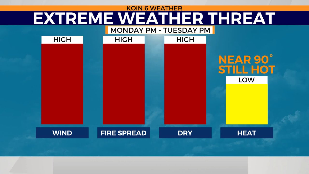
Monday afternoon, the wind is going to shift out of the east and pick up substantially. Pair that with very dry conditions, where the relative humidity is very low for the Willamette Valley, and we are going to have dangerous conditions. Here is the deal — it’s not winter, but we are going to have a very similar setup of what would be a winter wind event coming out of the Gorge.
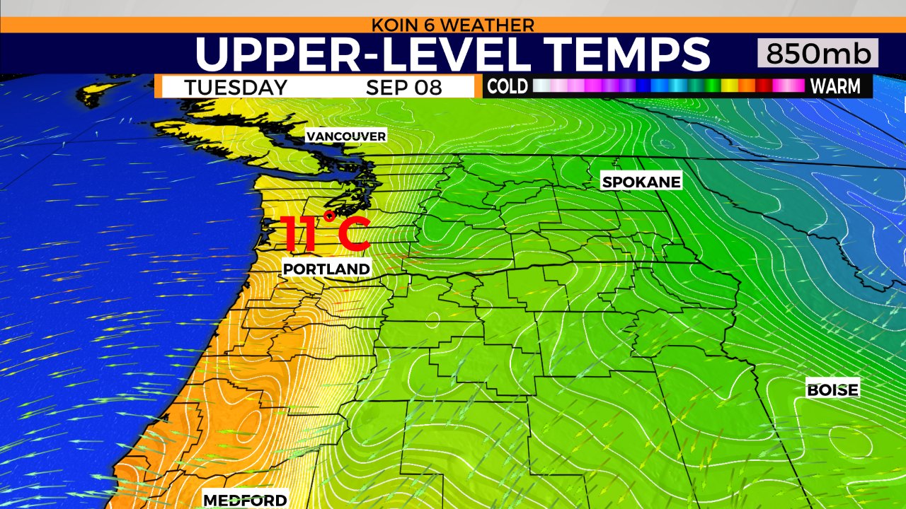
This is a graphic of the upper-level temperatures (Celsius), around 5,000′. A surge of cold air is going to find a way towards Washington and Oregon as it extends out of Canada come Monday afternoon. It’s going to be that large contrast from the extreme heat to the south and and that cold winter air that is going to create this wind event. We of course have the Cascades to the east and the Gorge that plays a major part of this event. Think the Santa Ana winds that create dangerous conditions in California.
With this heightened danger, we have some weather alerts around the two states.
High Wind Warning: Monday 5 PM – Tuesday 1 PM. Greater Portland Metro Areathe brown color below. 15-25 MPH Gusts up to 45 MPH. Gusts up to 60 MPH possible on higher Terrain.
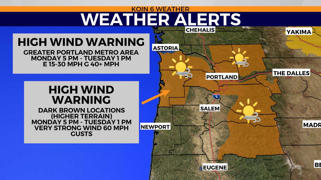
This will be an issue for the foothills too. 20-35 MPH Gusts up to 50 MPH. Gusts up to 75 MPH possible on higher exposed terrain.
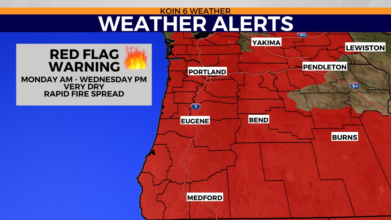
Red Flag Warning: Monday 11 AM – Wednesday 8 PM. NW Oregon and SW Washington. Relative Humidity below 15% and strong easterly winds. Outdoor burning is not recommended. Please be very careful.
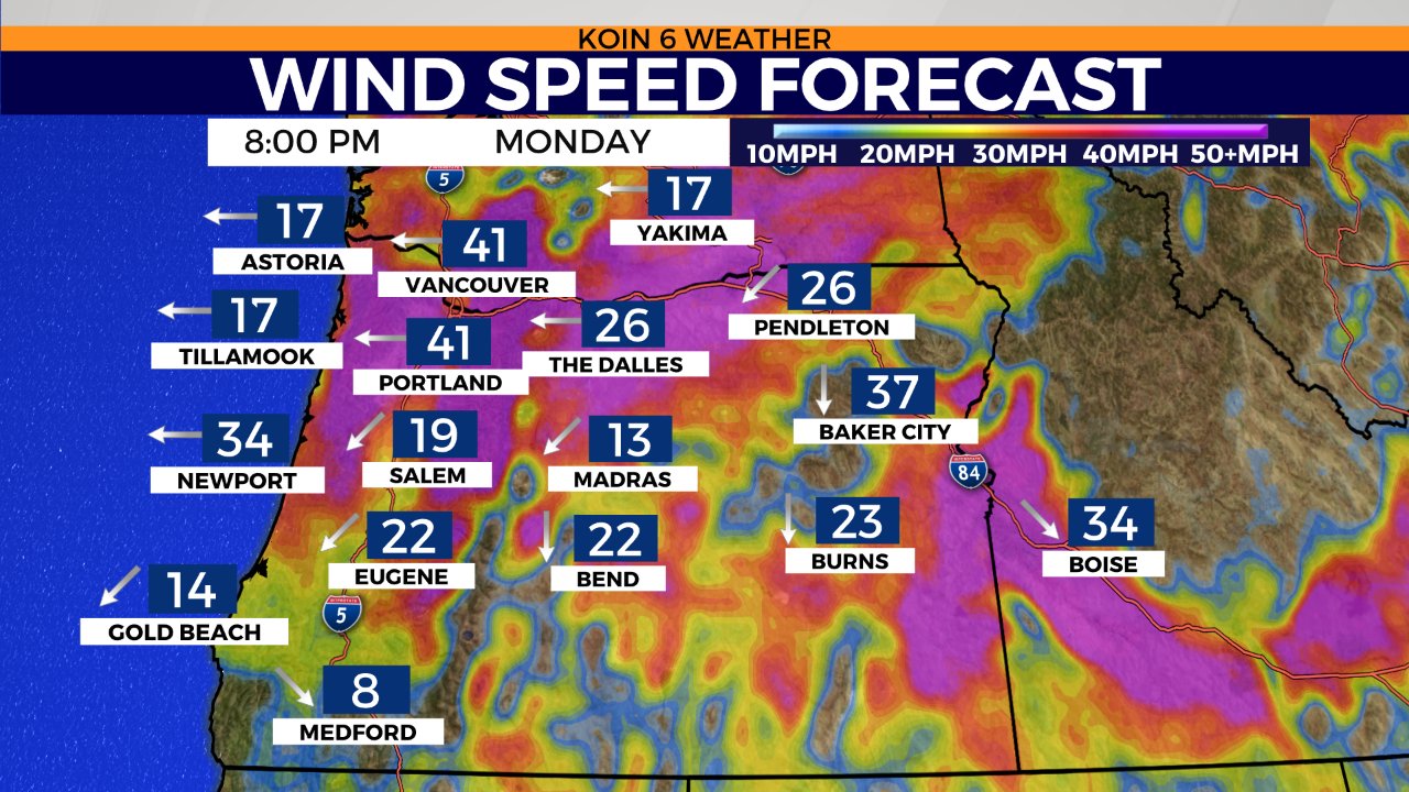
Here is an idea of the wind speed forecast by Monday at 8 PM. For the record, the wind may start increasing as early as the late afternoon, but more so after dinner. Notice the very strong wind around Portland and Vancouver. If you’re on one of those that live up on the West Hills, you may have 50+ mph wind gusts with this event. The trees aren’t bare and we have a different situation than what we typically have in the winter. We will have to see how this unfolds, but do what you can now and prepare for that wind.
Although the temperatures aren’t extreme Tuesday, we will still have many locations in the lower 90s on Monday and then in the mid 80s on Tuesday. The heat will become more of an issue on Thursday with a forecast high in the mid to upper 90s.
Lastly, you should check out this article about Portland General Electric preparing to shut off power in an area near Mt. Hood along Hwy 26 to prevent wildfires because of this event.