Editor’s note: Click here for the latest winter weather forecast and weather blog details.
PORTLAND, Ore. (KOIN) — Bottom line: You need to prepare for the impacts of winter weather including travel and utility interruptions now if you haven’t started already.
We are now entering the start to the winter transition and some locations are going to be hit harder than others when it all wraps up. Thursday may be low impact to start before we see conditions worsen further by Friday afternoon and through the weekend.
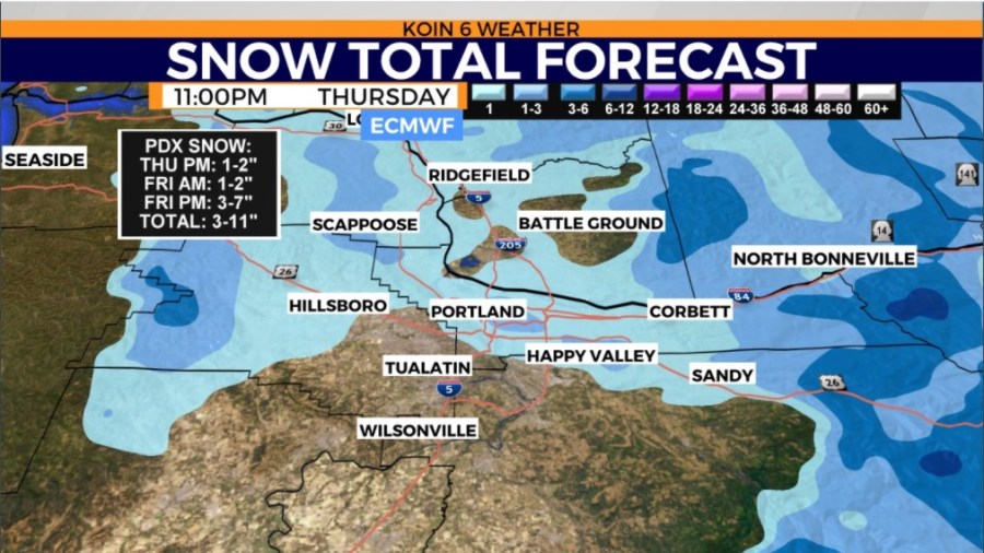
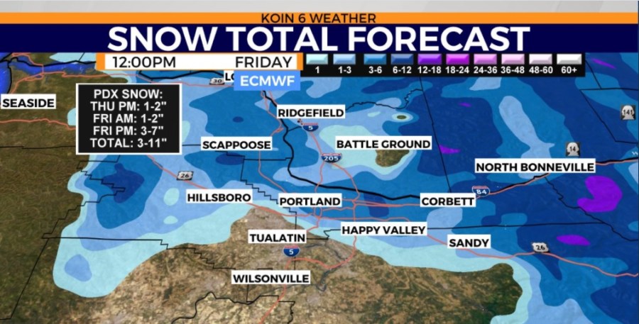
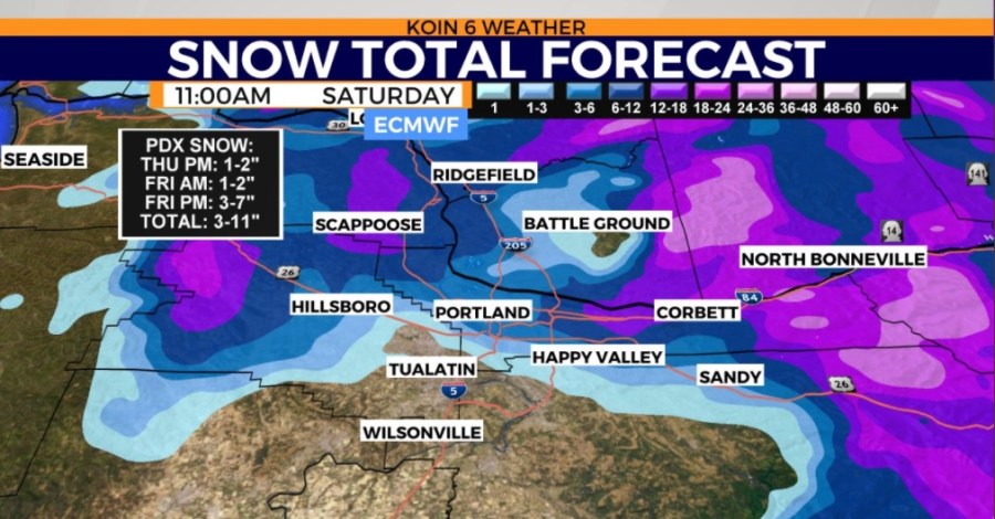
This is an event where there is likely to be a quick flip from areas that just have freezing rain to areas that have significant snow. You may find locations pushing 6 inches on the east side of Portland and then a 10-minute drive west it drastically drops off. This is because of the cold air coming in from the gorge and the southerly wind doing whatever it can to come up through the valley.
Right now that boundary for snow to freezing rain is south of Portland, potentially as far south as Keizer. We can’t rule out snow for areas of Marion County, but the heaviest stays north.
Timing
Below is a slideshow of three graphics to help show the timing of the moisture moving in. Now this weather model is slightly higher in resolution so we will go with it. It is not the weather model that we are using to determine the full forecast, but it is one that will help deliver a picture that is close to the scenario to come today.
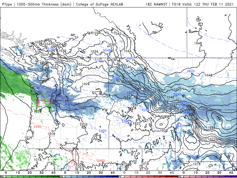
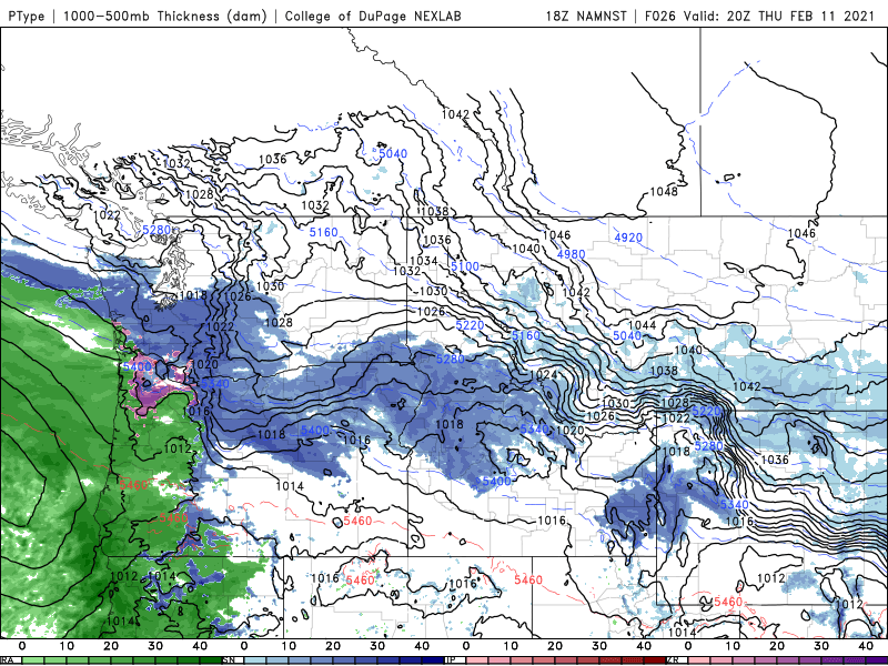
Notice very light rain by the early morning hours. That moisture may come before sunrise and if it does, it won’t be too deep. At that point in time, we may have some light snow for the gorge and the mountains. Moisture really increases by the time we get to mid-day with rain through most of the southern valley and the potential for a wintry mix around the Portland area. This is when the wind will start cranking and that cold air will funnel in.
If you go to the second photo of the slideshow you can see how there is definitely more moisture to work with, but the delineation between snow and rain is still a bit muddy. The transition from rain to a wintry mix will likely be somewhere around Portland at this point in time. It is completely possible for snow around Portland by mid-day, although not certain.
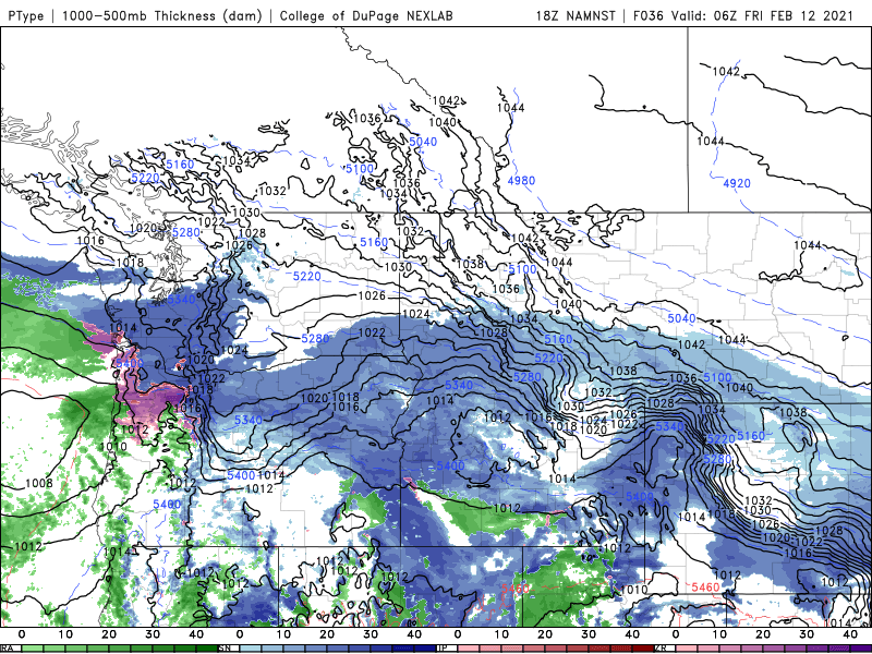
Thursday night is going to be more favorable for the cold air to settle in and the snow to start around the Portland area. By the time we wrap up Thursday night, we may only have a few inches of snow. It is going to increase overnight into Friday, as low pressure starts to get closer and colder air is pulled into the northern valley. That area of freezing rain will likely be farther south at this point, likely somewhere around southern Multnomah county.
Large concerns
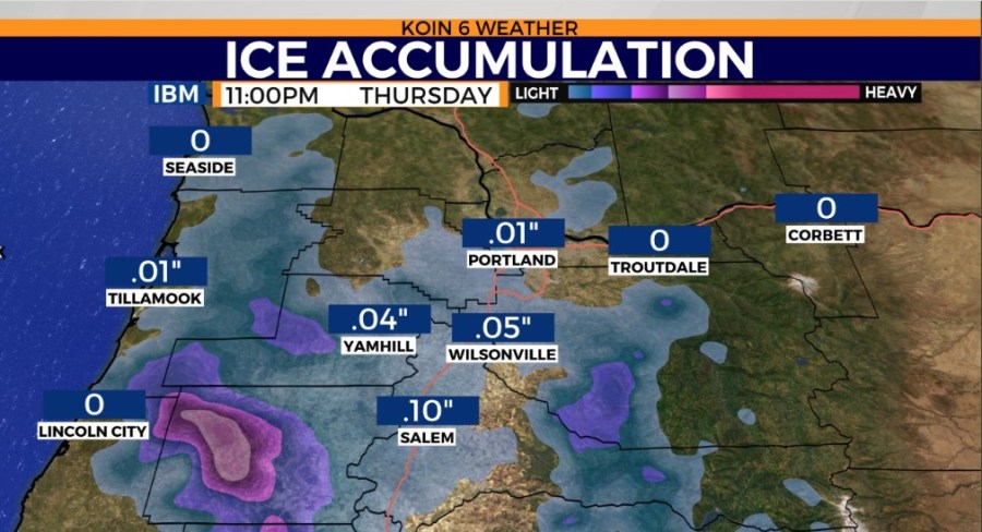
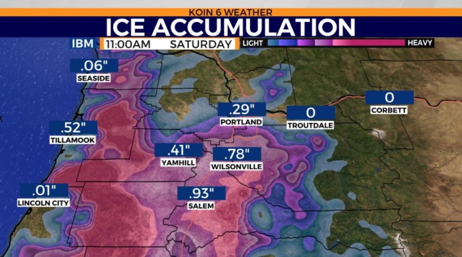
Icing is a major concern as a result of a freezing rain event for points south of Portland and down to Salem from Friday afternoon to Saturday morning, then going west into the coastal range. Ice accumulation could be between 0.1-0.5 inches, which could result in power outages and downed tree limbs.
We have a very gusty east wind coming from the Gorge on Thursday, leaving many locations from Troutdale over to the Multnomah Falls area in potential blizzard conditions. This is where the wind may be gusting 55 to 70 mph. Sustained speeds will be cranking for an extended period of time. The combination of the wind and the snow may create visibility problems with blowing snow.

A winter storm warning is in effect from Thu 12p to Fri 12p. This warning encompasses a wide area from the coast range to SW Washington to Portland, Vancouver metro areas.
A blizzard warning is in effect from 10a Thurs until noon Friday. It is likely that the highway gets shut down, but even if it is open, travel is not advised. I would plan on hunkering down through this event.


Interesting tidbit – the last time a blizzard warning was issued for the Gorge was Feb. 2014. The time before that was Dec. 2008.